STS41G-40-51
| NASA Photo ID | STS41G-40-51 |
| Focal Length | 100mm |
| Date taken | 1984.10.12 |
| Time taken | 12:04:09 GMT |

Cloud masks available for this image:
Spacecraft nadir point: 36.9° N, 4.5° W
Photo center point: 35.5° N, 5.0° W
Photo center point by machine learning:
Photo center point: 35.5° N, 5.0° W
Photo center point by machine learning:
Nadir to Photo Center: South
Spacecraft Altitude: 122 nautical miles (226km)
Country or Geographic Name: | MOROCCO |
Features: | MEDITERRANEAN SEA STRUCT |
| Features Found Using Machine Learning: | |
Cloud Cover Percentage: | 10 (1-10)% |
Sun Elevation Angle: | 45° |
Sun Azimuth: | 137° |
Camera: | Hasselblad |
Focal Length: | 100mm |
Camera Tilt: | 36 degrees |
Format: | 6017: Kodak Ektachrome 64, 220 Roll Format |
Film Exposure: | Normal |
| Additional Information | |
| Width | Height | Annotated | Cropped | Purpose | Links |
|---|---|---|---|---|---|
| 5700 pixels | 5900 pixels | No | No | Download Image | |
| 500 pixels | 518 pixels | No | No | Download Image | |
| 640 pixels | 480 pixels | No | No | Download Image |
Download Packaged File
Download a Google Earth KML for this Image
View photo footprint information
Download a GeoTIFF for this photo
Image Caption:
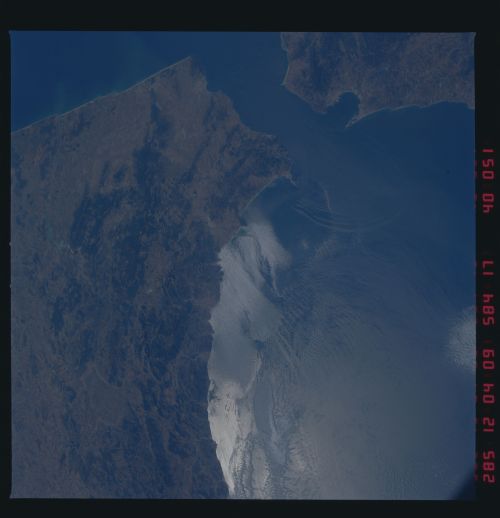
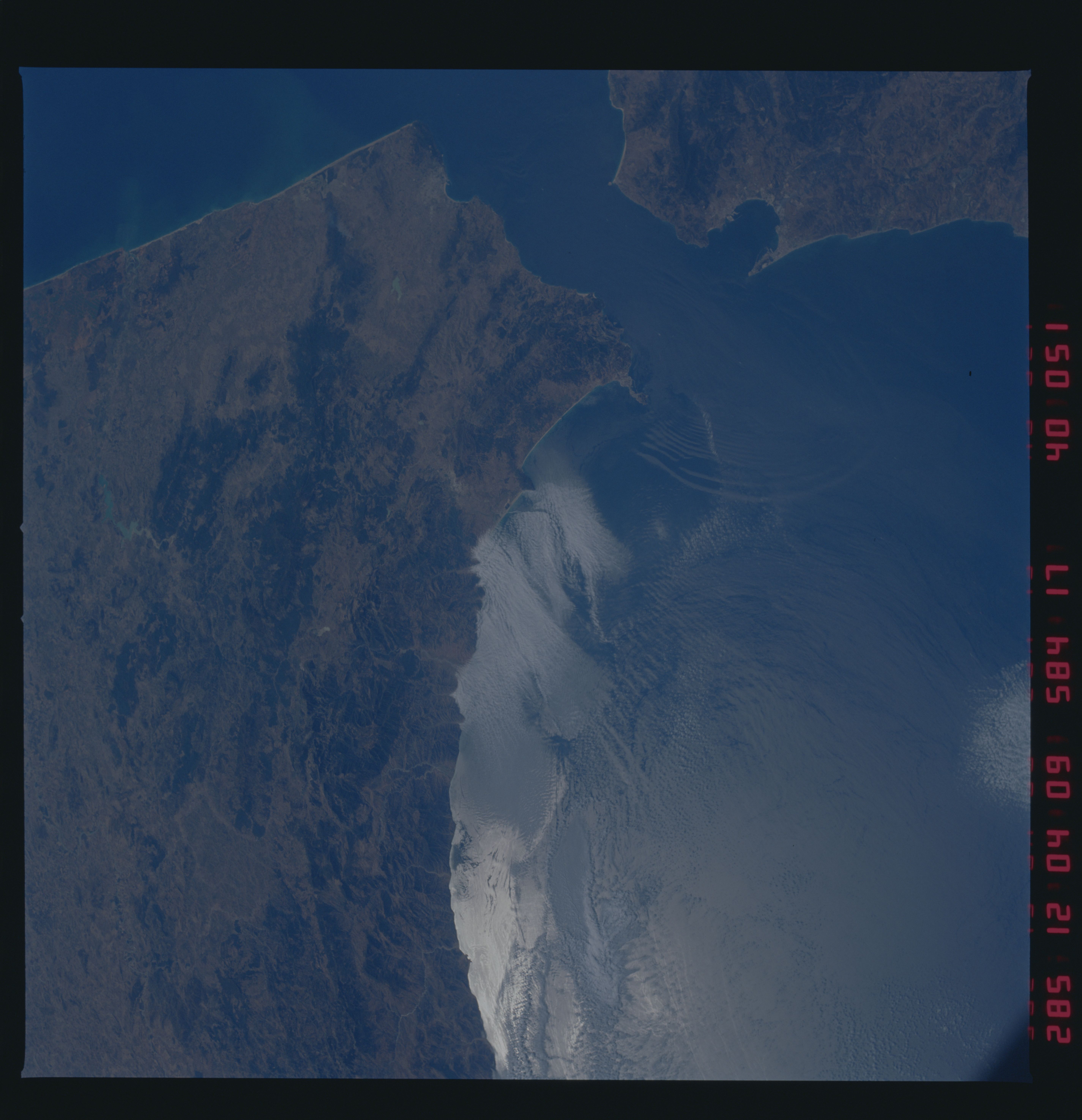
STS41G-40-051 Strait of Gibraltar (36.0! N, 5.5! W) This
view of sunglint in the Strait of Gibraltar and the western Medi-
terranean was photographed during STS-41G (11 October 1984) and
shows a group of six solitons emanating from the Strait and pro-
pagating eastward through the Mediterranean Sea. Solitons such as
these form as tidal currents pass over the Camarinal Sill, si-
tuated in the center of the Strait, and perturb the density in-
terface between the less dense Atlantic water at the surface and
the more dense Mediterranean water below.
