STS41G-37-79
| NASA Photo ID | STS41G-37-79 |
| Focal Length | 100mm |
| Date taken | 1984.10.07 |
| Time taken | 10:31:02 GMT |
Resolutions offered for this image:
5159 x 5159 pixels 640 x 640 pixels 5700 x 5900 pixels 500 x 518 pixels 640 x 480 pixels
5159 x 5159 pixels 640 x 640 pixels 5700 x 5900 pixels 500 x 518 pixels 640 x 480 pixels
Cloud masks available for this image:
Spacecraft nadir point: 40.1° N, 44.1° E
Photo center point: 38.5° N, 43.0° E
Photo center point by machine learning:
Photo center point: 38.5° N, 43.0° E
Photo center point by machine learning:
Nadir to Photo Center: Southwest
Spacecraft Altitude: 143 nautical miles (265km)
Country or Geographic Name: | TURKEY |
Features: | LAKE VAN |
| Features Found Using Machine Learning: | |
Cloud Cover Percentage: | 1 (1-10)% |
Sun Elevation Angle: | 38° |
Sun Azimuth: | 134° |
Camera: | Hasselblad |
Focal Length: | 100mm |
Camera Tilt: | 39 degrees |
Format: | 6017: Kodak Ektachrome 64, 220 Roll Format |
Film Exposure: | Normal |
| Additional Information | |
| Width | Height | Annotated | Cropped | Purpose | Links |
|---|---|---|---|---|---|
| 5159 pixels | 5159 pixels | No | No | Earth From Space collection | Download Image |
| 640 pixels | 640 pixels | No | No | Earth From Space collection | Download Image |
| 5700 pixels | 5900 pixels | No | No | Download Image | |
| 500 pixels | 518 pixels | No | No | Download Image | |
| 640 pixels | 480 pixels | No | No | Download Image |
Download Packaged File
Download a Google Earth KML for this Image
View photo footprint information
Download a GeoTIFF for this photo
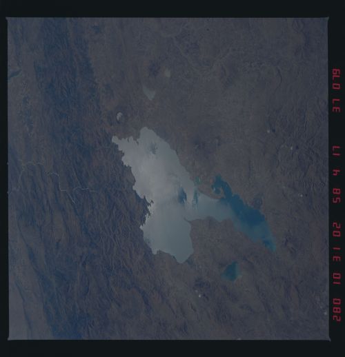
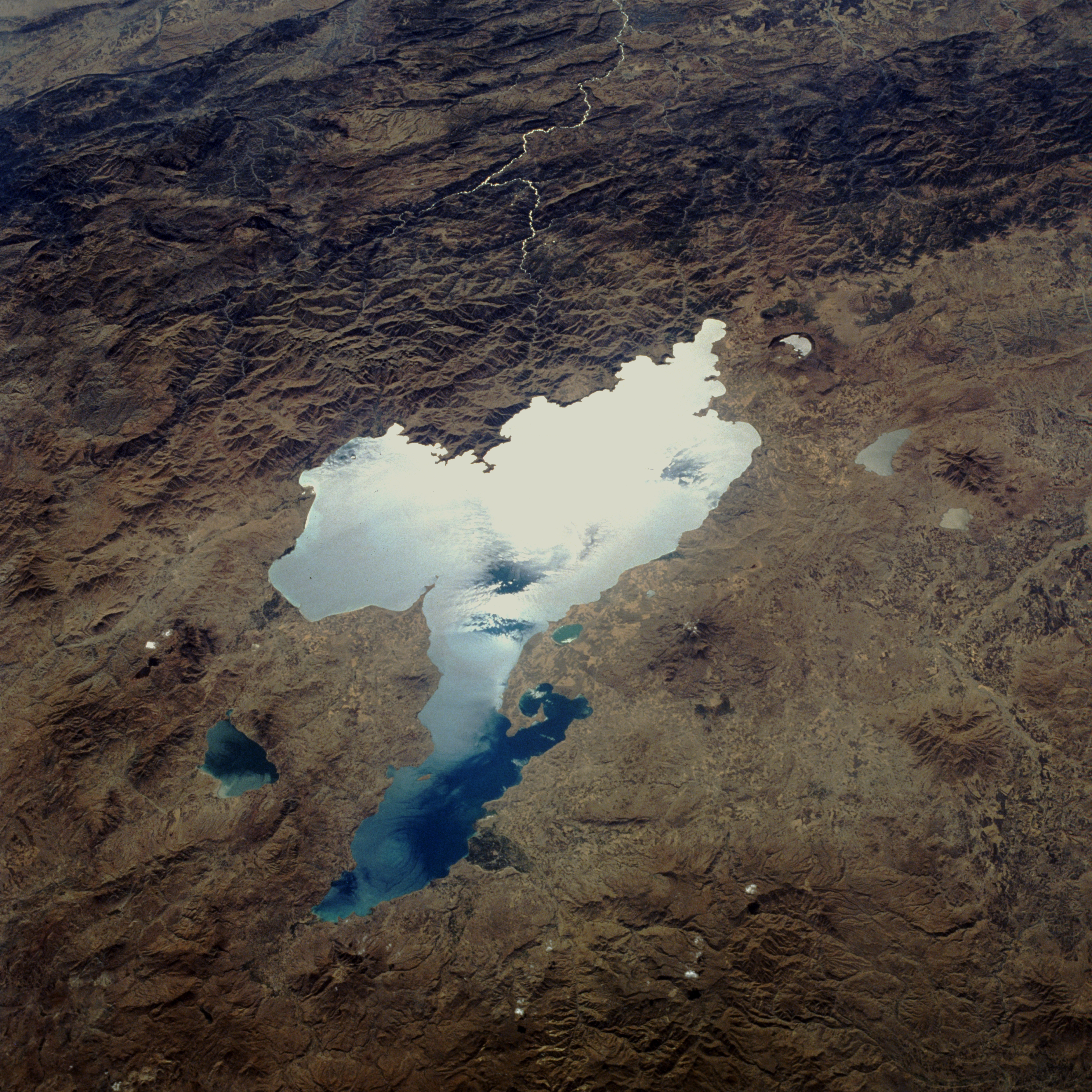
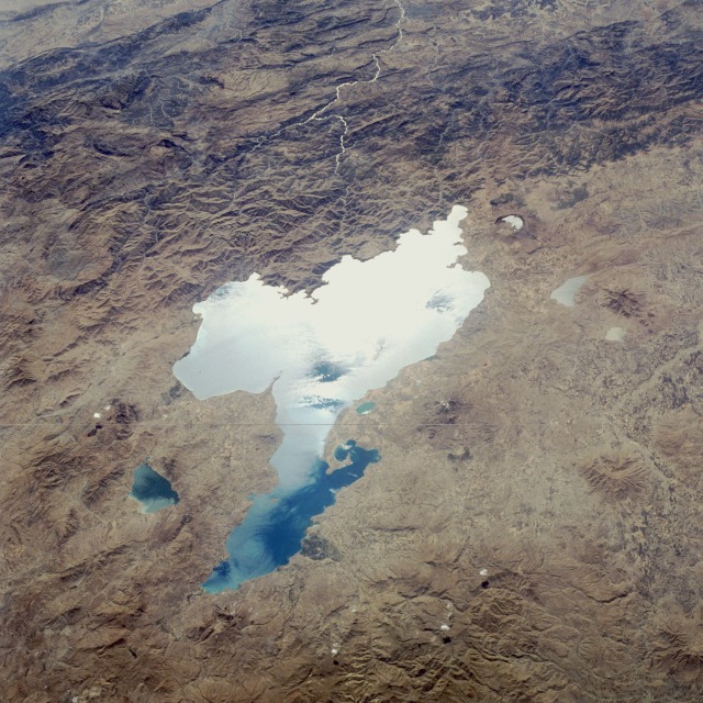
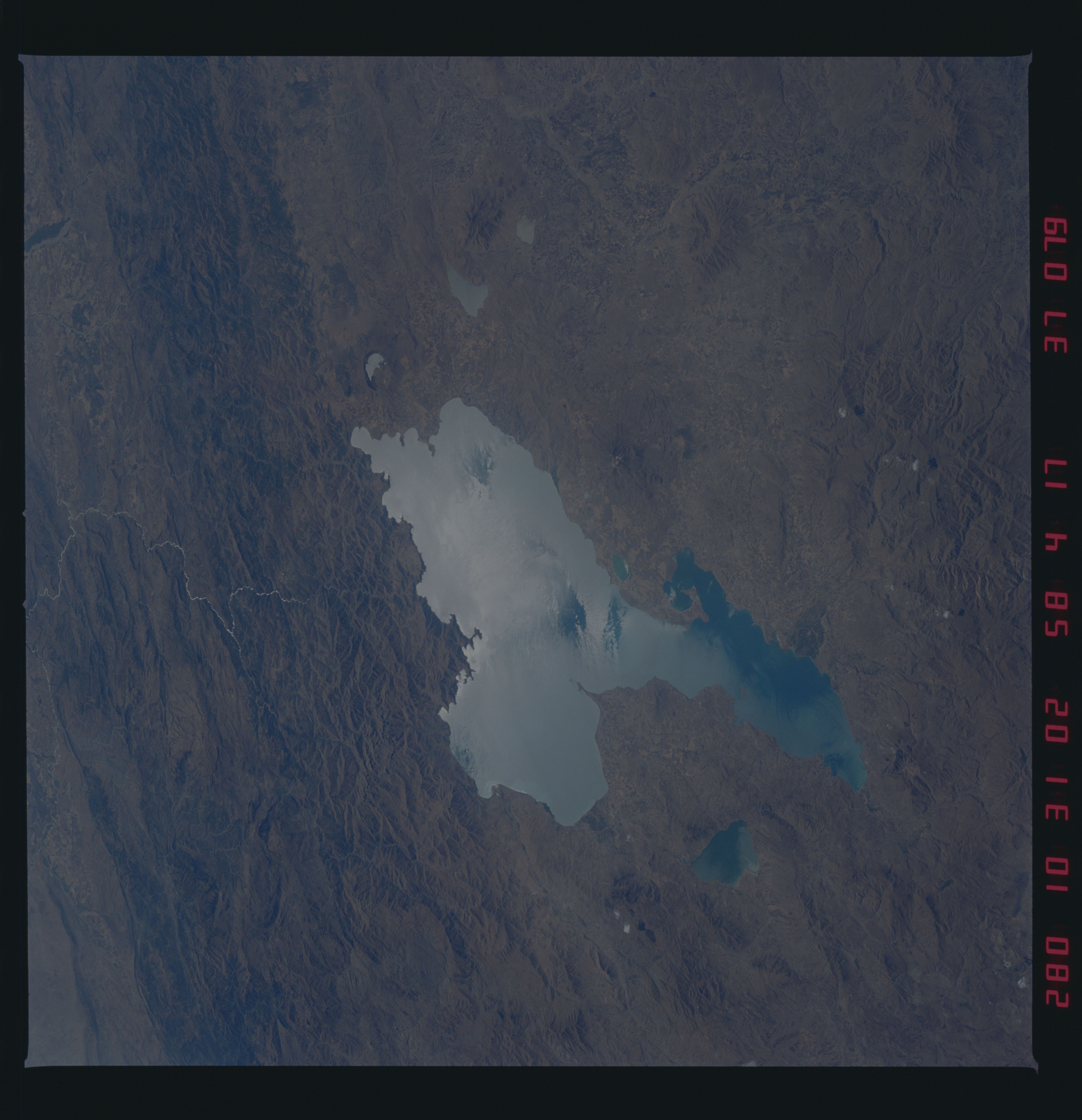
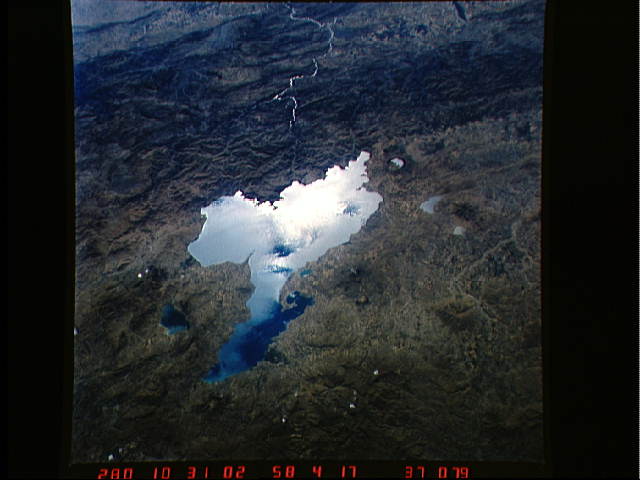
Image Caption: STS41G-037-0079 Lake Van, Turkey October 1984
This low-oblique, southwest-looking photograph shows Lake Van, the largest lake in Turkey. This saline lake, located in eastern Turkey at 5640 feet (1719 meters) above sea level, has no outlet, a maximum length of 75 miles (120 kilometers), a maximum width of 50 miles (80 kilometers), and an area of 1450 square miles (3755 square kilometers). Its waters are unusually rich in sodium carbonate and other salts that are extracted by evaporation and used as detergents. Darekh, a species of herring caught during the spring floods, spawns near the mouths of streams feeding the lake and is the only fish that can survive Lake Van's brackish waters. The lake is surrounded by fruit- and grain-growing agricultural areas. Visible in this photograph, viewing clockwise from south to east of the lake, are the rugged Satak Mountains; Nemrut Lake, the crater lake of an active volcano that last erupted in 1440; and Lake Ercek, a small blue lake.
This low-oblique, southwest-looking photograph shows Lake Van, the largest lake in Turkey. This saline lake, located in eastern Turkey at 5640 feet (1719 meters) above sea level, has no outlet, a maximum length of 75 miles (120 kilometers), a maximum width of 50 miles (80 kilometers), and an area of 1450 square miles (3755 square kilometers). Its waters are unusually rich in sodium carbonate and other salts that are extracted by evaporation and used as detergents. Darekh, a species of herring caught during the spring floods, spawns near the mouths of streams feeding the lake and is the only fish that can survive Lake Van's brackish waters. The lake is surrounded by fruit- and grain-growing agricultural areas. Visible in this photograph, viewing clockwise from south to east of the lake, are the rugged Satak Mountains; Nemrut Lake, the crater lake of an active volcano that last erupted in 1440; and Lake Ercek, a small blue lake.
