STS41G-120-56
| NASA Photo ID | STS41G-120-56 |
| Focal Length | 90mm |
| Date taken | 1984.10.__ |
| Time taken | GMT |
Cloud masks available for this image:
Spacecraft nadir point:
Photo center point: 32.5° N, 35.5° E
Photo center point by machine learning:
Photo center point: 32.5° N, 35.5° E
Photo center point by machine learning:
Nadir to Photo Center:
Spacecraft Altitude: nautical miles (0km)
Country or Geographic Name: | ISRAEL |
Features: | LEBANON/SYRIA/JORDAN |
| Features Found Using Machine Learning: | |
Cloud Cover Percentage: | 1 (1-10)% |
Sun Elevation Angle: | ° |
Sun Azimuth: | ° |
Camera: | Linhof |
Focal Length: | 90mm |
Camera Tilt: | Near Vertical |
Format: | 6017: Kodak Ektachrome 64, 220 Roll Format |
Film Exposure: | Normal |
| Additional Information | |
| Width | Height | Annotated | Cropped | Purpose | Links |
|---|---|---|---|---|---|
| 5572 pixels | 4457 pixels | No | No | Earth From Space collection | Download Image |
| 639 pixels | 511 pixels | No | No | Earth From Space collection | Download Image |
| 640 pixels | 480 pixels | No | No | ISD 1 | Download Image |
Download Packaged File
Download a Google Earth KML for this Image
View photo footprint information
Download a GeoTIFF for this photo
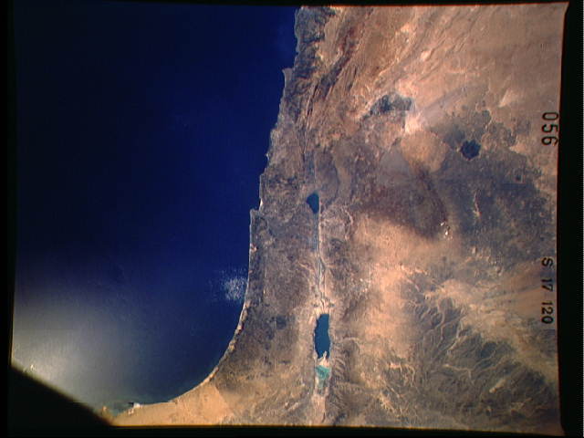
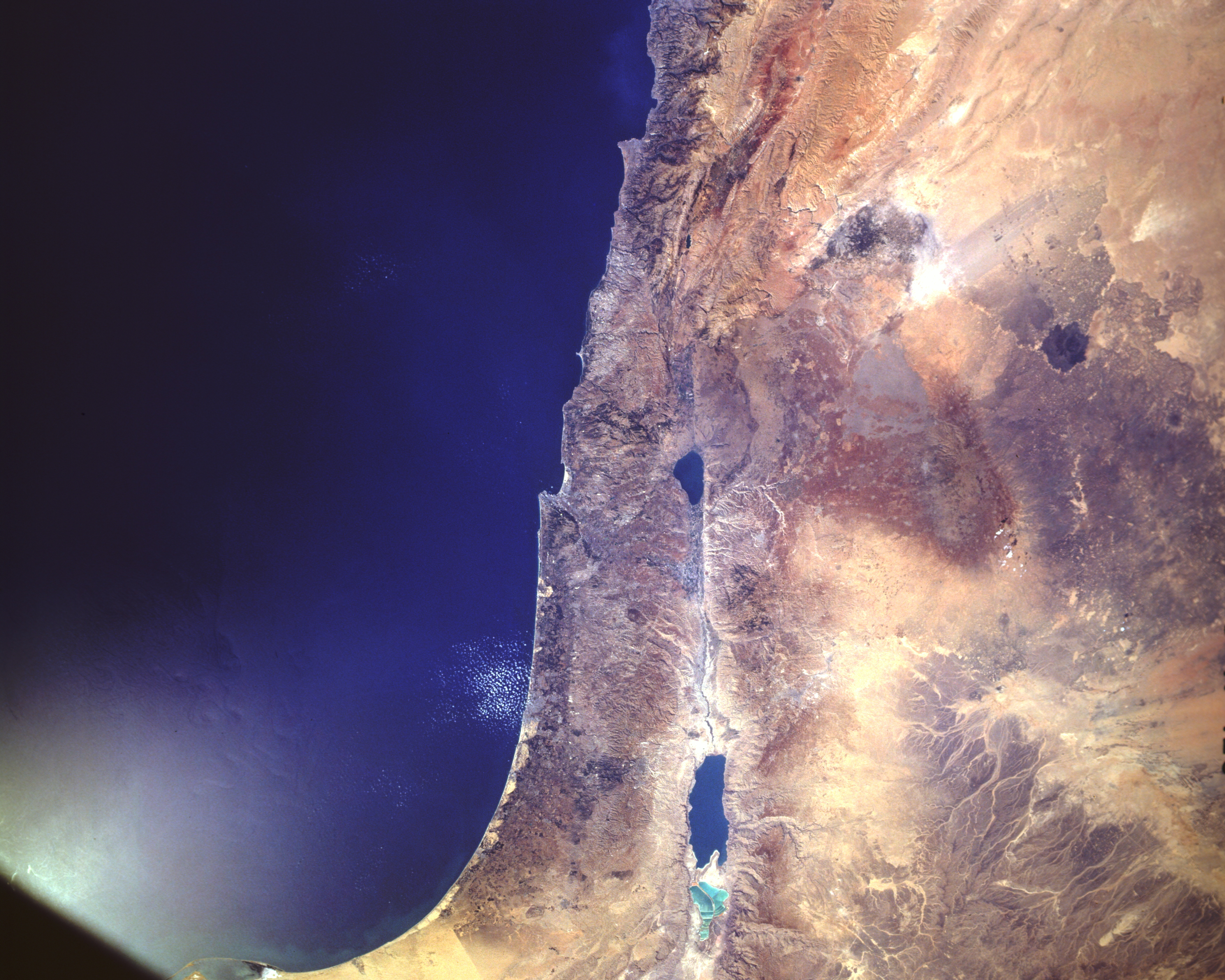
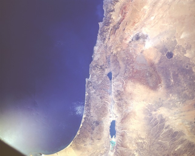
Image Caption: STS41G-120-0056 Dead Sea Rift Valley, Israel, Lebanon, Syria and Jordan October 1984
Seen from an altitude of 190 nautical miles (350 kilometers) in this near-vertical photograph, the Dead Sea Rift Valley slices south-north through the Middle East. The surface of the Dead Sea, 1292 feet (394 meters) below sea level, is the lowest point on Earth and is a continuation of the East African Rift through the Red Sea and the Gulf of Aqaba. Rift faulting connects the Dead Sea with the Jordan River Valley and through the Sea of Galilee; however, northward in Lebanon the rifting splays out into a series of north-northeast trending faults. East of the rift are two large ancient lava fields about which little is known. Close to the southwestern edge of the photograph, the Gaza Strip can be seen near the border between Egypt and Israel.
Seen from an altitude of 190 nautical miles (350 kilometers) in this near-vertical photograph, the Dead Sea Rift Valley slices south-north through the Middle East. The surface of the Dead Sea, 1292 feet (394 meters) below sea level, is the lowest point on Earth and is a continuation of the East African Rift through the Red Sea and the Gulf of Aqaba. Rift faulting connects the Dead Sea with the Jordan River Valley and through the Sea of Galilee; however, northward in Lebanon the rifting splays out into a series of north-northeast trending faults. East of the rift are two large ancient lava fields about which little is known. Close to the southwestern edge of the photograph, the Gaza Strip can be seen near the border between Egypt and Israel.
