STS41D-41-62
| NASA Photo ID | STS41D-41-62 |
| Focal Length | 250mm |
| Date taken | 1984.09.05 |
| Time taken | 05:00:49 GMT |
Resolutions offered for this image:
4000 x 4000 pixels 790 x 799 pixels 3899 x 3881 pixels 639 x 637 pixels 4440 x 4600 pixels 4000 x 4000 pixels 483 x 500 pixels 640 x 480 pixels
4000 x 4000 pixels 790 x 799 pixels 3899 x 3881 pixels 639 x 637 pixels 4440 x 4600 pixels 4000 x 4000 pixels 483 x 500 pixels 640 x 480 pixels


Cloud masks available for this image:
Spacecraft nadir point: 27.6° S, 153.5° E
Photo center point: 27.5° S, 153.0° E
Photo center point by machine learning:
Photo center point: 27.5° S, 153.0° E
Photo center point by machine learning:
Nadir to Photo Center: West
Spacecraft Altitude: 161 nautical miles (298km)
Country or Geographic Name: | AUSTRALIA-Q |
Features: | BRISBANE |
| Features Found Using Machine Learning: | |
Cloud Cover Percentage: | 0 (no clouds present) |
Sun Elevation Angle: | 31° |
Sun Azimuth: | 97° |
Camera: | Hasselblad |
Focal Length: | 250mm |
Camera Tilt: | 11 degrees |
Format: | 6017: Kodak Ektachrome 64, 220 Roll Format |
Film Exposure: | Normal |
| Additional Information | |
| Width | Height | Annotated | Cropped | Purpose | Links |
|---|---|---|---|---|---|
| 4000 pixels | 4000 pixels | Cities collection | Download Image | ||
| 790 pixels | 799 pixels | No | No | Cities collection | Download Image |
| 3899 pixels | 3881 pixels | No | No | Earth From Space collection | Download Image |
| 639 pixels | 637 pixels | No | No | Earth From Space collection | Download Image |
| 4440 pixels | 4600 pixels | No | No | Download Image | |
| 4000 pixels | 4000 pixels | No | No | Download Image | |
| 483 pixels | 500 pixels | No | No | Download Image | |
| 640 pixels | 480 pixels | No | No | Download Image |
Download Packaged File
Download a Google Earth KML for this Image
View photo footprint information
Download a GeoTIFF for this photo
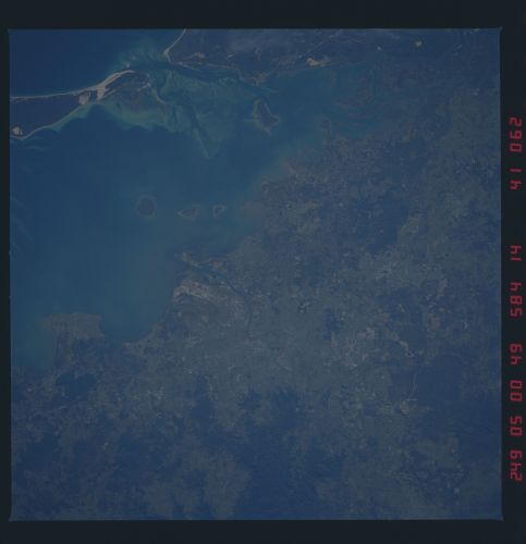
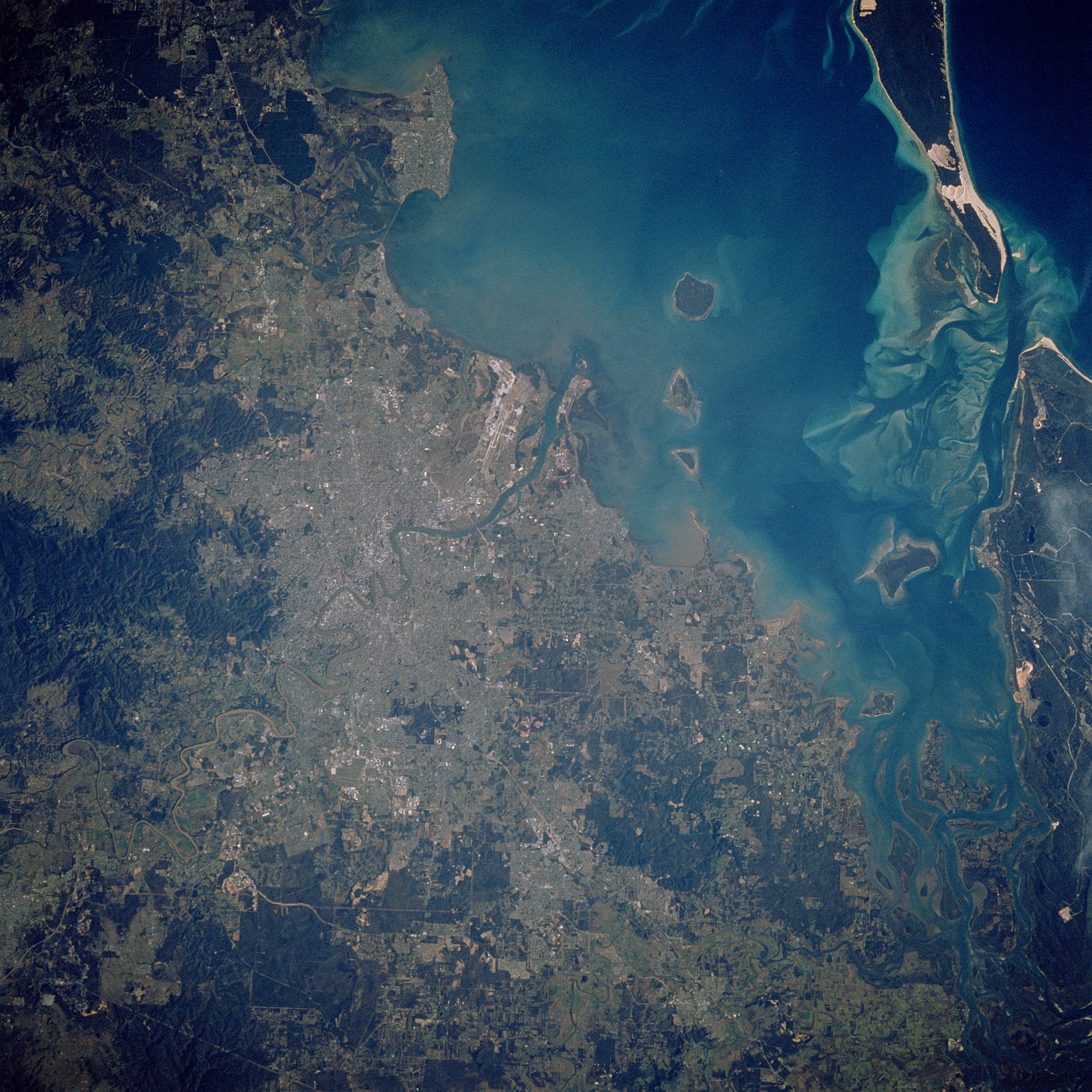
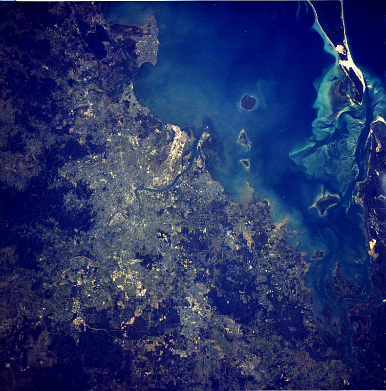
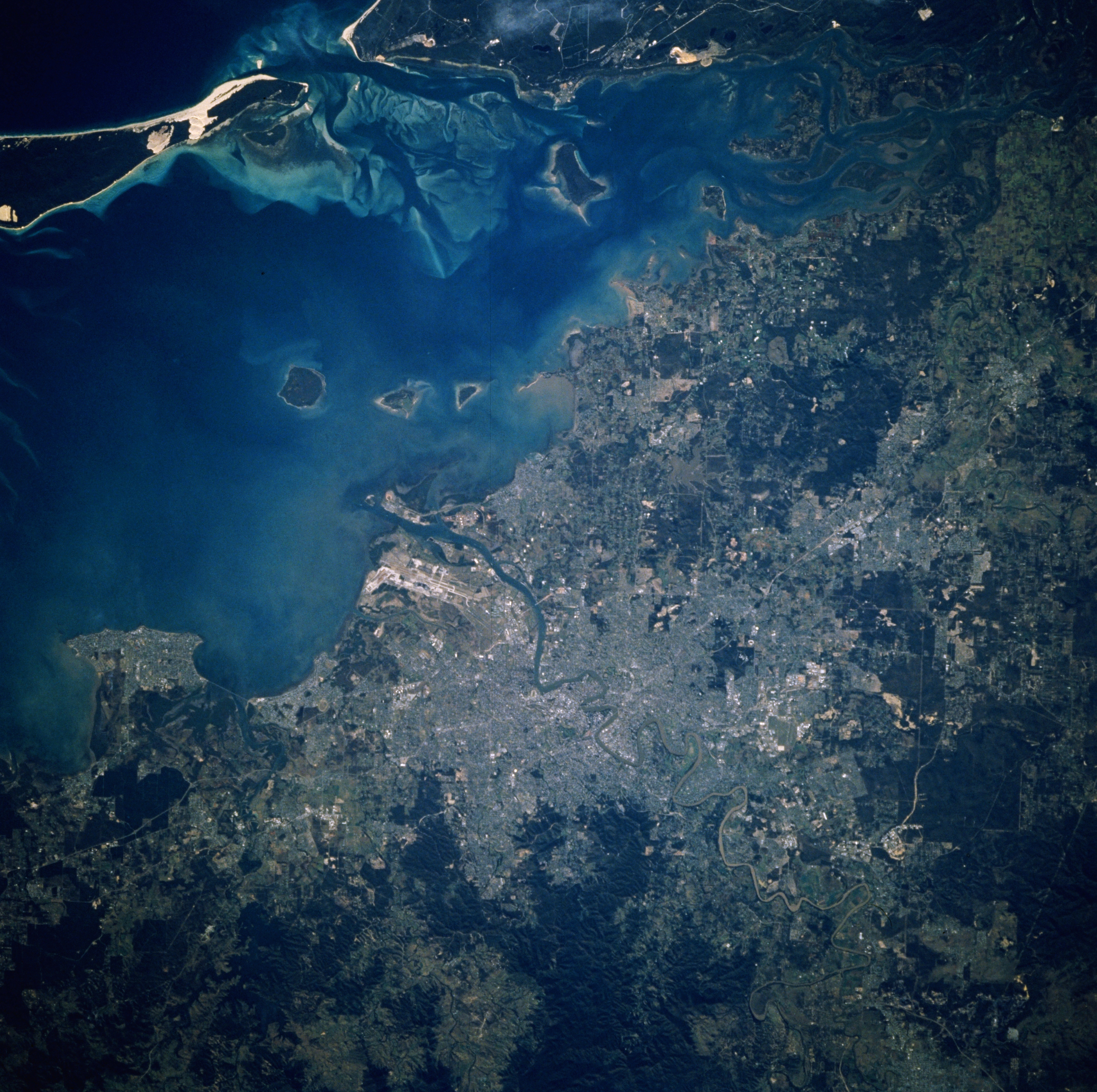
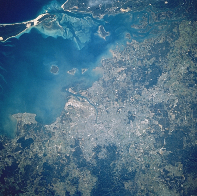
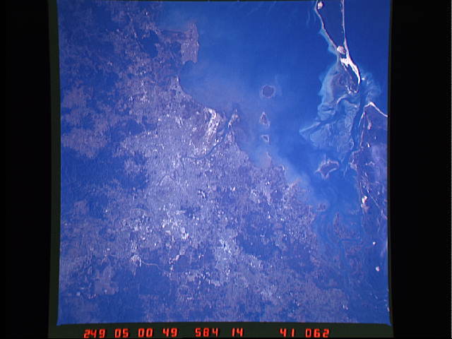
Image Caption: STS41D-41-0062 Brisbane, Queensland, Australia September 1984
Australia's third largest city, Brisbane (near center of image), is located midway up the east coast of Australia. A segment of the Brisbane River is visible as it empties into Moreton Bay. The highly reflective white area north of where the Brisbane River enters Moreton Bay is Brisbane International Airport. Moreton Island can be identified by the extensive sandy, highly reflective area near the south end of the island near the top left. Several shallow and sandy bottom channels can be seen in the water between the southern end of Moreton Island and the northern end of North Stradbroke Island. Several islands are visible in Moreton Bay. The darker (greenish looking) terrain scattered throughout the image is forested lands.
Australia's third largest city, Brisbane (near center of image), is located midway up the east coast of Australia. A segment of the Brisbane River is visible as it empties into Moreton Bay. The highly reflective white area north of where the Brisbane River enters Moreton Bay is Brisbane International Airport. Moreton Island can be identified by the extensive sandy, highly reflective area near the south end of the island near the top left. Several shallow and sandy bottom channels can be seen in the water between the southern end of Moreton Island and the northern end of North Stradbroke Island. Several islands are visible in Moreton Bay. The darker (greenish looking) terrain scattered throughout the image is forested lands.
