STS41D-41-31
| NASA Photo ID | STS41D-41-31 |
| Focal Length | 250mm |
| Date taken | 1984.09.05 |
| Time taken | 04:55:59 GMT |
Resolutions offered for this image:
3904 x 3904 pixels 639 x 639 pixels 4440 x 4600 pixels 483 x 500 pixels 640 x 480 pixels
3904 x 3904 pixels 639 x 639 pixels 4440 x 4600 pixels 483 x 500 pixels 640 x 480 pixels
Cloud masks available for this image:
Spacecraft nadir point: 23.6° S, 133.8° E
Photo center point: 24.0° S, 133.0° E
Photo center point by machine learning:
Photo center point: 24.0° S, 133.0° E
Photo center point by machine learning:
Nadir to Photo Center: Southwest
Spacecraft Altitude: 161 nautical miles (298km)
Country or Geographic Name: | AUSTRALIA-NT |
Features: | MACDONNELL RANGES |
| Features Found Using Machine Learning: | |
Cloud Cover Percentage: | 0 (no clouds present) |
Sun Elevation Angle: | 49° |
Sun Azimuth: | 106° |
Camera: | Hasselblad |
Focal Length: | 250mm |
Camera Tilt: | 18 degrees |
Format: | 6017: Kodak Ektachrome 64, 220 Roll Format |
Film Exposure: | Normal |
| Additional Information | |
| Width | Height | Annotated | Cropped | Purpose | Links |
|---|---|---|---|---|---|
| 3904 pixels | 3904 pixels | No | No | Earth From Space collection | Download Image |
| 639 pixels | 639 pixels | No | No | Earth From Space collection | Download Image |
| 4440 pixels | 4600 pixels | No | No | Download Image | |
| 483 pixels | 500 pixels | No | No | Download Image | |
| 640 pixels | 480 pixels | No | No | Download Image |
Download Packaged File
Download a Google Earth KML for this Image
View photo footprint information
Download a GeoTIFF for this photo
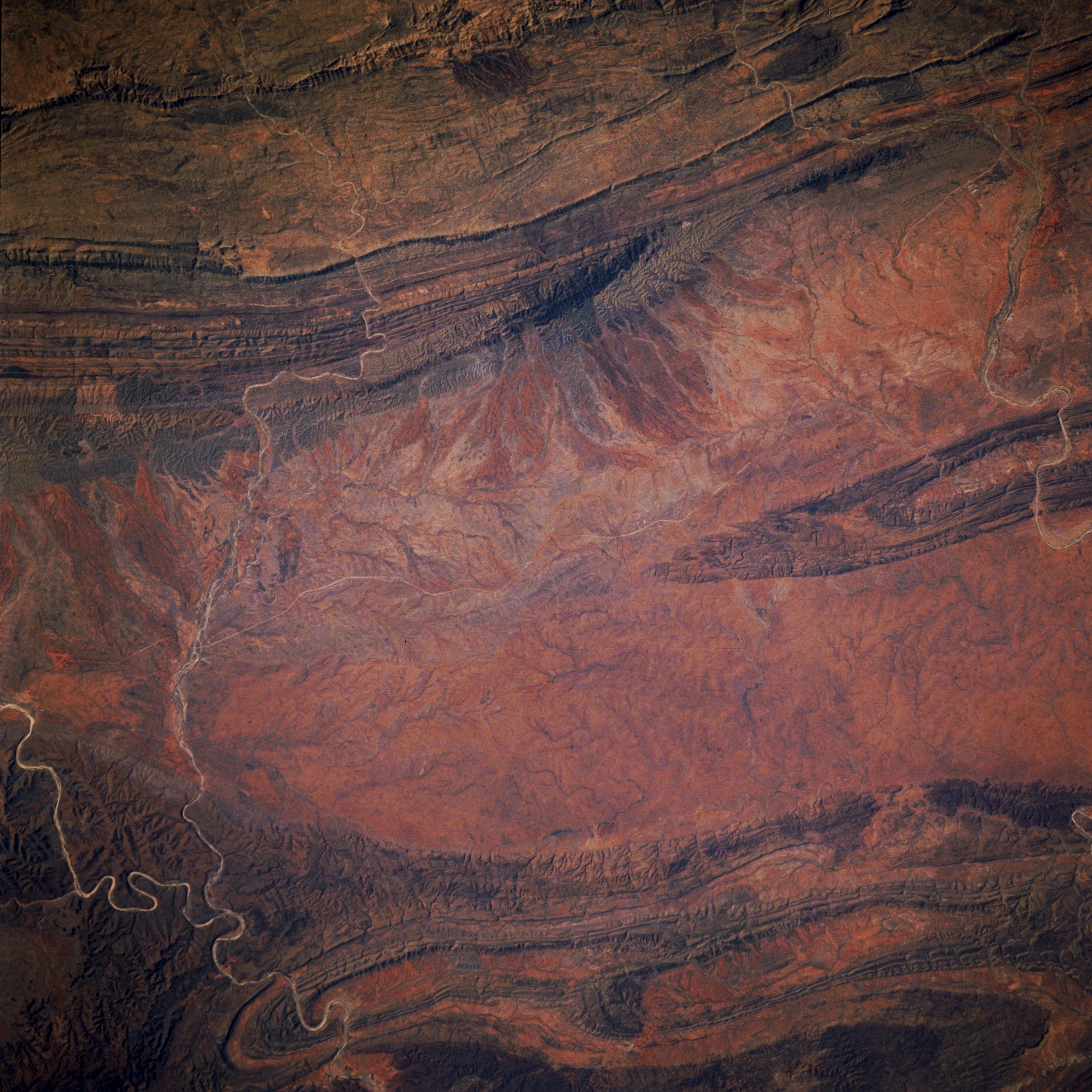
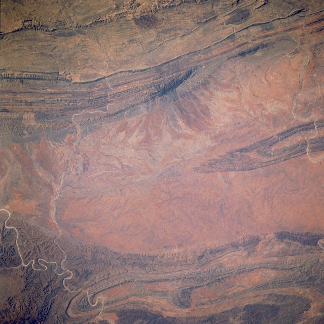
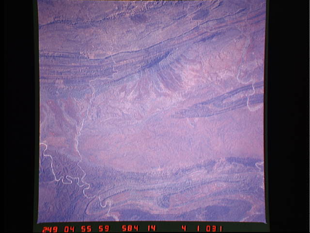
Image Caption: STS41D-41-0031 MacDonnell Ranges, Northern Territory, Australia September 1984
The western (left) side of this image overlaps with a small geographic area on image STS41D-41-029, specifically the Finke River (bottom left). Ellery Creek, a small ephemeral stream and a tributaryof the Finke River, can also be traced across this desert terrain to its confluence with the Finke River at lower left. The plains between the MacDonnell Ranges (north) and the James/Krichauff Ranges (south) widen from west to east. The channel of Hugh Creek,another ephemeral stream, is visible in the upper right quadrant of the picture. Because of the lack of vegetation, folds in the bedrock strata can be traced over tens of kilometers.
The western (left) side of this image overlaps with a small geographic area on image STS41D-41-029, specifically the Finke River (bottom left). Ellery Creek, a small ephemeral stream and a tributaryof the Finke River, can also be traced across this desert terrain to its confluence with the Finke River at lower left. The plains between the MacDonnell Ranges (north) and the James/Krichauff Ranges (south) widen from west to east. The channel of Hugh Creek,another ephemeral stream, is visible in the upper right quadrant of the picture. Because of the lack of vegetation, folds in the bedrock strata can be traced over tens of kilometers.
