STS41D-41-29
| NASA Photo ID | STS41D-41-29 |
| Focal Length | 250mm |
| Date taken | 1984.09.05 |
| Time taken | 04:55:50 GMT |
Resolutions offered for this image:
3904 x 3904 pixels 639 x 639 pixels 4440 x 4600 pixels 483 x 500 pixels 640 x 480 pixels
3904 x 3904 pixels 639 x 639 pixels 4440 x 4600 pixels 483 x 500 pixels 640 x 480 pixels
Cloud masks available for this image:
Spacecraft nadir point: 23.4° S, 133.2° E
Photo center point: 24.0° S, 132.5° E
Photo center point by machine learning:
Photo center point: 24.0° S, 132.5° E
Photo center point by machine learning:
Nadir to Photo Center: Southwest
Spacecraft Altitude: 161 nautical miles (298km)
Country or Geographic Name: | AUSTRALIA-NT |
Features: | MACDONNELL RANGES |
| Features Found Using Machine Learning: | |
Cloud Cover Percentage: | 0 (no clouds present) |
Sun Elevation Angle: | 49° |
Sun Azimuth: | 106° |
Camera: | Hasselblad |
Focal Length: | 250mm |
Camera Tilt: | 19 degrees |
Format: | 6017: Kodak Ektachrome 64, 220 Roll Format |
Film Exposure: | Normal |
| Additional Information | |
| Width | Height | Annotated | Cropped | Purpose | Links |
|---|---|---|---|---|---|
| 3904 pixels | 3904 pixels | No | No | Earth From Space collection | Download Image |
| 639 pixels | 639 pixels | No | No | Earth From Space collection | Download Image |
| 4440 pixels | 4600 pixels | No | No | Download Image | |
| 483 pixels | 500 pixels | No | No | Download Image | |
| 640 pixels | 480 pixels | No | No | Download Image |
Download Packaged File
Download a Google Earth KML for this Image
View photo footprint information
Download a GeoTIFF for this photo
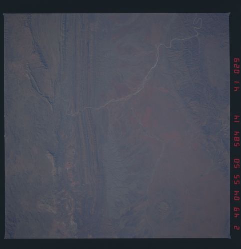
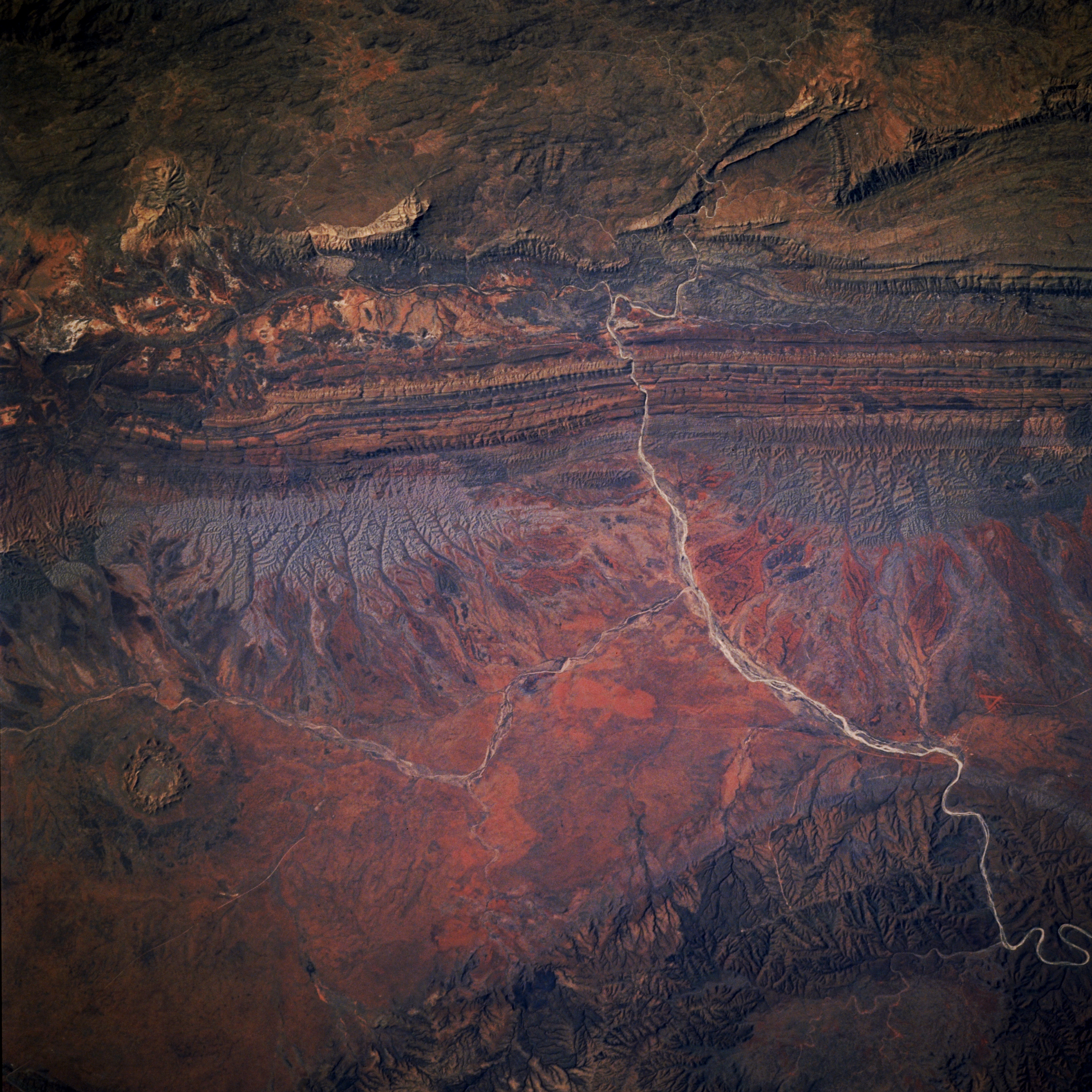
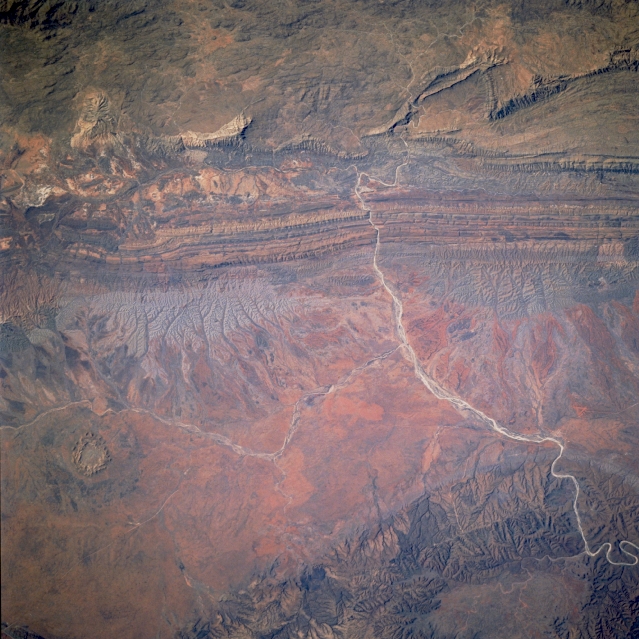
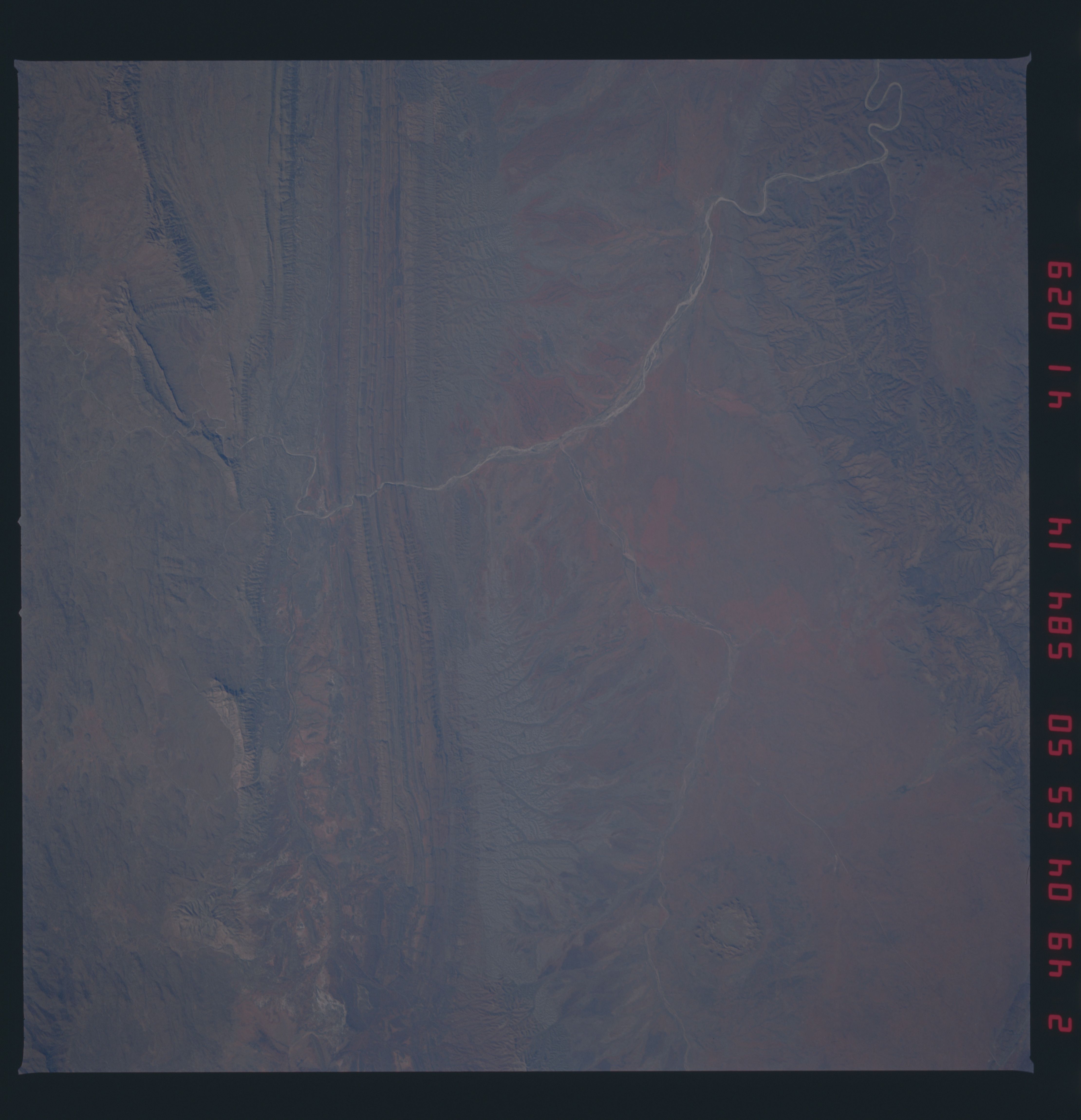
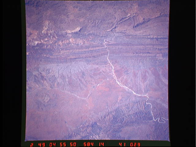
Image Caption: STS41D-41-0029 MacDonnell Ranges, Northern Territory, Australia September 1984
The parallel, folded ridges stretching east-west across the upper half of the picture are part of the MacDonnell Ranges of arid central Australia (Northern Territory). Finke River, the curving light-colored dry channel cuts through the MacDonnell Ranges (north) and the James/Krichauff Ranges (south). A small tributary (ephemeral at best) can also be traced westward across the uplifted intermontane plain from its confluence with the Finke River (slightly right of center). The oval feature (lower left quadrant) is Gosses Bluff, an impact crater. The varied colors throughout the image reflect differing types of bedrock and iron content of the sediment. Refer to STS41D-41-031 for overlapping coverage east of this image.
The parallel, folded ridges stretching east-west across the upper half of the picture are part of the MacDonnell Ranges of arid central Australia (Northern Territory). Finke River, the curving light-colored dry channel cuts through the MacDonnell Ranges (north) and the James/Krichauff Ranges (south). A small tributary (ephemeral at best) can also be traced westward across the uplifted intermontane plain from its confluence with the Finke River (slightly right of center). The oval feature (lower left quadrant) is Gosses Bluff, an impact crater. The varied colors throughout the image reflect differing types of bedrock and iron content of the sediment. Refer to STS41D-41-031 for overlapping coverage east of this image.
