STS41D-38-86

| NASA Photo ID | STS41D-38-86 |
| Focal Length | 100mm |
| Date taken | 1984.09.02 |
| Time taken | 23:54:02 GMT |
Cloud masks available for this image:
Spacecraft nadir point:
Photo center point: 14.0° N, 145.0° E
Photo center point by machine learning:
Photo center point: 14.0° N, 145.0° E
Photo center point by machine learning:
Nadir to Photo Center:
Spacecraft Altitude: nautical miles (0km)
Camera: | Hasselblad |
Focal Length: | 100mm |
Camera Tilt: | Low Oblique |
Format: | 6017: Kodak Ektachrome 64, 220 Roll Format |
Film Exposure: | Normal |
| Additional Information | |
| Width | Height | Annotated | Cropped | Purpose | Links |
|---|---|---|---|---|---|
| 4440 pixels | 4600 pixels | No | No | Download Image | |
| 483 pixels | 500 pixels | No | No | Download Image | |
| 640 pixels | 480 pixels | No | No | Download Image |
Download Packaged File
Download a Google Earth KML for this Image
View photo footprint information
Download a GeoTIFF for this photo
Image Caption:
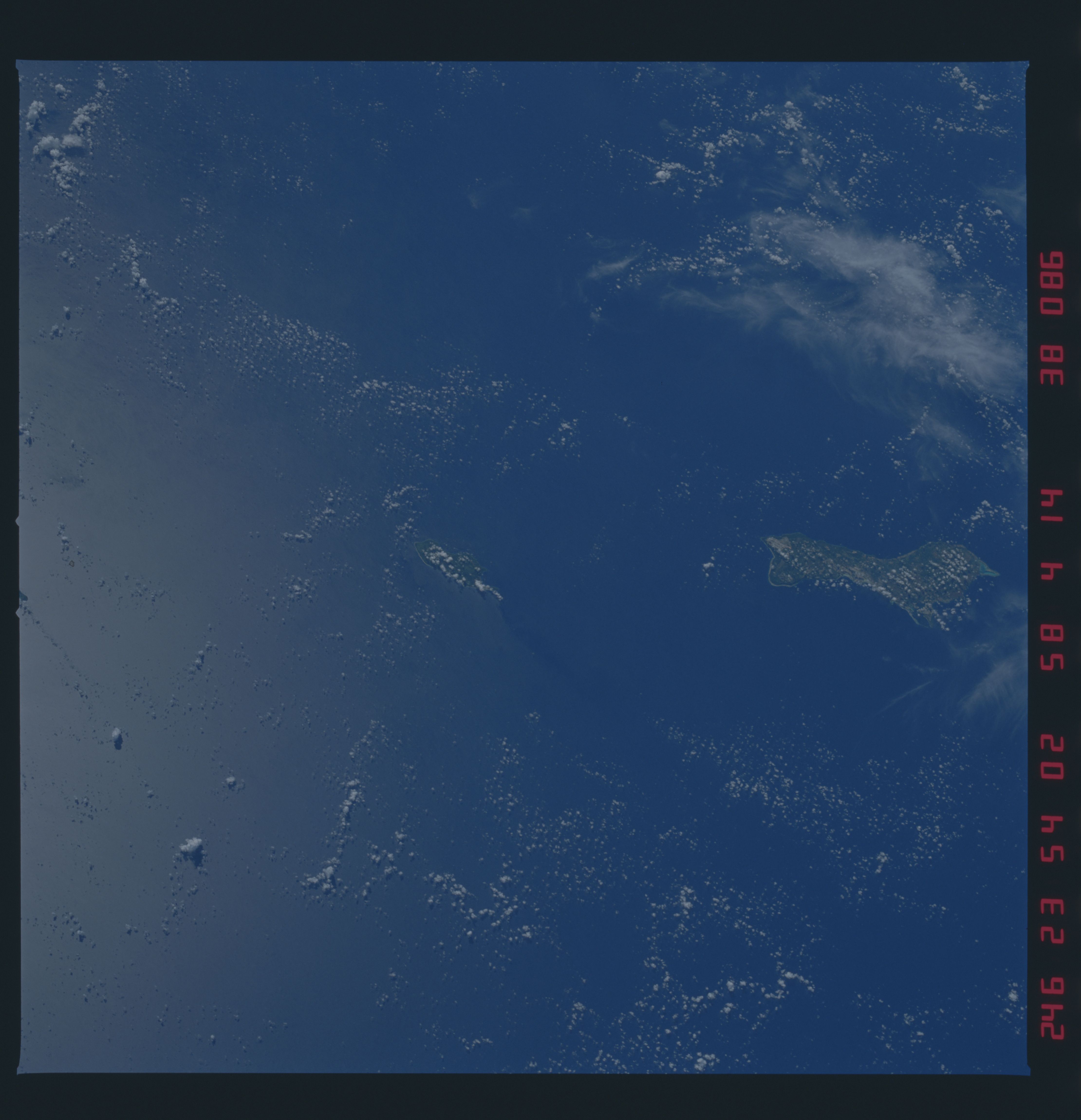
Guam and Rota, Southern Mariana Islands
Guam (1) is a frequent stopover for all sorts of trans-Pacific
travel. The northern part of the island is a high plateau. The
southern part of the island is made up of high volcanic hills
covered in sword grass. The island has been uplifted throughout
the Pleistocene. The enclosed harbor of Agana and two of the
several airstrips on the island can be seen at (2), (3), and (4).
The only good reef development is at the southern tip of Guam
(5). An island wake (6) which is parallel to the wind direction
can be seen in the surface waters west of Rota (7). (41D-38-86)
