STS41C-40-2130
| NASA Photo ID | STS41C-40-2130 |
| Focal Length | 100mm |
| Date taken | 1984.04.__ |
| Time taken | GMT |
Resolutions offered for this image:
5221 x 5274 pixels 633 x 640 pixels 4410 x 4600 pixels 479 x 500 pixels 640 x 480 pixels
5221 x 5274 pixels 633 x 640 pixels 4410 x 4600 pixels 479 x 500 pixels 640 x 480 pixels

Cloud masks available for this image:
Spacecraft nadir point:
Photo center point: 28.0° N, 84.0° W
Photo center point by machine learning:
Photo center point: 28.0° N, 84.0° W
Photo center point by machine learning:
Nadir to Photo Center:
Spacecraft Altitude: nautical miles (0km)
Country or Geographic Name: | GULF OF MEXICO |
Features: | CLOUDS, FRONTAL SYSTEM |
| Features Found Using Machine Learning: | |
Cloud Cover Percentage: | 80 (76-100)% |
Sun Elevation Angle: | ° |
Sun Azimuth: | ° |
Camera: | Hasselblad |
Focal Length: | 100mm |
Camera Tilt: | Low Oblique |
Format: | 6017: Kodak Ektachrome 64, 220 Roll Format |
Film Exposure: | Normal |
| Additional Information | |
| Width | Height | Annotated | Cropped | Purpose | Links |
|---|---|---|---|---|---|
| 5221 pixels | 5274 pixels | No | No | Earth From Space collection | Download Image |
| 633 pixels | 640 pixels | No | No | Earth From Space collection | Download Image |
| 4410 pixels | 4600 pixels | No | No | Download Image | |
| 479 pixels | 500 pixels | No | No | Download Image | |
| 640 pixels | 480 pixels | No | No | Download Image |
Download Packaged File
Download a Google Earth KML for this Image
View photo footprint information
Download a GeoTIFF for this photo
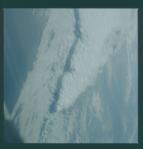
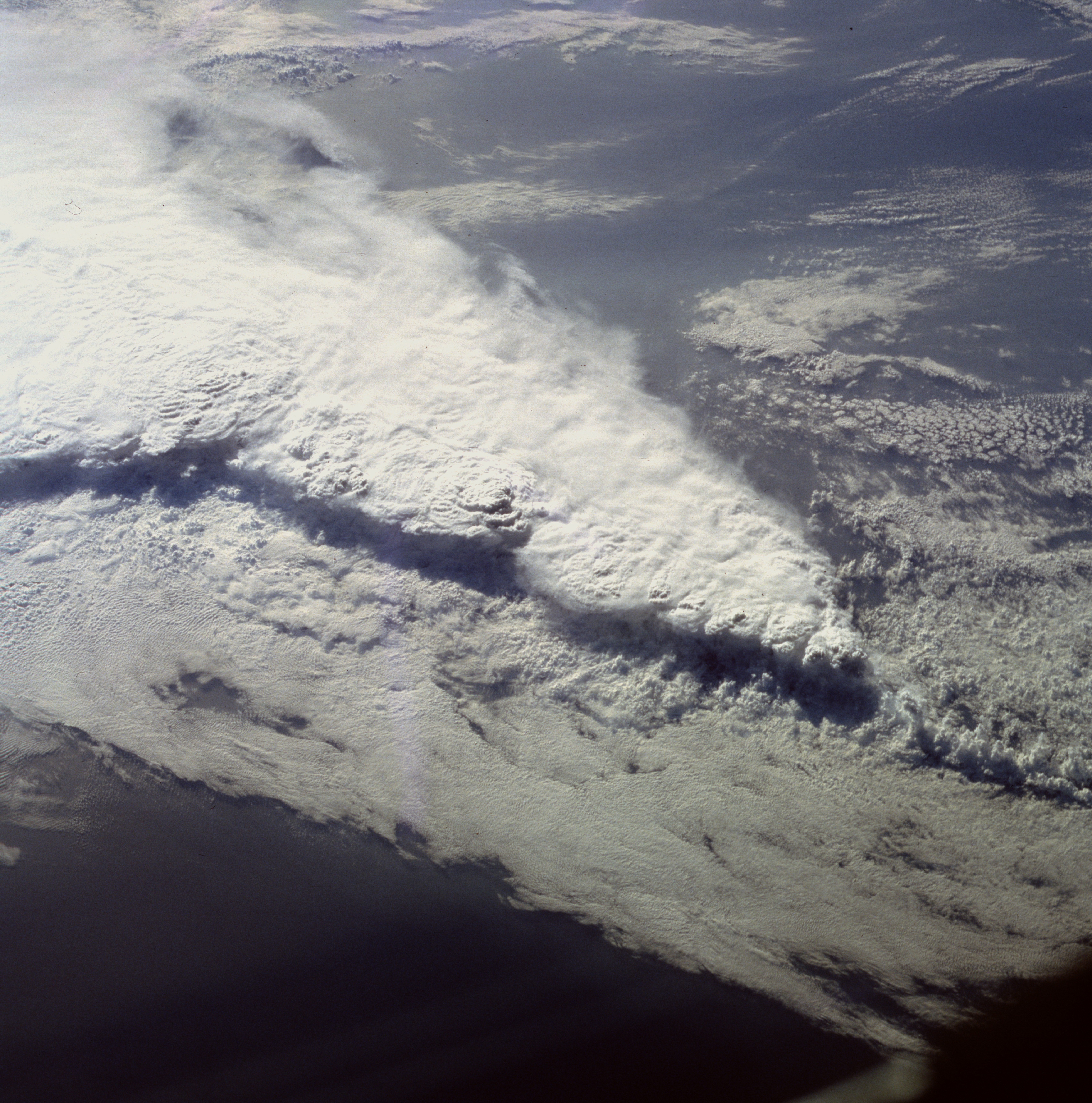
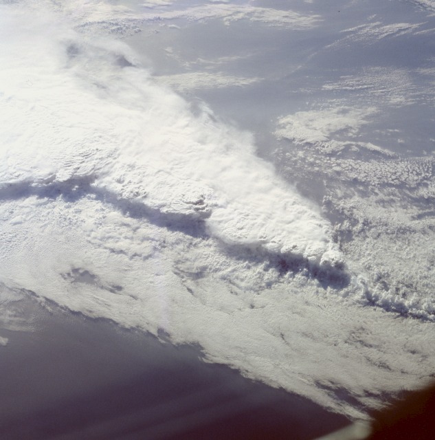
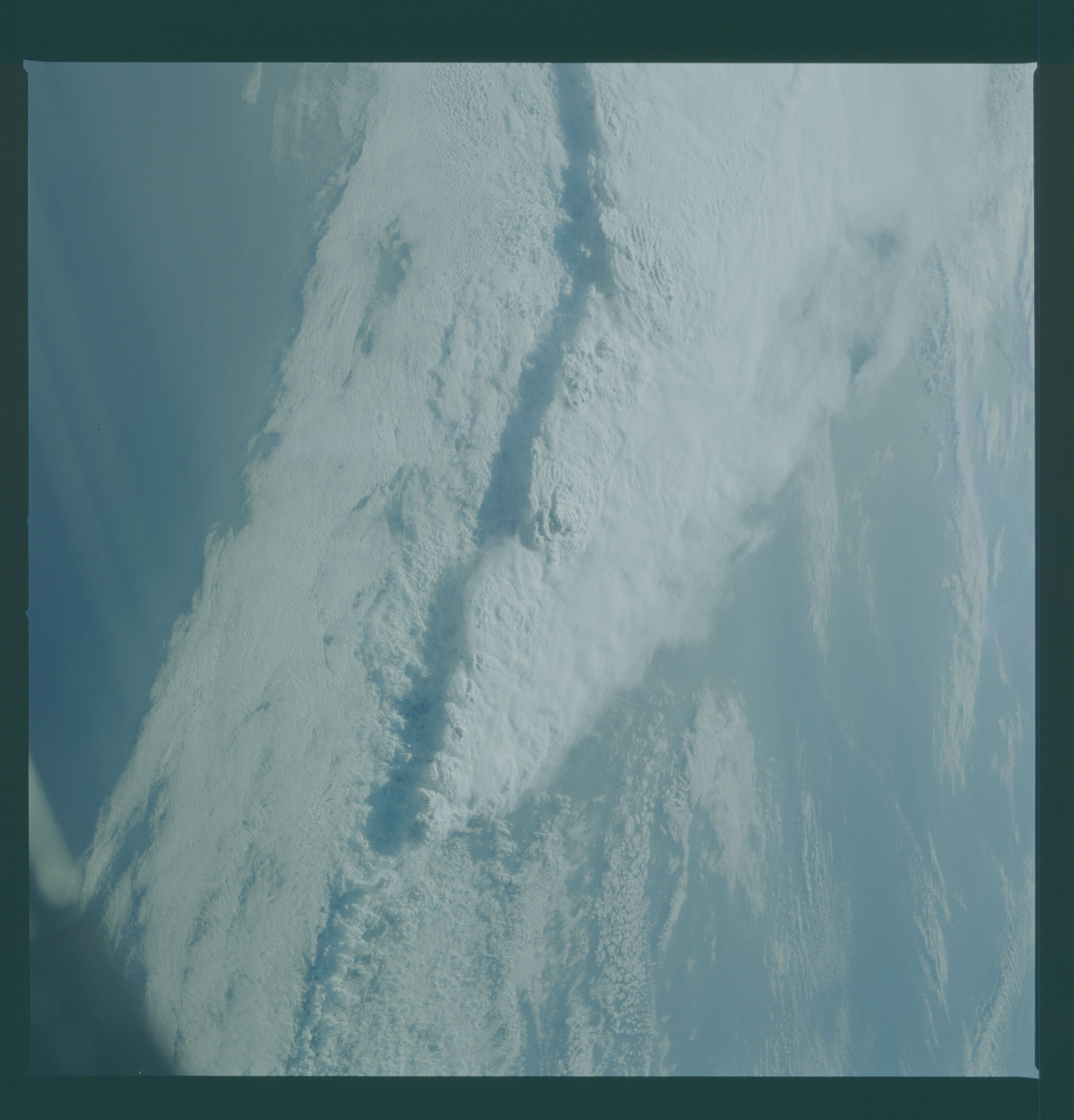
Image Caption: STS41C-40-2130 Frontal System and Thunderstorms, Florida, U.S.A. April 1984
This spectacular, low-oblique photograph shows a convective line of thunderstorms associated with a passing cold front over Florida. A shadow from the height of the thunderstorms, caused by early morning sunlight, can be seen traversing the scene southwest to northeast. Some of these storms were estimated to reach heights in excess of 40 000 feet (12 000 meters). The V-shaped cloud structure is normally associated with cold fronts that cross the Gulf of Mexico and Florida in late winter and early spring. Severe thunderstorms and tornadoes usually occur with this type of storm system. At the time this photograph was taken, weather stations across Florida reported severe thunderstorms, strong winds, hail, torrential rains, and numerous tornadoes.
This spectacular, low-oblique photograph shows a convective line of thunderstorms associated with a passing cold front over Florida. A shadow from the height of the thunderstorms, caused by early morning sunlight, can be seen traversing the scene southwest to northeast. Some of these storms were estimated to reach heights in excess of 40 000 feet (12 000 meters). The V-shaped cloud structure is normally associated with cold fronts that cross the Gulf of Mexico and Florida in late winter and early spring. Severe thunderstorms and tornadoes usually occur with this type of storm system. At the time this photograph was taken, weather stations across Florida reported severe thunderstorms, strong winds, hail, torrential rains, and numerous tornadoes.
