STS41B-46-3000
| NASA Photo ID | STS41B-46-3000 |
| Focal Length | 250mm |
| Date taken | 1984.02.__ |
| Time taken | GMT |
Cloud masks available for this image:
Spacecraft nadir point:
Photo center point: 9.0° S, 40.0° W
Photo center point by machine learning:
Photo center point: 9.0° S, 40.0° W
Photo center point by machine learning:
Nadir to Photo Center:
Spacecraft Altitude: nautical miles (0km)
Country or Geographic Name: | BRAZIL |
Features: | RESERVOIR |
| Features Found Using Machine Learning: | |
Cloud Cover Percentage: | 5 (1-10)% |
Sun Elevation Angle: | ° |
Sun Azimuth: | ° |
Camera: | Hasselblad |
Focal Length: | 250mm |
Camera Tilt: | |
Format: | 6017: Kodak Ektachrome 64, 220 Roll Format |
Film Exposure: | Normal |
| Additional Information | |
| Width | Height | Annotated | Cropped | Purpose | Links |
|---|---|---|---|---|---|
| 5700 pixels | 5900 pixels | No | No | Download Image | |
| 483 pixels | 500 pixels | No | No | Download Image | |
| 640 pixels | 480 pixels | No | No | Download Image |
Download Packaged File
Download a Google Earth KML for this Image
View photo footprint information
Download a GeoTIFF for this photo
Image Caption:
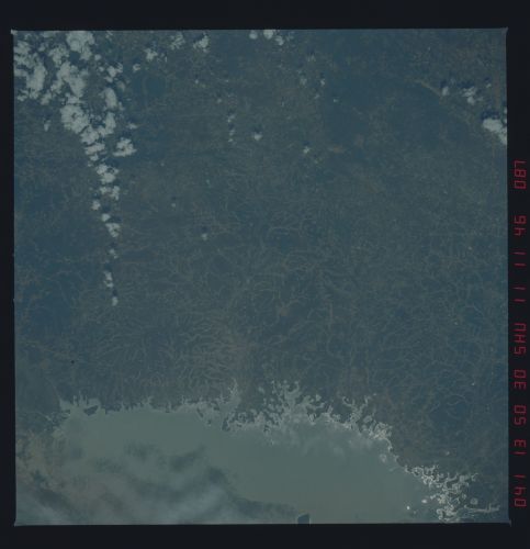
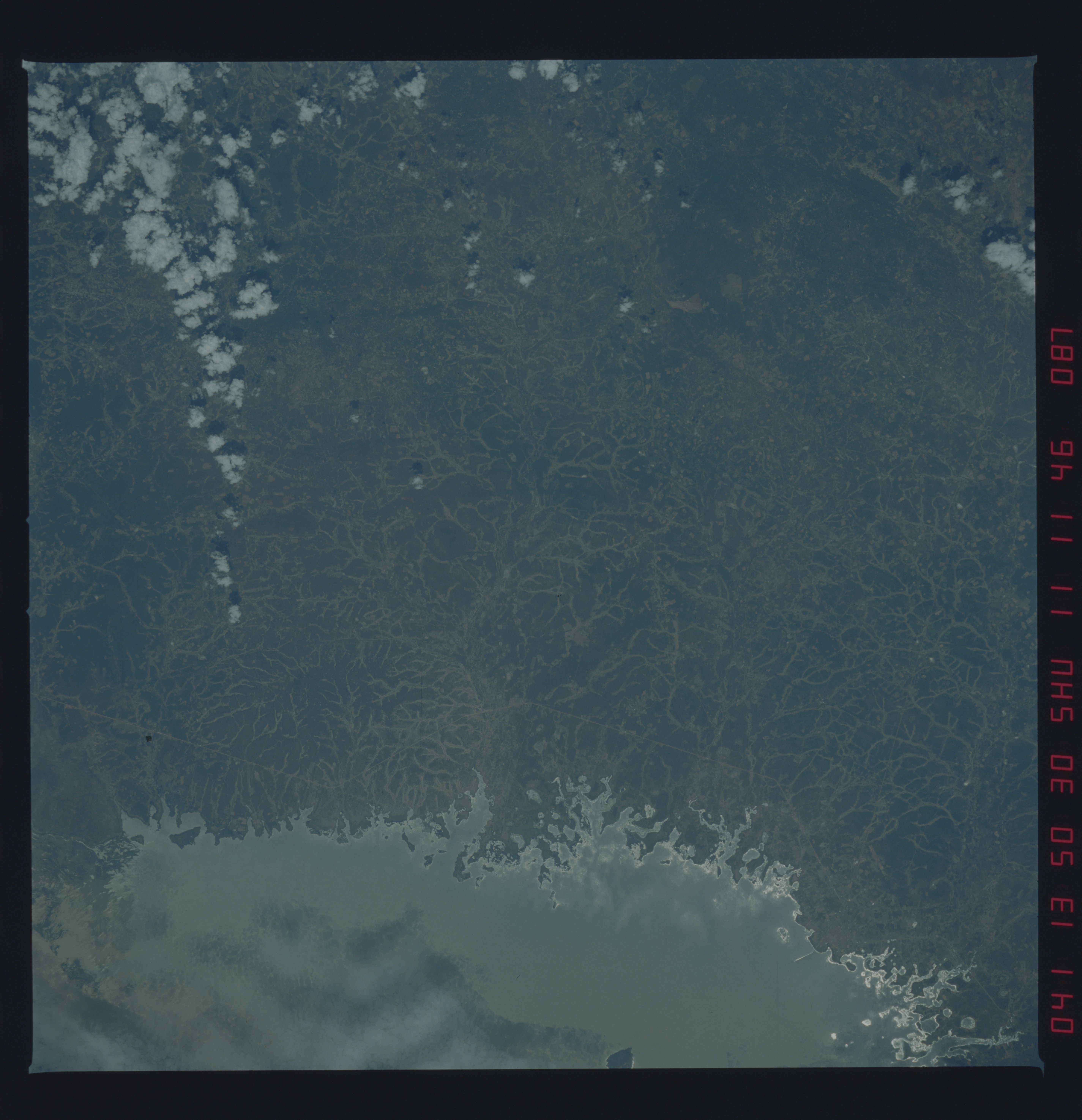
Land Use Practices
A large reservoir on the Rio So Francisco is surrounded by the
dissected shrub plateau of Sierra des Dois Irmaos in Bahia, Bra-
zil. This area is poorly mapped and has been suffering from four
consecutive years of drought. Scientists are interested in sur-
face water resources of this region. Space Shuttle photography
assists in documenting new water distribution/irrigation pro-
jects, regional deforestation, and land use practices. (41B-46-
3000)
