STS41B-46-2957

| NASA Photo ID | STS41B-46-2957 |
| Focal Length | 250mm |
| Date taken | 1984.02.__ |
| Time taken | GMT |
Resolutions offered for this image:
5230 x 5230 pixels 639 x 639 pixels 5700 x 5900 pixels 483 x 500 pixels 640 x 480 pixels 1264 x 1258 pixels
5230 x 5230 pixels 639 x 639 pixels 5700 x 5900 pixels 483 x 500 pixels 640 x 480 pixels 1264 x 1258 pixels


Cloud masks available for this image:
Spacecraft nadir point:
Photo center point: 3.0° S, 37.5° E
Photo center point by machine learning:
Photo center point: 3.0° S, 37.5° E
Photo center point by machine learning:
Nadir to Photo Center:
Spacecraft Altitude: nautical miles (0km)
Country or Geographic Name: | TANZANIA |
Features: | KILIMANJARO |
| Features Found Using Machine Learning: | |
Cloud Cover Percentage: | 10 (1-10)% |
Sun Elevation Angle: | ° |
Sun Azimuth: | ° |
Camera: | Hasselblad |
Focal Length: | 250mm |
Camera Tilt: | Near Vertical |
Format: | 6017: Kodak Ektachrome 64, 220 Roll Format |
Film Exposure: | Normal |
| Additional Information | |
| Width | Height | Annotated | Cropped | Purpose | Links |
|---|---|---|---|---|---|
| 5230 pixels | 5230 pixels | No | No | Earth From Space collection | Download Image |
| 639 pixels | 639 pixels | No | No | Earth From Space collection | Download Image |
| 5700 pixels | 5900 pixels | No | No | Download Image | |
| 483 pixels | 500 pixels | No | No | Download Image | |
| 640 pixels | 480 pixels | No | No | Download Image | |
| 1264 pixels | 1258 pixels | No | No | Download Image |
Download Packaged File
Download a Google Earth KML for this Image
View photo footprint information
Download a GeoTIFF for this photo
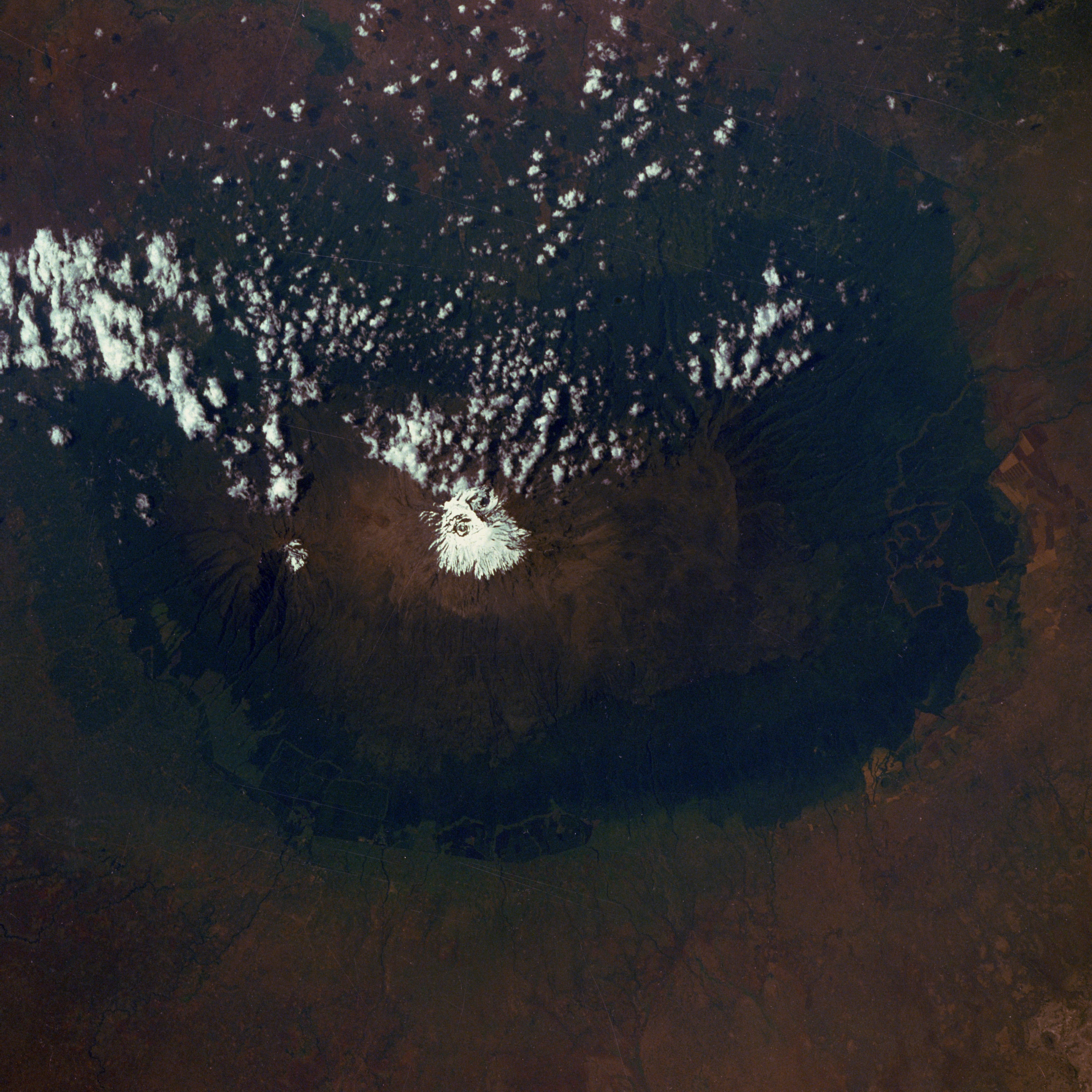
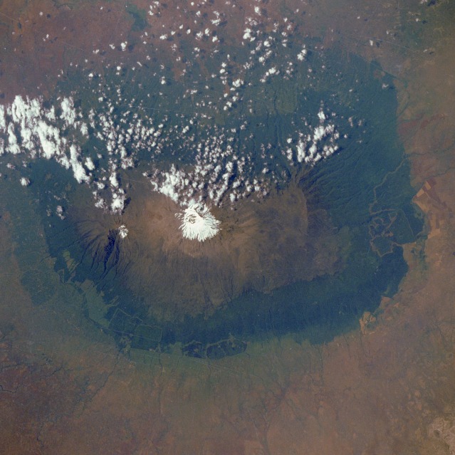
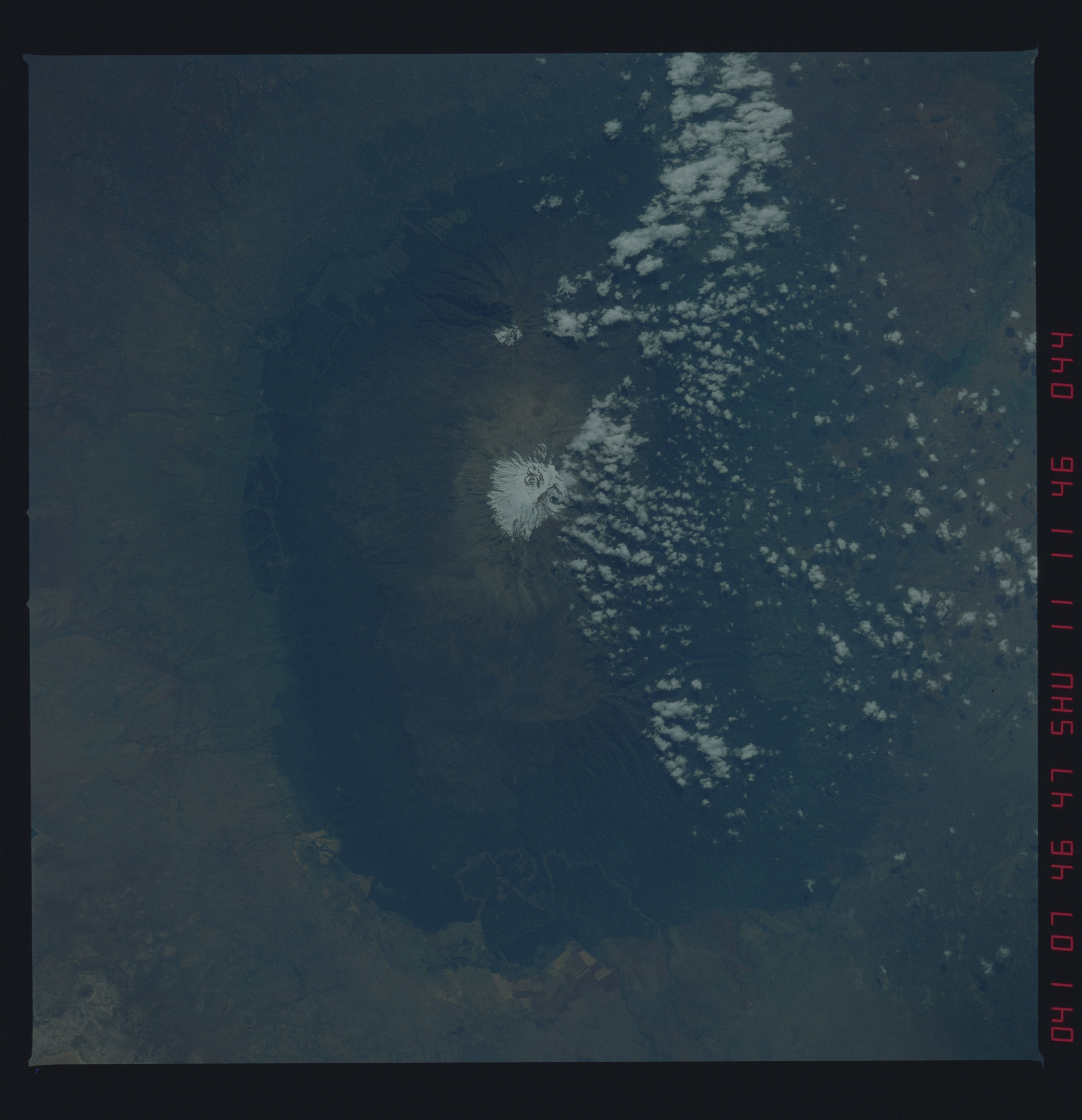
Image Caption: STS41B-046-2957 Mount Kilimanjaro, Tanzania February 1984
Mount Kilimanjaro, the highest [19 340 feet (5898 meters)] and most celebrated mountain in Africa, is the centerpiece in this east-looking, low-oblique photograph. Looming some 16 000 feet (4900 meters) above the plains that spread out from its base, the mountain dominates its surroundings. Composed of three separate volcanoes, massive and complex Kilimanjaro covers an area 60 miles (100 kilometers) long and 40 miles (65 kilometers) wide. The volcanoes, whose lava fields overlapped and partially obliterated each other, began erupting approximately 2 million years ago. At the center is the culminating massif, Kibo (snow-covered peak near the center of the photograph), flanked by the lower summits of Mawenzi to the east and Shira to the west. The peaks of Kibo and Mawenzi are joined by a broad saddle 7 miles (11 kilometers) long. Because of Kilimanjaro's great height, the mountain influences its own weather. Winds incoming from the Indian Ocean are deflected upward by the slopes and drop their moisture as rain and snow. This moisture results in a variety of vegetative zones that contrast dramatically with the savanna grasses and semidesert scrub on the surrounding plains. The mount's lower slopes, probably once forested, have been cleared for the cultivation of coffee, corn, and other crops. At higher elevations [approximately 9800 feet (3000 meters)] lies a belt of tropical rain forest that gives way to grasslands and moorlands. This belt, in turn, is replaced by high-altitude desert [near 14 500 feet (4400 meters)]. At the highest elevations is a zone of permanent ice and snow that is responsible for the name Kilimanjaro, which in Swahili means "the mountain that glitters."
Mount Kilimanjaro, the highest [19 340 feet (5898 meters)] and most celebrated mountain in Africa, is the centerpiece in this east-looking, low-oblique photograph. Looming some 16 000 feet (4900 meters) above the plains that spread out from its base, the mountain dominates its surroundings. Composed of three separate volcanoes, massive and complex Kilimanjaro covers an area 60 miles (100 kilometers) long and 40 miles (65 kilometers) wide. The volcanoes, whose lava fields overlapped and partially obliterated each other, began erupting approximately 2 million years ago. At the center is the culminating massif, Kibo (snow-covered peak near the center of the photograph), flanked by the lower summits of Mawenzi to the east and Shira to the west. The peaks of Kibo and Mawenzi are joined by a broad saddle 7 miles (11 kilometers) long. Because of Kilimanjaro's great height, the mountain influences its own weather. Winds incoming from the Indian Ocean are deflected upward by the slopes and drop their moisture as rain and snow. This moisture results in a variety of vegetative zones that contrast dramatically with the savanna grasses and semidesert scrub on the surrounding plains. The mount's lower slopes, probably once forested, have been cleared for the cultivation of coffee, corn, and other crops. At higher elevations [approximately 9800 feet (3000 meters)] lies a belt of tropical rain forest that gives way to grasslands and moorlands. This belt, in turn, is replaced by high-altitude desert [near 14 500 feet (4400 meters)]. At the highest elevations is a zone of permanent ice and snow that is responsible for the name Kilimanjaro, which in Swahili means "the mountain that glitters."
