STS41B-41-2335
| NASA Photo ID | STS41B-41-2335 |
| Focal Length | 250mm |
| Date taken | 1984.02.__ |
| Time taken | GMT |
Resolutions offered for this image:
5221 x 5274 pixels 633 x 640 pixels 5700 x 5900 pixels 483 x 500 pixels 640 x 480 pixels
5221 x 5274 pixels 633 x 640 pixels 5700 x 5900 pixels 483 x 500 pixels 640 x 480 pixels
Cloud masks available for this image:
Spacecraft nadir point:
Photo center point: 18.5° S, 63.5° W
Photo center point by machine learning:
Photo center point: 18.5° S, 63.5° W
Photo center point by machine learning:
Nadir to Photo Center:
Spacecraft Altitude: nautical miles (0km)
Country or Geographic Name: | BOLIVIA |
Features: | RIVER GRANDE GUAPAY |
| Features Found Using Machine Learning: | |
Cloud Cover Percentage: | 0 (no clouds present) |
Sun Elevation Angle: | ° |
Sun Azimuth: | ° |
Camera: | Hasselblad |
Focal Length: | 250mm |
Camera Tilt: | Near Vertical |
Format: | 6017: Kodak Ektachrome 64, 220 Roll Format |
Film Exposure: | Normal |
| Additional Information | |
| Width | Height | Annotated | Cropped | Purpose | Links |
|---|---|---|---|---|---|
| 5221 pixels | 5274 pixels | No | No | Earth From Space collection | Download Image |
| 633 pixels | 640 pixels | No | No | Earth From Space collection | Download Image |
| 5700 pixels | 5900 pixels | No | No | Download Image | |
| 483 pixels | 500 pixels | No | No | Download Image | |
| 640 pixels | 480 pixels | No | No | Download Image |
Download Packaged File
Download a Google Earth KML for this Image
View photo footprint information
Download a GeoTIFF for this photo
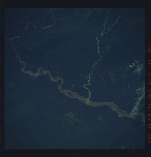
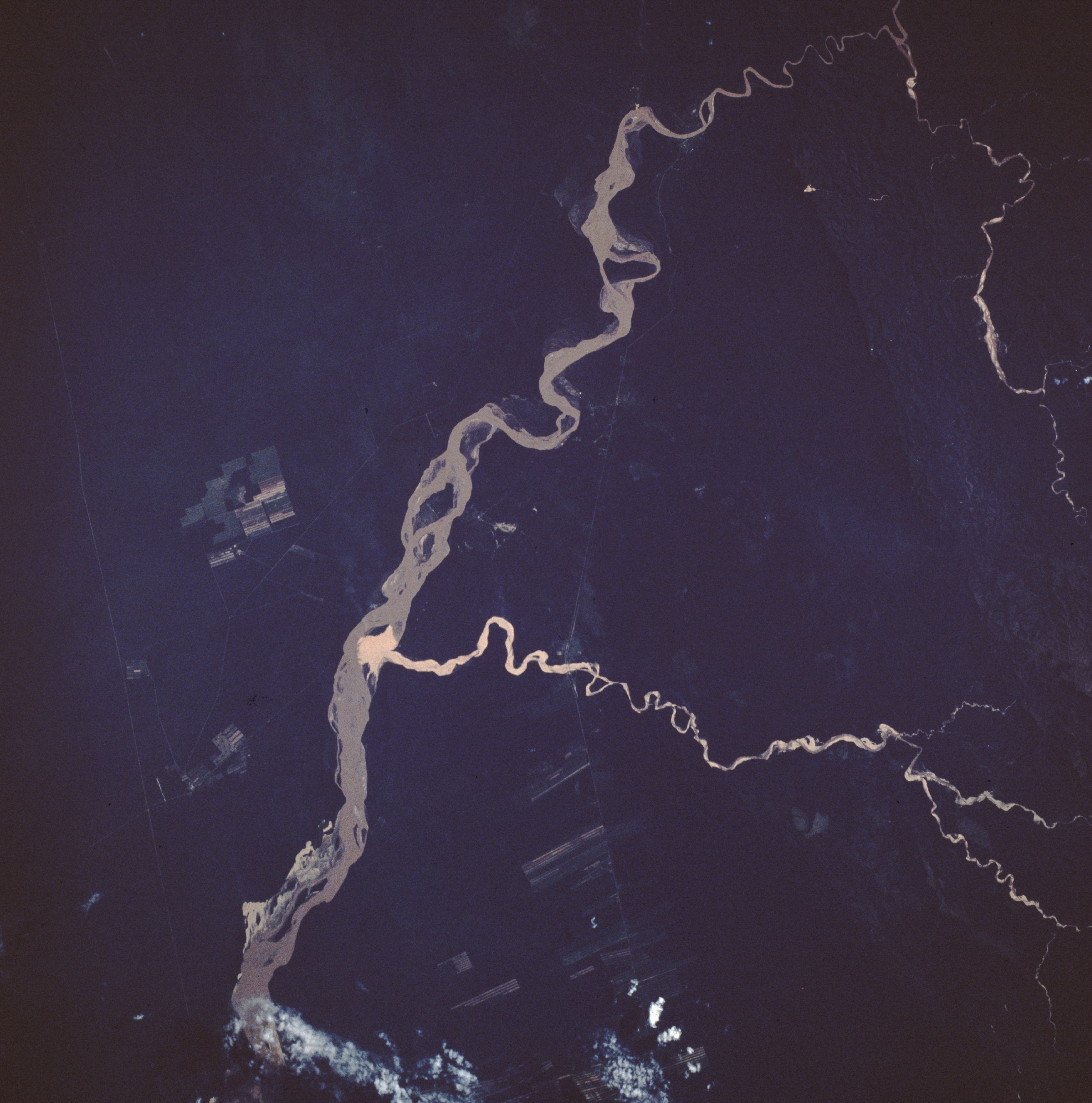
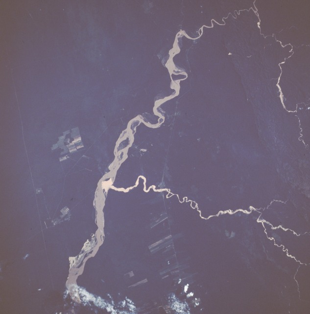
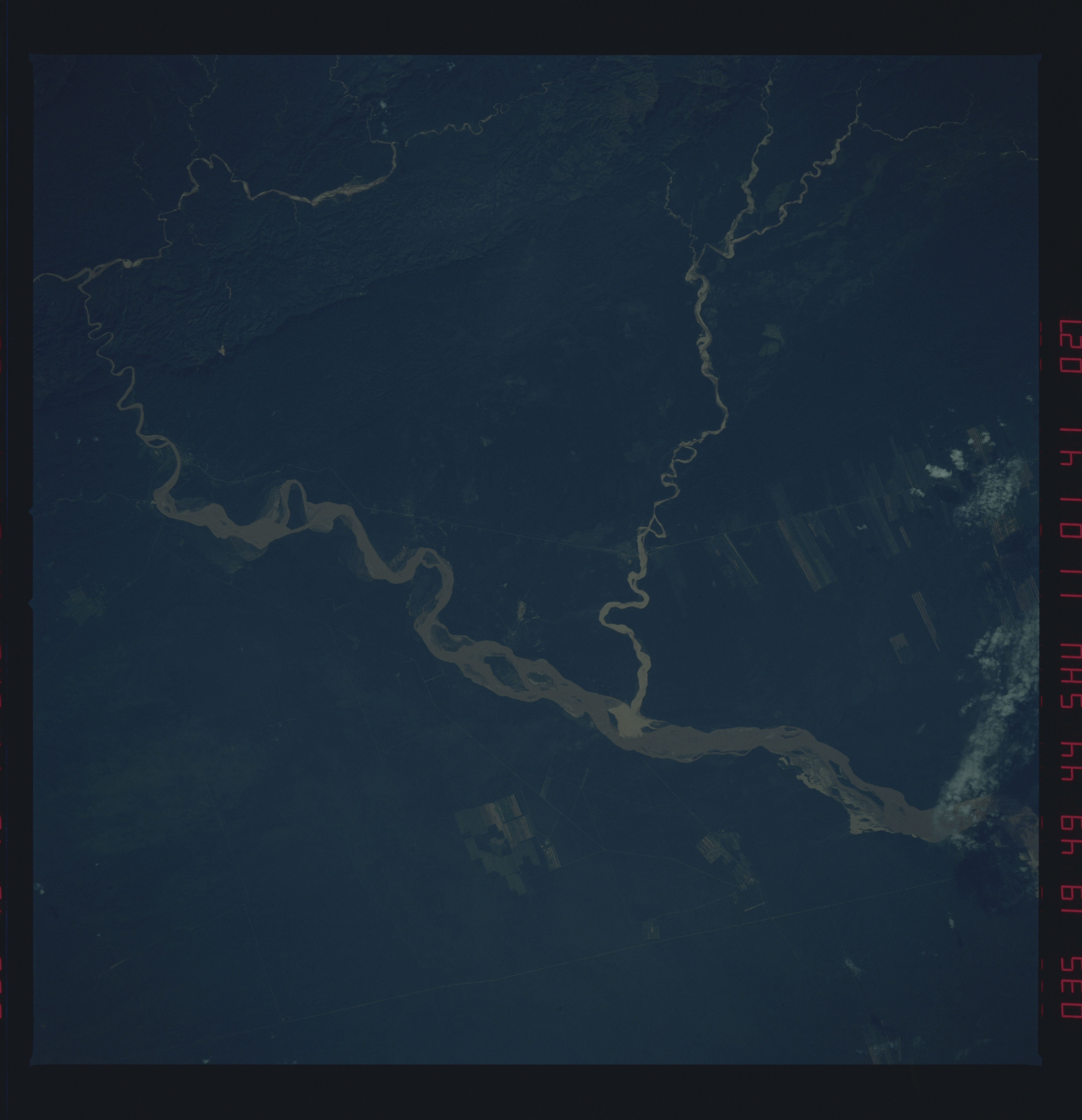
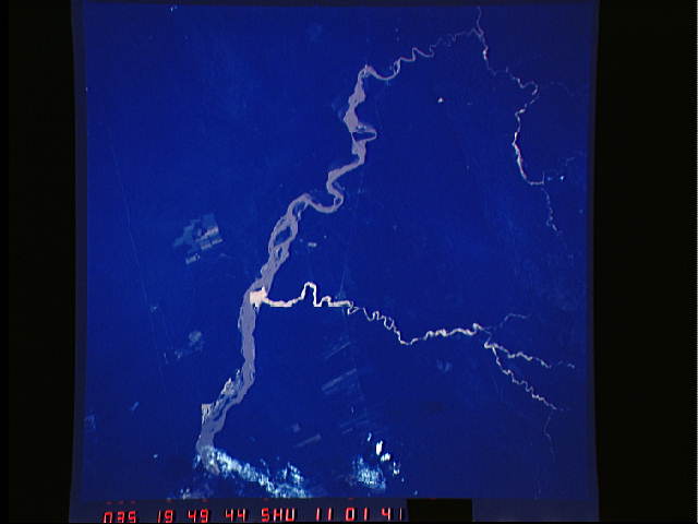
Image Caption: STS41B-041-2335 Rio Grande, Bolivia February 1984
The Rio Grande of Bolivia gradually arcs northeast as it exits the foothills of the eastern flank of the Andes Mountains. The segment of the Rio Grande shown in this near-vertical photograph is approximately 60 miles (95 kilometers) due south of Santa Cruz in the Bolivian lowlands. The tan water indicates that the river is transporting a large quantity of sediment. A somewhat unusual feature is the smaller tributary that flows for approximately 35 miles (55 kilometers), enters the Rio Grande, and creates its own delta within the much larger river. The source of the silt that is transported by the shorter tributary is unknown. The north-south lines on either side of the Rio Grande are railroad and pipeline rights-of-way on the west and a pipeline right-of-way on the east. Dense vegetation covers most of the area except for some cultivated fields in the northern half of the photograph.
The Rio Grande of Bolivia gradually arcs northeast as it exits the foothills of the eastern flank of the Andes Mountains. The segment of the Rio Grande shown in this near-vertical photograph is approximately 60 miles (95 kilometers) due south of Santa Cruz in the Bolivian lowlands. The tan water indicates that the river is transporting a large quantity of sediment. A somewhat unusual feature is the smaller tributary that flows for approximately 35 miles (55 kilometers), enters the Rio Grande, and creates its own delta within the much larger river. The source of the silt that is transported by the shorter tributary is unknown. The north-south lines on either side of the Rio Grande are railroad and pipeline rights-of-way on the west and a pipeline right-of-way on the east. Dense vegetation covers most of the area except for some cultivated fields in the northern half of the photograph.
