STS41B-39-2159
| NASA Photo ID | STS41B-39-2159 |
| Focal Length | 250mm |
| Date taken | 1984.02.__ |
| Time taken | GMT |
Resolutions offered for this image:
5276 x 5276 pixels 640 x 640 pixels 5700 x 5900 pixels 483 x 500 pixels 640 x 480 pixels 5276 x 5276 pixels
5276 x 5276 pixels 640 x 640 pixels 5700 x 5900 pixels 483 x 500 pixels 640 x 480 pixels 5276 x 5276 pixels
Cloud masks available for this image:
Spacecraft nadir point:
Photo center point: 22.5° N, 74.0° W
Photo center point by machine learning:
Photo center point: 22.5° N, 74.0° W
Photo center point by machine learning:
Nadir to Photo Center:
Spacecraft Altitude: nautical miles (0km)
Country or Geographic Name: | BAHAMAS |
Features: | BIGHT OF ACKLINS BAY |
| Features Found Using Machine Learning: | |
Cloud Cover Percentage: | 5 (1-10)% |
Sun Elevation Angle: | ° |
Sun Azimuth: | ° |
Camera: | Hasselblad |
Focal Length: | 250mm |
Camera Tilt: | Near Vertical |
Format: | 6017: Kodak Ektachrome 64, 220 Roll Format |
Film Exposure: | Normal |
| Additional Information | |
| Width | Height | Annotated | Cropped | Purpose | Links |
|---|---|---|---|---|---|
| 5276 pixels | 5276 pixels | No | No | Earth From Space collection | Download Image |
| 640 pixels | 640 pixels | No | No | Earth From Space collection | Download Image |
| 5700 pixels | 5900 pixels | No | No | Download Image | |
| 483 pixels | 500 pixels | No | No | Download Image | |
| 640 pixels | 480 pixels | No | No | Download Image | |
| 5276 pixels | 5276 pixels | ReefBase pilot | Download Image |
Download Packaged File
Download a Google Earth KML for this Image
View photo footprint information
Download a GeoTIFF for this photo
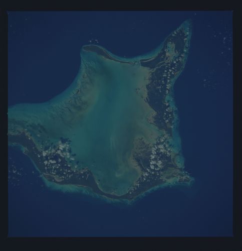
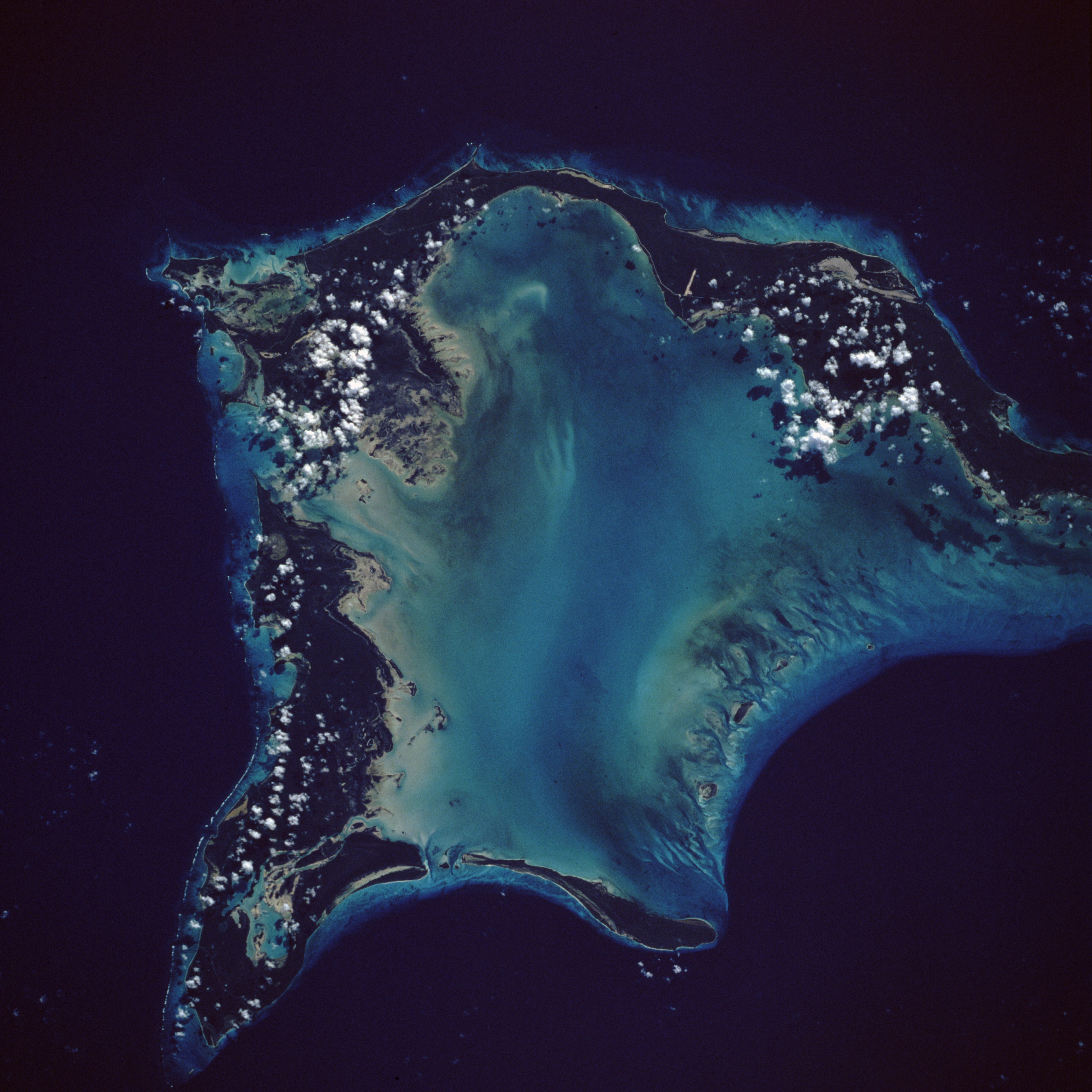
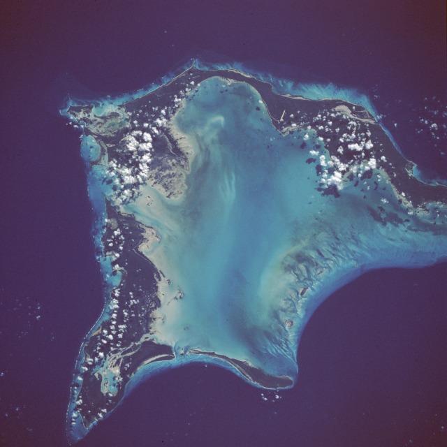
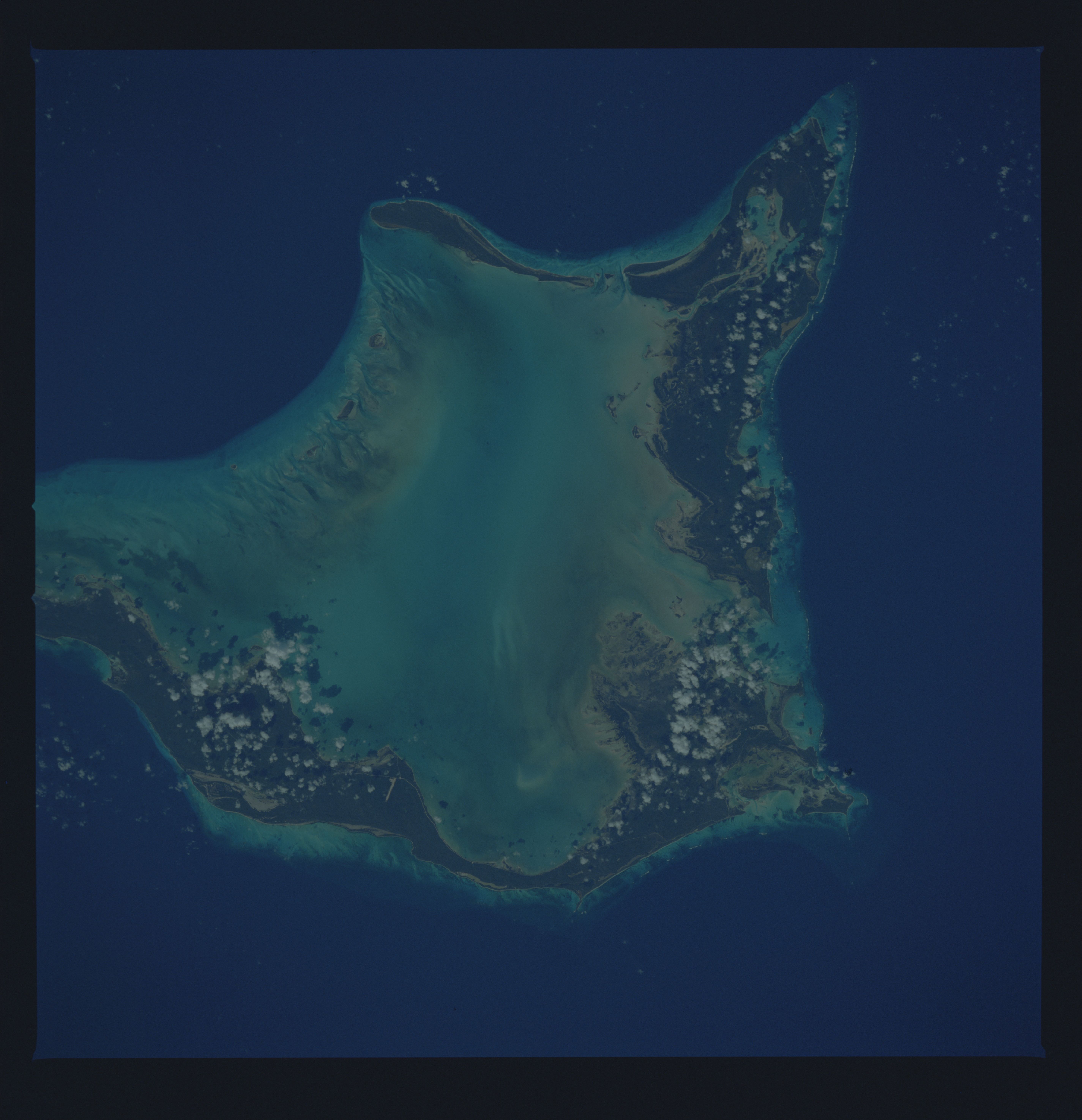
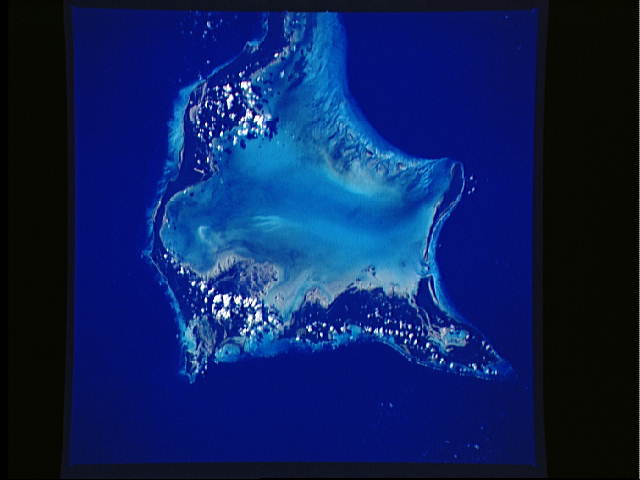
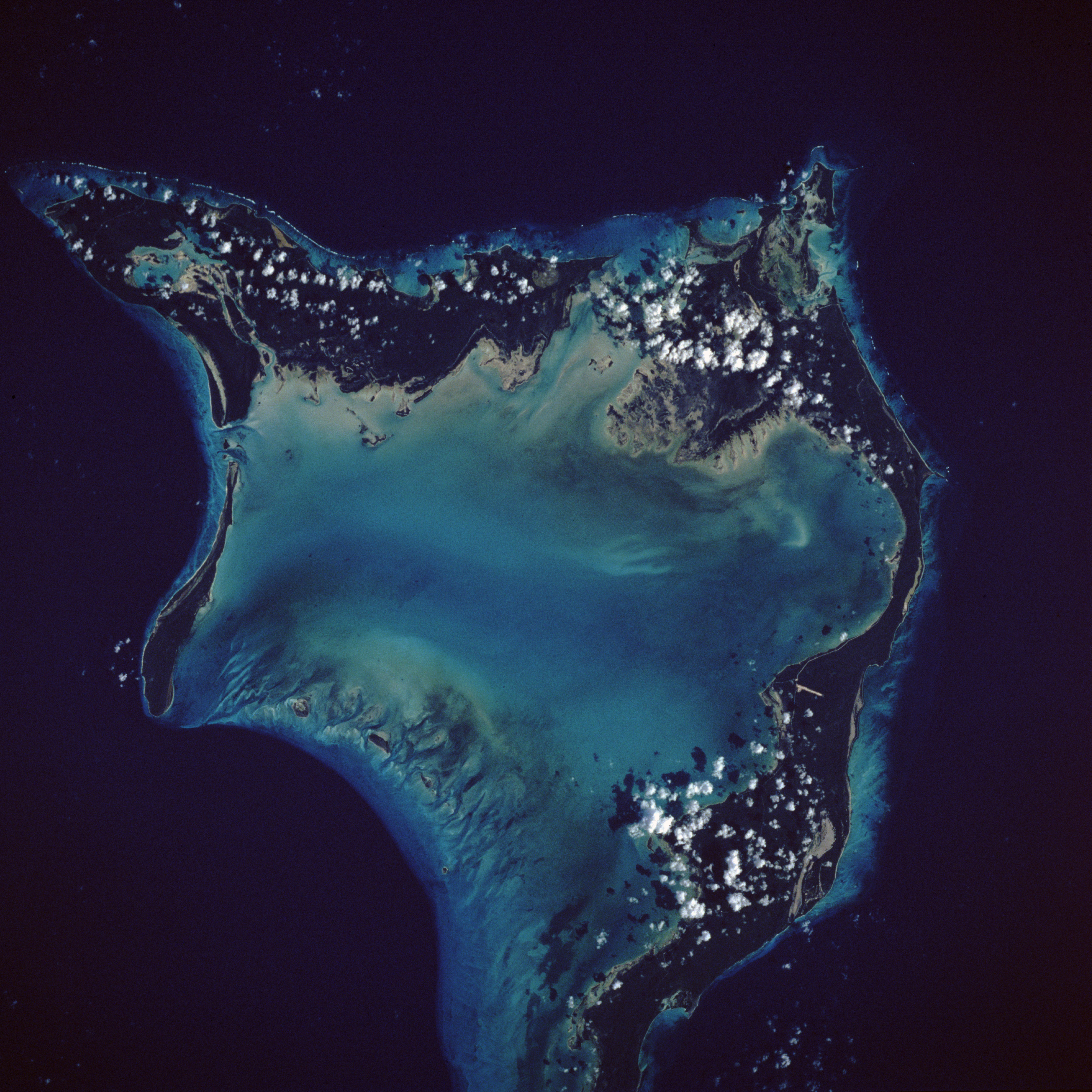
Image Caption: STS41B-39-2159 Crooked Island and Acklins Island, Bahamas February 1984
Two of the many islands that make up the Bahamas are highlighted in this near-vertical photograph--Crooked Island to the northwest, separated by the Bight of Acklins from Acklins Island, the elongated, eastward island. The Bahamas comprise a dramatic combination of carbonate banks, islands, and deep water channels that have built up during the past 70 million years. Coral and algal reefs abound in the warm, shallow water. The strikingly different shades of blue provide a wealth of information about the water--the lighter shades, for example, show a variety of features within the very shallow waters, including constantly changing small banks, channels, ripples, shoals, grass, and algal beds. The dropoff from the shallow depths of generally less than 50 feet (15 meters) to depths exceeding 1000 feet (300 meters), represented by the darker blue, is abrupt and precipitous. Clarity of the water throughout the Bahamas primarily results from their distance from continental sediment sources. These two islands have not experienced the fairly rapid economic, tourist-related growth that many of the other Bahamas have experienced; however, several roads and two airport runways are visible.
Two of the many islands that make up the Bahamas are highlighted in this near-vertical photograph--Crooked Island to the northwest, separated by the Bight of Acklins from Acklins Island, the elongated, eastward island. The Bahamas comprise a dramatic combination of carbonate banks, islands, and deep water channels that have built up during the past 70 million years. Coral and algal reefs abound in the warm, shallow water. The strikingly different shades of blue provide a wealth of information about the water--the lighter shades, for example, show a variety of features within the very shallow waters, including constantly changing small banks, channels, ripples, shoals, grass, and algal beds. The dropoff from the shallow depths of generally less than 50 feet (15 meters) to depths exceeding 1000 feet (300 meters), represented by the darker blue, is abrupt and precipitous. Clarity of the water throughout the Bahamas primarily results from their distance from continental sediment sources. These two islands have not experienced the fairly rapid economic, tourist-related growth that many of the other Bahamas have experienced; however, several roads and two airport runways are visible.
