STS131-E-11827
| NASA Photo ID | STS131-E-11827 |
| Focal Length | 22mm |
| Date taken | 2010.04.12 |
| Time taken | 05:34:02 GMT |
Resolutions offered for this image:
1000 x 667 pixels 540 x 360 pixels 720 x 360 pixels 4256 x 2913 pixels 640 x 438 pixels
1000 x 667 pixels 540 x 360 pixels 720 x 360 pixels 4256 x 2913 pixels 640 x 438 pixels

Cloud masks available for this image:
Spacecraft nadir point: 26.2° N, 82.6° E
Photo center point: 31.5° N, 85.5° E
Photo center point by machine learning:
Photo center point: 31.5° N, 85.5° E
Photo center point by machine learning:
Nadir to Photo Center: Northeast
Spacecraft Altitude: 183 nautical miles (339km)
Country or Geographic Name: | CHINA |
Features: | TIBETAN PLATEAU, HIMALAYA MOUNTAIN RANGE, GLACIERS |
| Features Found Using Machine Learning: | PAN- |
Cloud Cover Percentage: | 50 (26-50)% |
Sun Elevation Angle: | 68° |
Sun Azimuth: | 140° |
Camera: | Nikon D3 Electronic Still Camera |
Focal Length: | 22mm |
Camera Tilt: | High Oblique |
Format: | 4256E: 4256 x 2832 pixel CMOS sensor, 36.0mm x 23.9mm, total pixels: 12.87 million, Nikon FX format |
Film Exposure: | |
| Additional Information | |
| Width | Height | Annotated | Cropped | Purpose | Links |
|---|---|---|---|---|---|
| 1000 pixels | 667 pixels | No | Yes | Earth From Space collection | Download Image |
| 540 pixels | 360 pixels | No | Yes | Earth From Space collection | Download Image |
| 720 pixels | 360 pixels | No | Yes | NASA's Earth Observatory web site | Download Image |
| 4256 pixels | 2913 pixels | No | No | Download Image | |
| 640 pixels | 438 pixels | No | No | Download Image |
Download Packaged File
Download a Google Earth KML for this Image
View photo footprint information
Download a GeoTIFF for this photo
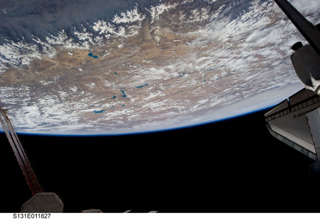
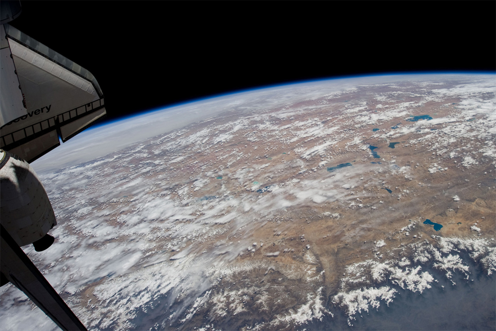
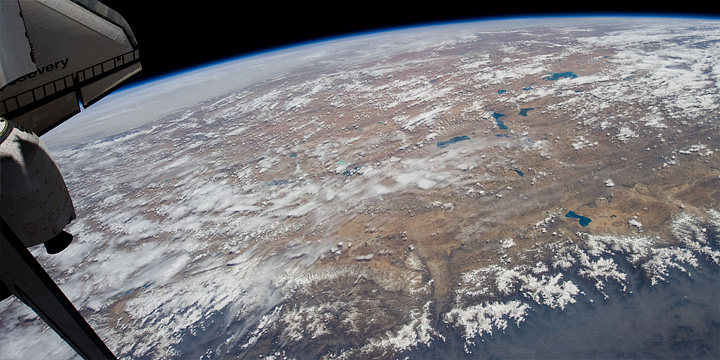
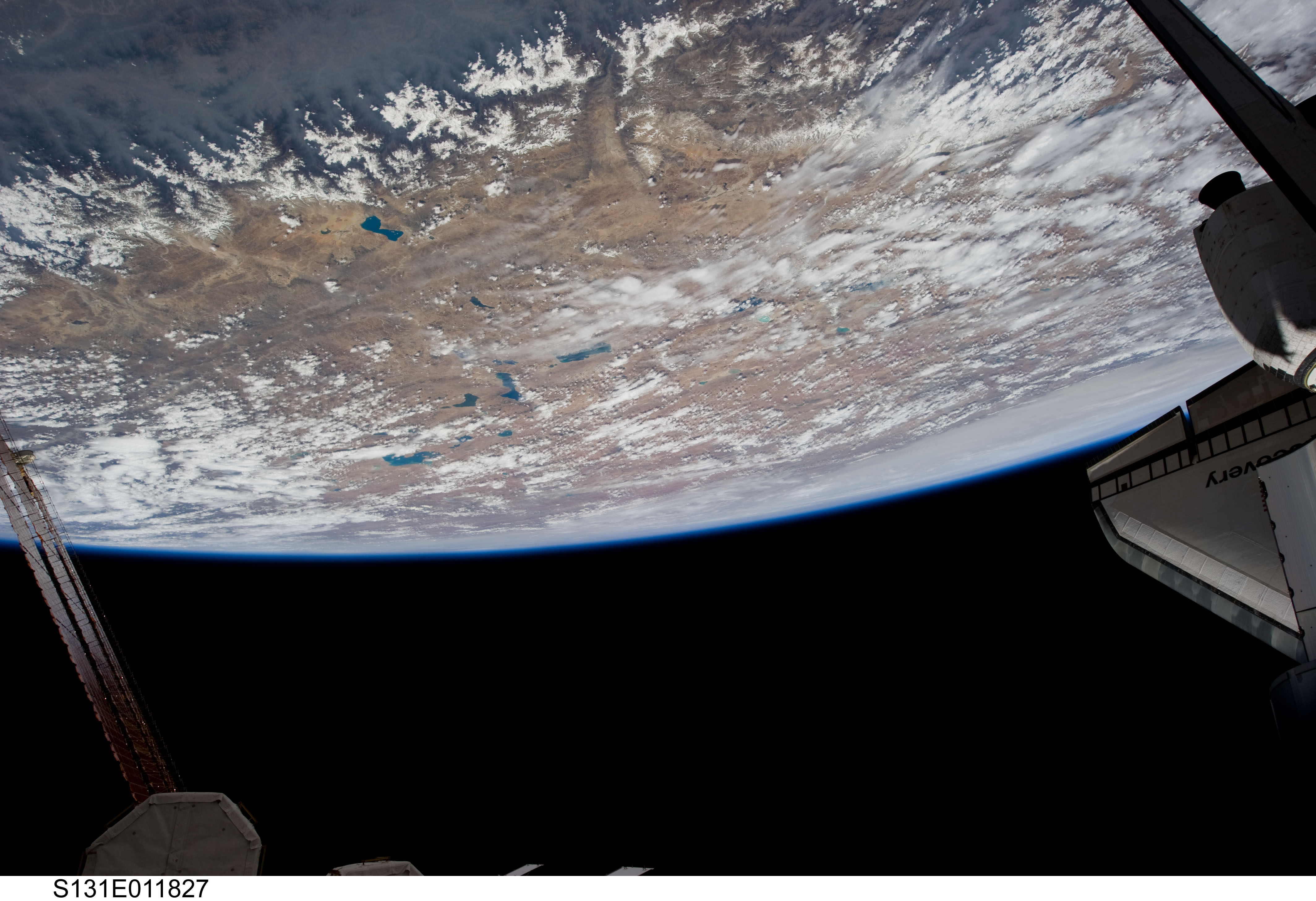
Image Caption: Orbital View of Earth from Docked Shuttle Discovery
The International Space Station orbits 354 kilometers (220 miles) above the Earth, completing one trip around the globe every 92 minutes. Cruising along at 27,700 km (17,200 miles) per hour, the astronauts experience 15 or 16 sunrises and -sets every day. Since the launch of the Zarya Control Module on November 20, 1998, the station has orbited the Earth over 66,500 times (as of June 27, 2010). The station's orbit is inclined to the equator by 51.65deg, meaning at its most northerly, it is at the latitude of London, England, and at it most southerly it is over the latitude of the Falkland Islands.
This view features the lake-studded Tibetan Plateau (image center) and the glaciers of the Himalayan Mountains (image top). Smoke-shrouded lowlands hug the southern margin of the Himalaya at image top left.
