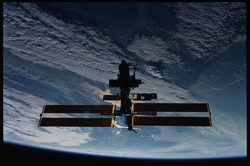
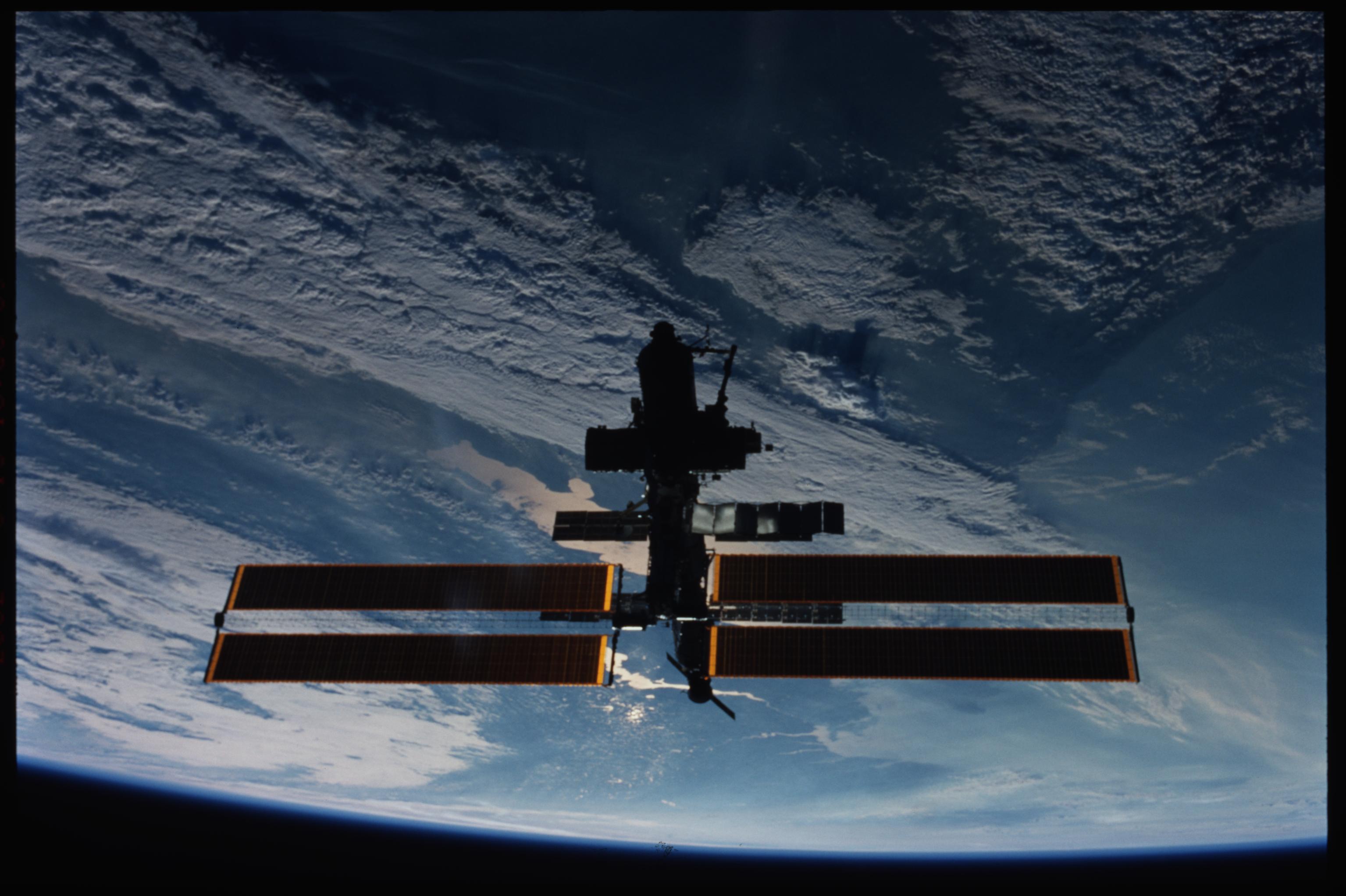
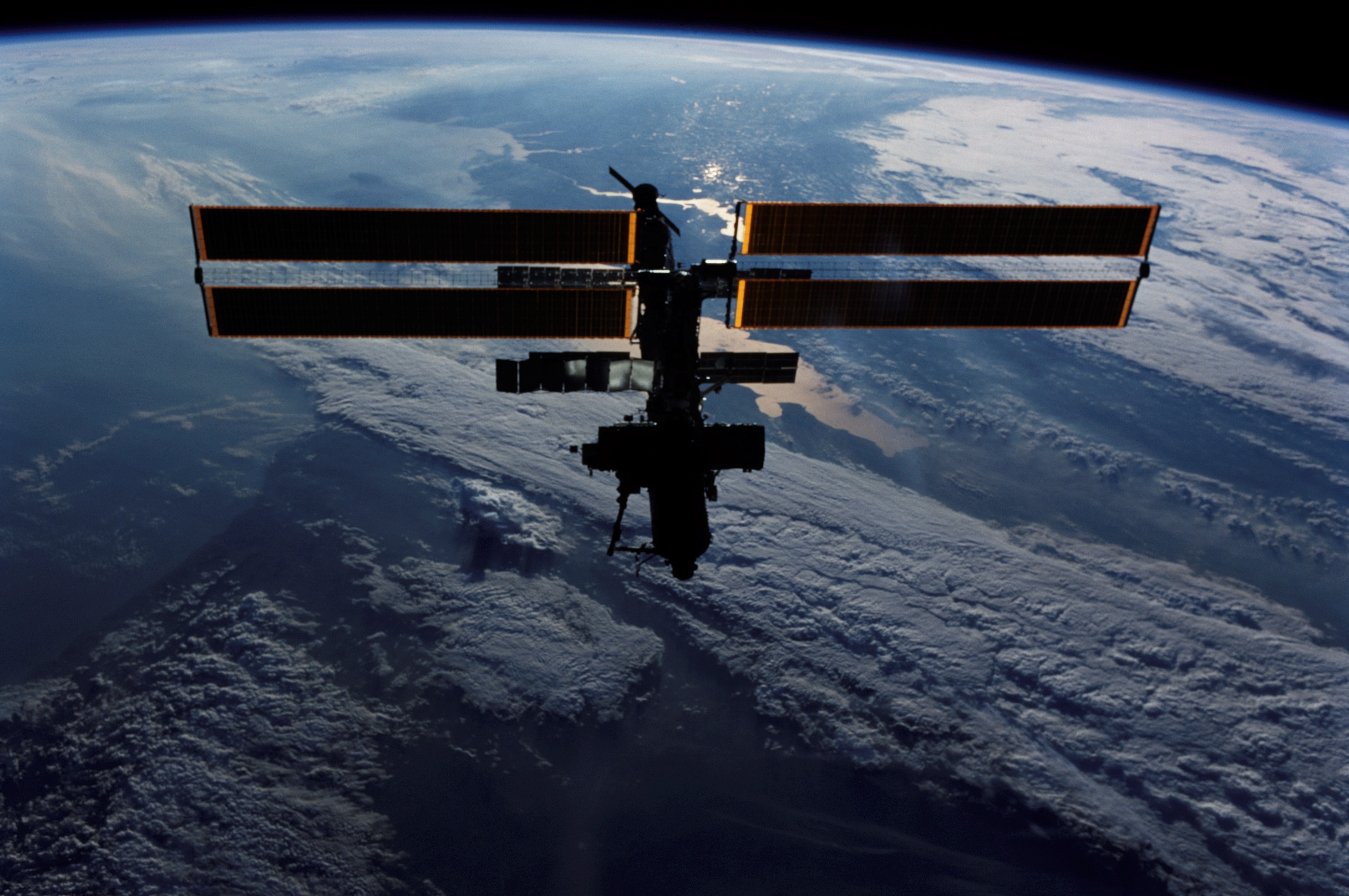
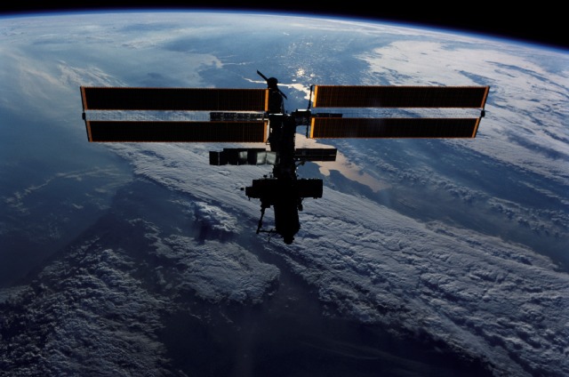
STS111-373-18
| NASA Photo ID | STS111-373-18 |
| Focal Length | mm |
| Date taken | 2002.06.15 |
| Time taken | 16:08:09 GMT |
Resolutions offered for this image:
3070 x 2044 pixels 2964 x 1968 pixels 515 x 342 pixels 2964 x 1968 pixels 640 x 424 pixels
3070 x 2044 pixels 2964 x 1968 pixels 515 x 342 pixels 2964 x 1968 pixels 640 x 424 pixels

Cloud masks available for this image:
Spacecraft nadir point: 43.1° N, 47.3° E
Photo center point: 46.0° N, 38.5° E
Photo center point by machine learning:
Photo center point: 46.0° N, 38.5° E
Photo center point by machine learning:
Nadir to Photo Center: West
Spacecraft Altitude: 211 nautical miles (391km)
Country or Geographic Name: | RUSSIAN FEDERATION |
Features: | PAN-SEA OF AZOV, CLOUDS, ISS |
| Features Found Using Machine Learning: | |
Cloud Cover Percentage: | 50 (26-50)% |
Sun Elevation Angle: | 3° |
Sun Azimuth: | 300° |
Camera: | Nikon 35mm film camera |
Focal Length: | mm |
Camera Tilt: | High Oblique |
Format: | |
Film Exposure: | |
| Additional Information | |
| Width | Height | Annotated | Cropped | Purpose | Links |
|---|---|---|---|---|---|
| 3070 pixels | 2044 pixels | No | No | Download Image | |
| 2964 pixels | 1968 pixels | No | No | Download Image | |
| 515 pixels | 342 pixels | No | No | Download Image | |
| 2964 pixels | 1968 pixels | No | No | Public Affairs Office (PAO) | Download Image |
| 640 pixels | 424 pixels | No | No | Public Affairs Office (PAO) | Download Image |
Download Packaged File
Download a Google Earth KML for this Image
View photo footprint information
Download a GeoTIFF for this photo
Image Caption: none
