STS111-368-36
| NASA Photo ID | STS111-368-36 |
| Focal Length | mm |
| Date taken | 2002.06.15 |
| Time taken | 23:11:15 GMT |
Resolutions offered for this image:
3070 x 2044 pixels 1200 x 798 pixels 1003 x 725 pixels 540 x 390 pixels 3070 x 2044 pixels 515 x 342 pixels 2956 x 1968 pixels 639 x 426 pixels
3070 x 2044 pixels 1200 x 798 pixels 1003 x 725 pixels 540 x 390 pixels 3070 x 2044 pixels 515 x 342 pixels 2956 x 1968 pixels 639 x 426 pixels


Cloud masks available for this image:
Spacecraft nadir point: 19.1° S, 151.4° E
Photo center point: 20.5° S, 150.5° E
Photo center point by machine learning:
Photo center point: 20.5° S, 150.5° E
Photo center point by machine learning:
Nadir to Photo Center: Southwest
Spacecraft Altitude: 188 nautical miles (348km)
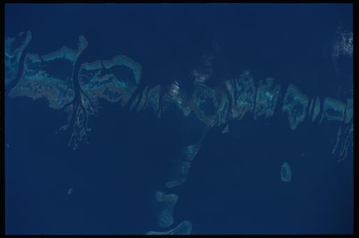
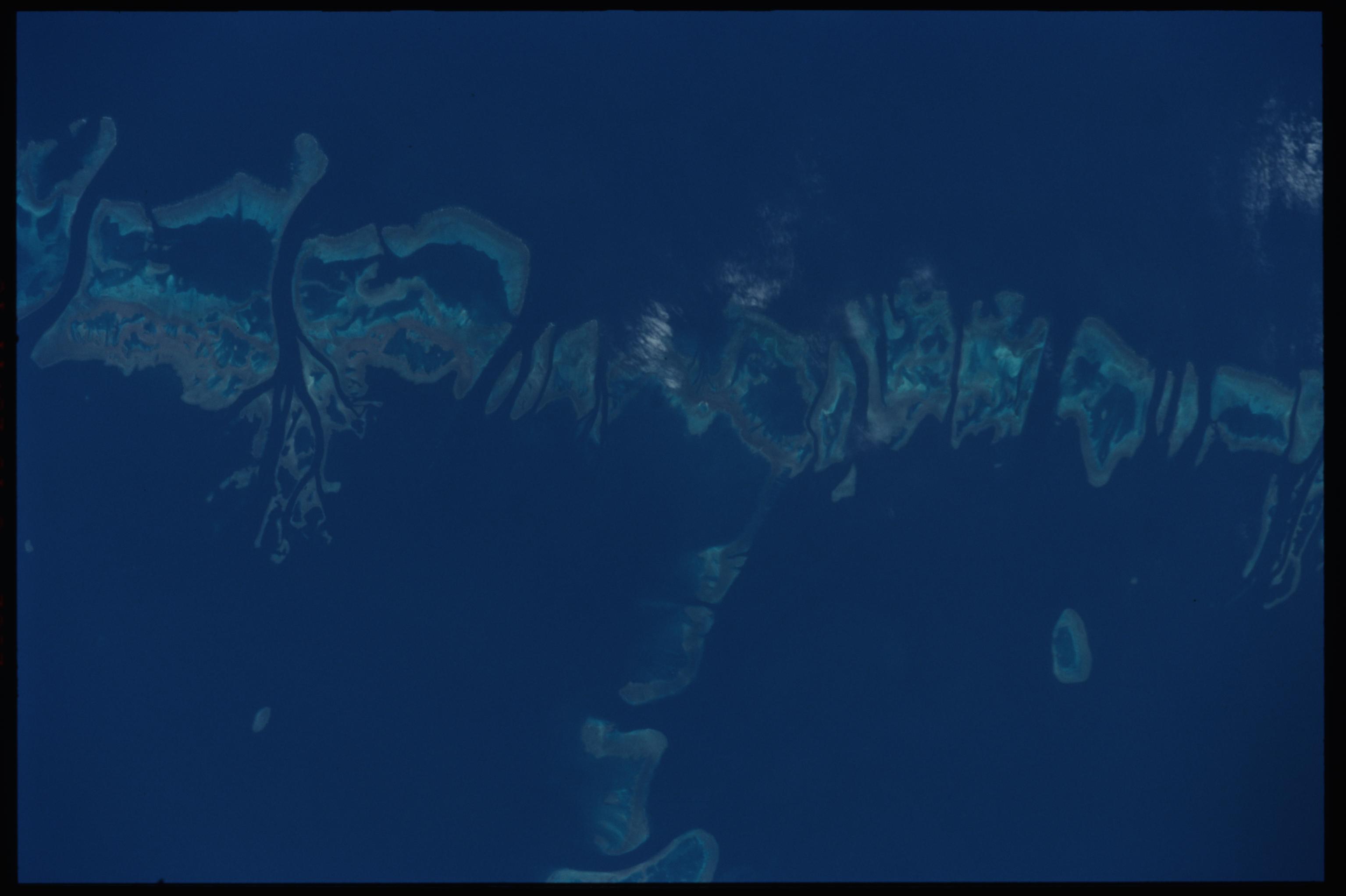
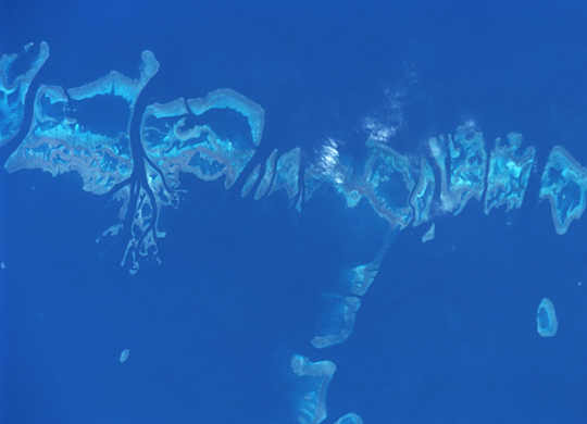
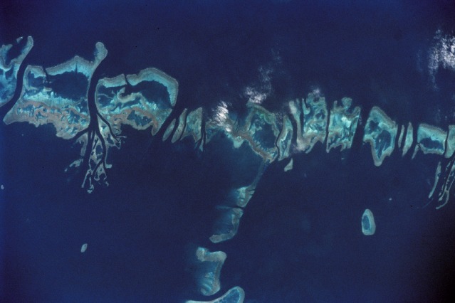
Country or Geographic Name: | AUSTRALIA-Q |
Features: | GREAT BARRIER REEF |
| Features Found Using Machine Learning: | |
Cloud Cover Percentage: | 10 (1-10)% |
Sun Elevation Angle: | 32° |
Sun Azimuth: | 45° |
Camera: | Nikon 35mm film camera |
Focal Length: | mm |
Camera Tilt: | 28 degrees |
Format: | 5069: Kodak Elite 100S, E6 Reversal, Replaces Lumiere, Warmer in tone vs. Lumiere |
Film Exposure: | |
| Additional Information | |
| Width | Height | Annotated | Cropped | Purpose | Links |
|---|---|---|---|---|---|
| 3070 pixels | 2044 pixels | No | No | Photographic Highlights | Download Image |
| 1200 pixels | 798 pixels | No | No | Photographic Highlights | Download Image |
| 1003 pixels | 725 pixels | Photographic Highlights | Download Image | ||
| 540 pixels | 390 pixels | Photographic Highlights | Download Image | ||
| 3070 pixels | 2044 pixels | No | No | Download Image | |
| 515 pixels | 342 pixels | No | No | Download Image | |
| 2956 pixels | 1968 pixels | No | No | Public Affairs Office (PAO) | Download Image |
| 639 pixels | 426 pixels | No | No | Public Affairs Office (PAO) | Download Image |
Download Packaged File
Download a Google Earth KML for this Image
View photo footprint information
Download a GeoTIFF for this photo
Image Caption: Detail of the Pompey Island Group, Southern Great Barrier Reef, Australia. Ocean flow between the islands has produced unique wash features in the structures of the island banks.
