STS110-726-10
| NASA Photo ID | STS110-726-10 |
| Focal Length | 110mm |
| Date taken | 2002.04.09 |
| Time taken | 22:56:22 GMT |
Resolutions offered for this image:
4600 x 4400 pixels 540 x 533 pixels 875 x 836 pixels 778 x 768 pixels 540 x 509 pixels 1000 x 988 pixels 1271 x 1290 pixels
4600 x 4400 pixels 540 x 533 pixels 875 x 836 pixels 778 x 768 pixels 540 x 509 pixels 1000 x 988 pixels 1271 x 1290 pixels


Cloud masks available for this image:
Spacecraft nadir point: 37.5° S, 176.8° E
Photo center point: 38.0° S, 176.0° E
Photo center point by machine learning:
Photo center point: 38.0° S, 176.0° E
Photo center point by machine learning:
Nadir to Photo Center: Southwest
Spacecraft Altitude: 89 nautical miles (165km)
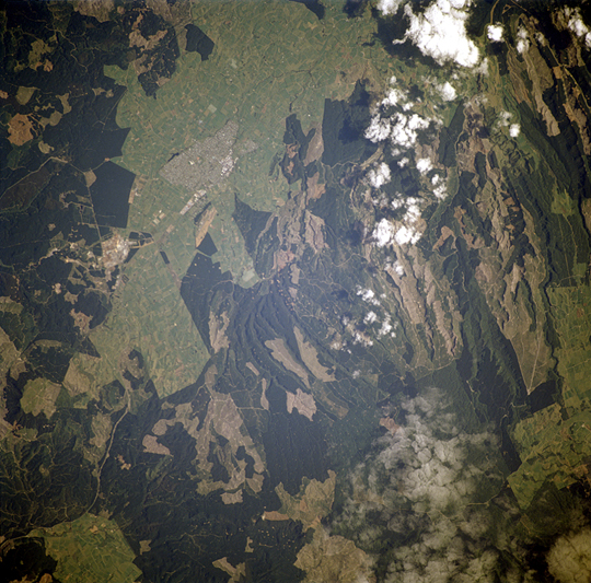
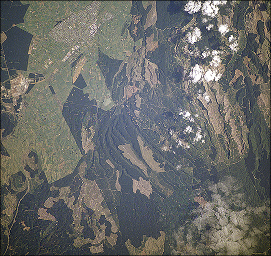
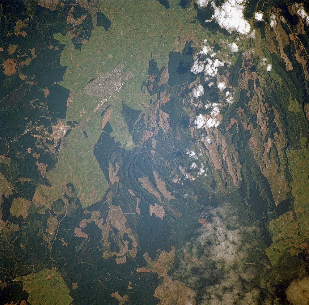
Country or Geographic Name: | NEW ZEALAND-NI |
Features: | ROTORUA GEOTHERMAL |
| Features Found Using Machine Learning: | |
Cloud Cover Percentage: | 10 (1-10)% |
Sun Elevation Angle: | 41° |
Sun Azimuth: | 26° |
Camera: | Hasselblad |
Focal Length: | 110mm |
Camera Tilt: | 32 degrees |
Format: | 5069: Kodak Elite 100S, E6 Reversal, Replaces Lumiere, Warmer in tone vs. Lumiere |
Film Exposure: | |
| Additional Information | |
| Width | Height | Annotated | Cropped | Purpose | Links |
|---|---|---|---|---|---|
| 4600 pixels | 4400 pixels | No | No | Photographic Highlights | Download Image |
| 540 pixels | 533 pixels | Photographic Highlights | Download Image | ||
| 875 pixels | 836 pixels | No | No | Photographic Highlights | Download Image |
| 778 pixels | 768 pixels | Photographic Highlights | Download Image | ||
| 540 pixels | 509 pixels | No | Yes | Earth From Space collection | Download Image |
| 1000 pixels | 988 pixels | No | No | NASA's Earth Observatory web site | Download Image |
| 1271 pixels | 1290 pixels | No | No | Download Image |
Download Packaged File
Download a Google Earth KML for this Image
View photo footprint information
Download a GeoTIFF for this photo
Image Caption: Forests are being harvested near Tokoroa, New Zealand, which has been described as the hub of New Zealand's forestry industry. According to an Earth Observatory reader, the land use pattern that looks like tan beads on a string are clearings used to stock timber before it is sent to pulp and paper mills about 4 km south of Tokoroa. The light green areas around the town are dairy farms.
