STS110-707-95
| NASA Photo ID | STS110-707-95 |
| Focal Length | 110mm |
| Date taken | 2002.04.09 |
| Time taken | 20:21:38 GMT |
Resolutions offered for this image:
4600 x 4400 pixels 515 x 492 pixels 4104 x 4104 pixels 640 x 640 pixels
4600 x 4400 pixels 515 x 492 pixels 4104 x 4104 pixels 640 x 640 pixels
Cloud masks available for this image:
Spacecraft nadir point: 29.6° N, 80.1° W
Photo center point: 28.5° N, 80.5° W
Photo center point by machine learning:
Photo center point: 28.5° N, 80.5° W
Photo center point by machine learning:
Nadir to Photo Center: South
Spacecraft Altitude: 88 nautical miles (163km)
Country or Geographic Name: | USA-FLORIDA |
Features: | KENNEDY SPACE CENTER |
| Features Found Using Machine Learning: | |
Cloud Cover Percentage: | 50 (26-50)% |
Sun Elevation Angle: | 43° |
Sun Azimuth: | 252° |
Camera: | Hasselblad |
Focal Length: | 110mm |
Camera Tilt: | 39 degrees |
Format: | 5069: Kodak Elite 100S, E6 Reversal, Replaces Lumiere, Warmer in tone vs. Lumiere |
Film Exposure: | |
| Additional Information | |
| Width | Height | Annotated | Cropped | Purpose | Links |
|---|---|---|---|---|---|
| 4600 pixels | 4400 pixels | No | No | Download Image | |
| 515 pixels | 492 pixels | No | No | Download Image | |
| 4104 pixels | 4104 pixels | Public Affairs Office (PAO) | Download Image | ||
| 640 pixels | 640 pixels | Photographic Highlights | Download Image |
Download Packaged File
Download a Google Earth KML for this Image
View photo footprint information
Download a GeoTIFF for this photo
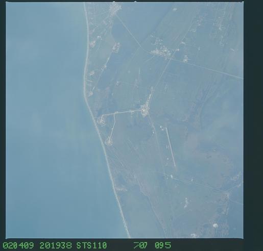
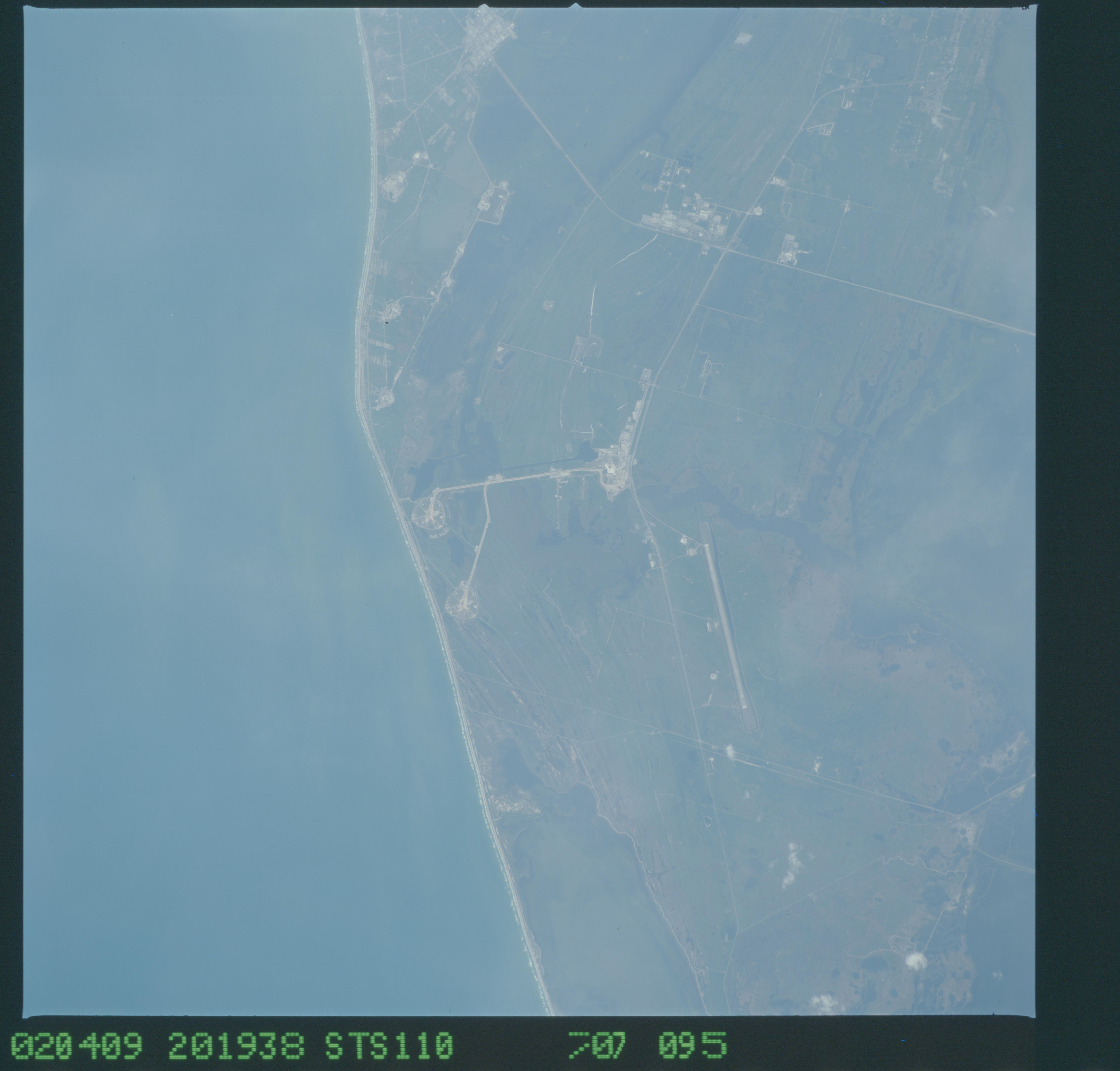
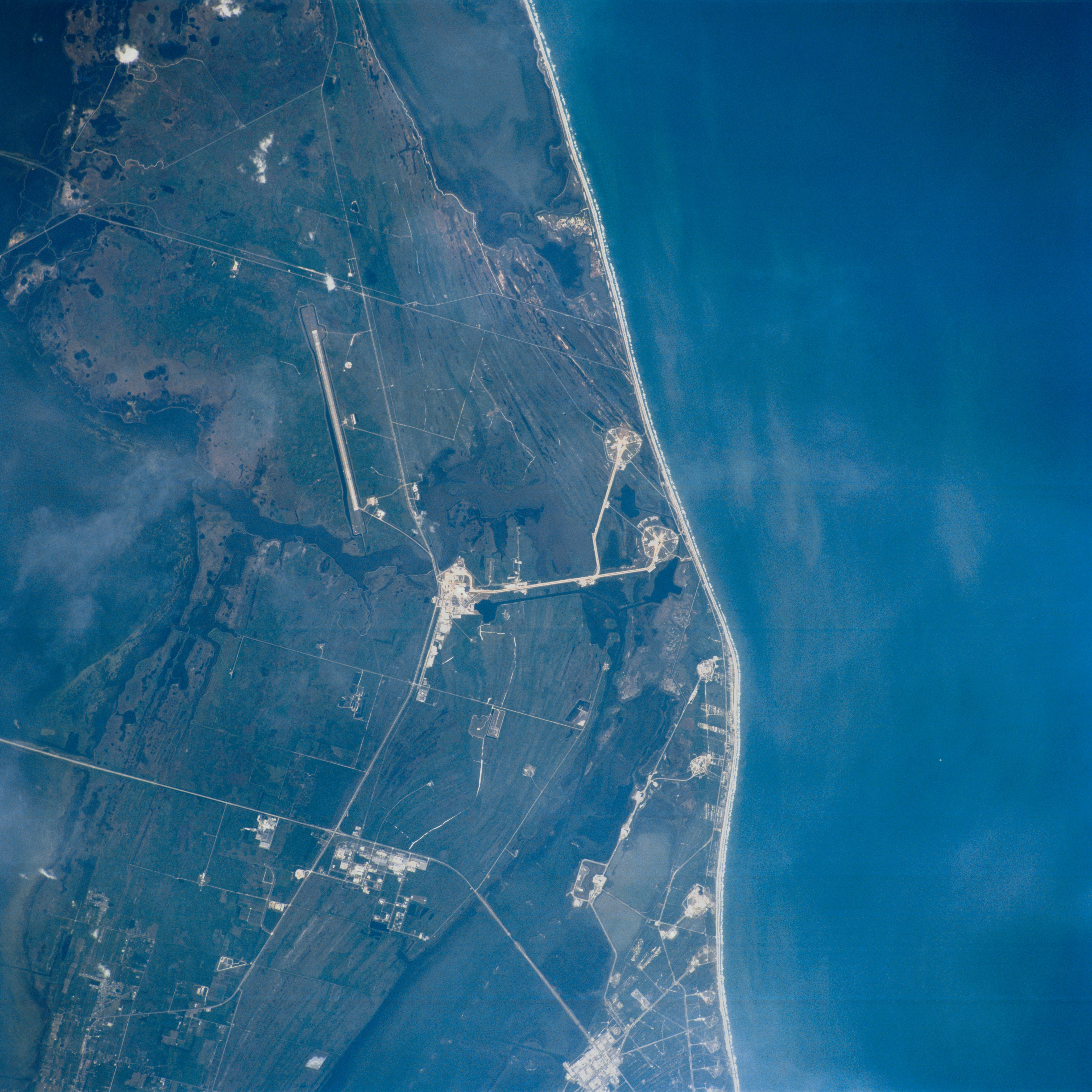
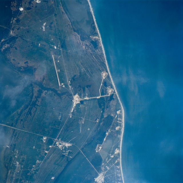
Image Caption: John F. Kennedy Space Center, Florida April 2002
This spectacular view shows the John F. Kennedy Space Center. Located at Cape Canaveral on Florida's east-central coast, the spaceport has been the home to the United States east coast spacecraft launches since the 1950's. Near the center of the image, a number of structures can be seen which include the large Space Shuttle Assembly Building. To the right (east) of the structures, Shuttle Launch Pads A and B are visible. To the northwest of the Assembly Building area is the long, linear Shuttle landing runway. At the top center of the image is Mosquito Lagoon. Visible at the bottom center (south) on the image are the multiple launch pads used for NASA's un-manned space vehicles and Banana Lagoon. To the left (west) of the multiple launch pads are a number buildings/structures including the Kennedy Space Center's Visitor Complex.
This spectacular view shows the John F. Kennedy Space Center. Located at Cape Canaveral on Florida's east-central coast, the spaceport has been the home to the United States east coast spacecraft launches since the 1950's. Near the center of the image, a number of structures can be seen which include the large Space Shuttle Assembly Building. To the right (east) of the structures, Shuttle Launch Pads A and B are visible. To the northwest of the Assembly Building area is the long, linear Shuttle landing runway. At the top center of the image is Mosquito Lagoon. Visible at the bottom center (south) on the image are the multiple launch pads used for NASA's un-manned space vehicles and Banana Lagoon. To the left (west) of the multiple launch pads are a number buildings/structures including the Kennedy Space Center's Visitor Complex.
