STS109-E-6003
| NASA Photo ID | STS109-E-6003 |
| Focal Length | 35mm |
| Date taken | 2002.03.10 |
| Time taken | 04:06:17 GMT |
Resolutions offered for this image:
768 x 1024 pixels 405 x 540 pixels 3032 x 2064 pixels 639 x 435 pixels 400 x 272 pixels
768 x 1024 pixels 405 x 540 pixels 3032 x 2064 pixels 639 x 435 pixels 400 x 272 pixels
Cloud masks available for this image:
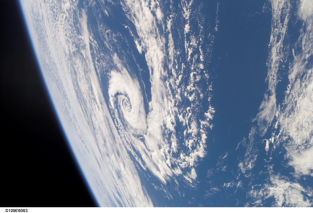
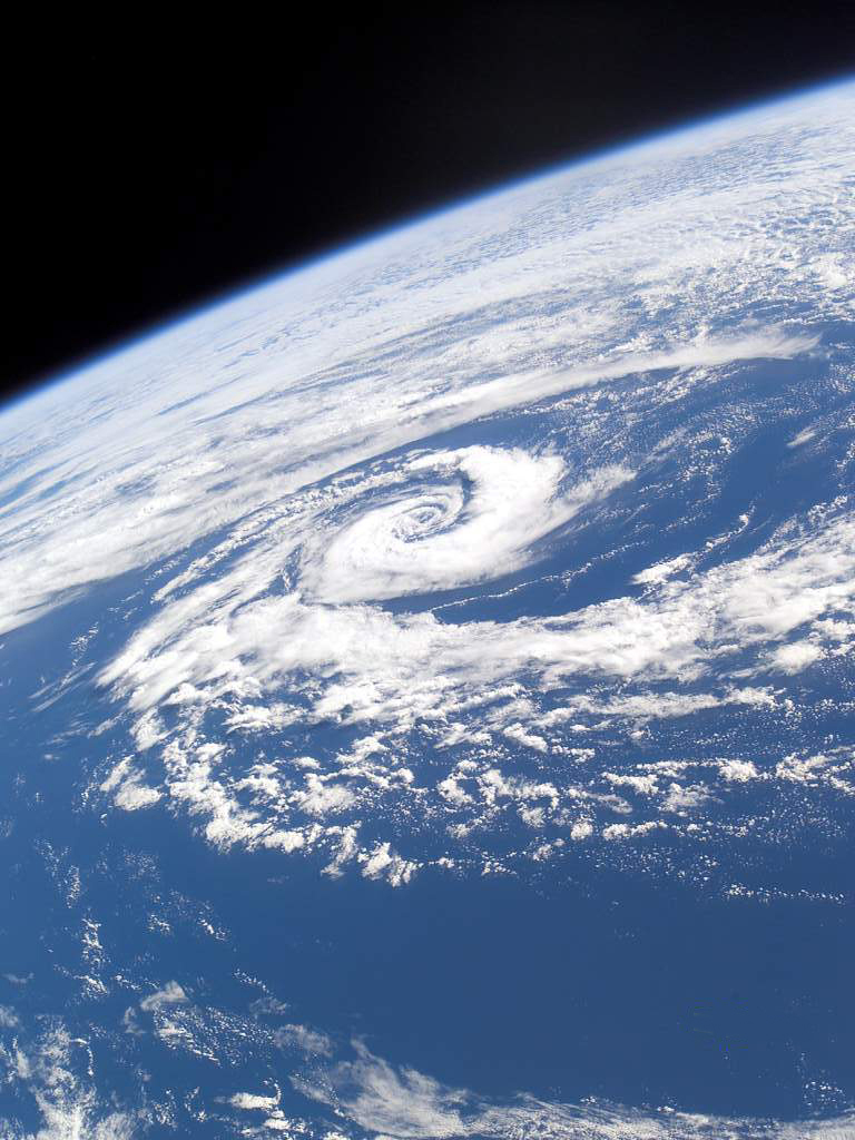
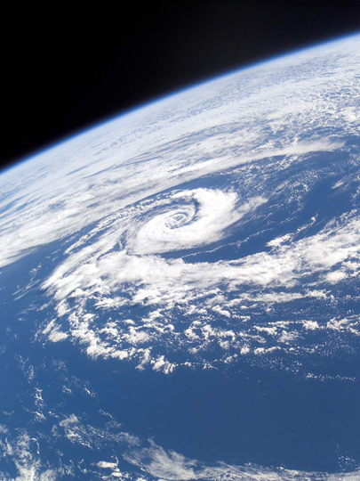
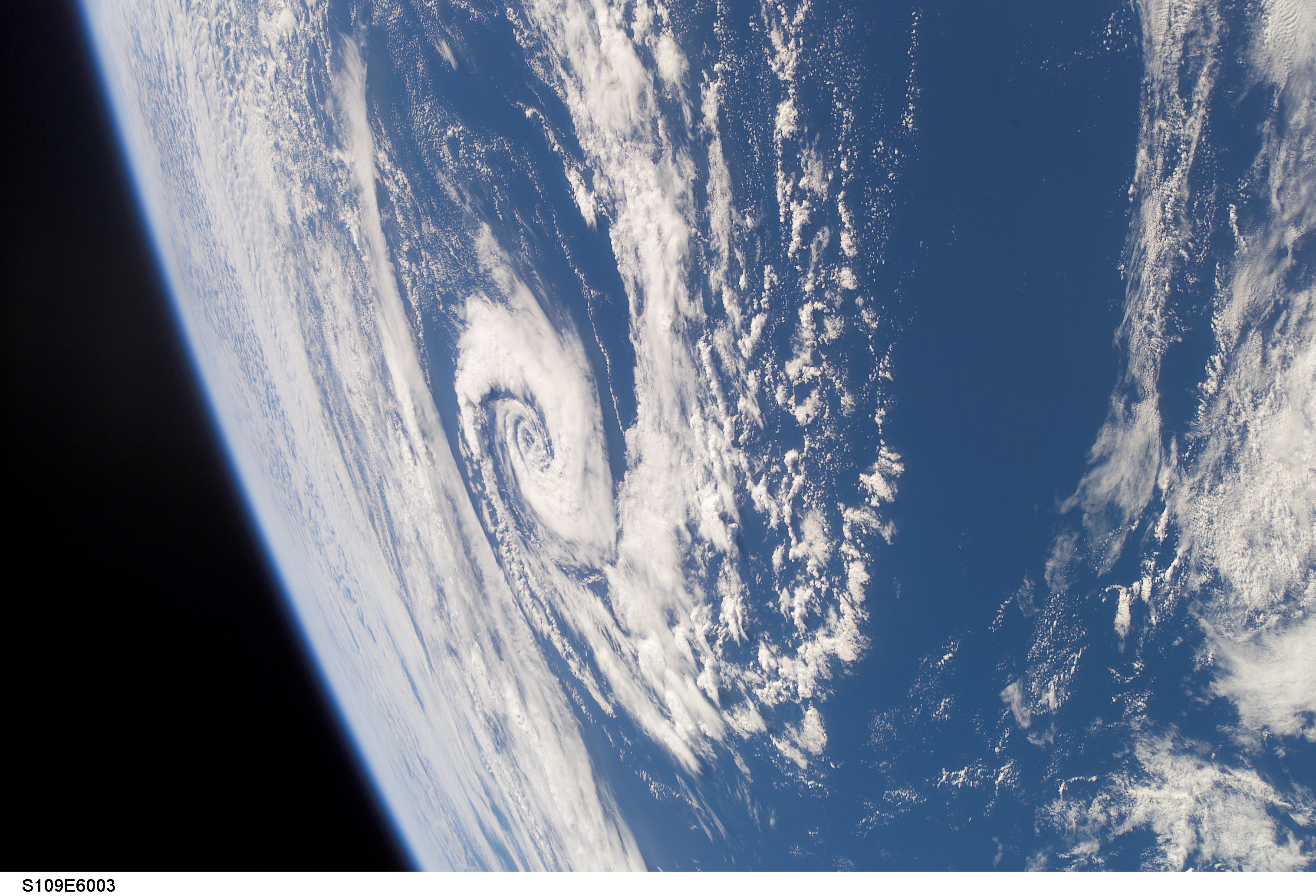
Spacecraft nadir point: 28.6° S, 161.8° E
Photo center point:
Photo center point by machine learning:
Photo center point:
Photo center point by machine learning:
Nadir to Photo Center:
Spacecraft Altitude: 308 nautical miles (570km)
Country or Geographic Name: | PACIFIC OCEAN |
Features: | PAN-CLOUD VORTEX |
| Features Found Using Machine Learning: | PAN- |
Cloud Cover Percentage: | 75 (51-75)% |
Sun Elevation Angle: | 44° |
Sun Azimuth: | 294° |
Camera: | Kodak DCS760c Electronic Still Camera |
Focal Length: | 35mm |
Camera Tilt: | |
Format: | 3060E: 3060 x 2036 pixel CCD, RGBG array |
Film Exposure: | |
| Additional Information | |
| Width | Height | Annotated | Cropped | Purpose | Links |
|---|---|---|---|---|---|
| 768 pixels | 1024 pixels | Photographic Highlights | Download Image | ||
| 405 pixels | 540 pixels | Photographic Highlights | Download Image | ||
| 3032 pixels | 2064 pixels | Download Image | |||
| 639 pixels | 435 pixels | Download Image | |||
| 400 pixels | 272 pixels | No | No | Photographic Highlights | Download Image |
Download Packaged File
Download a Google Earth KML for this Image
View photo footprint information
Download a GeoTIFF for this photo
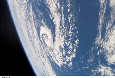
Image Caption: This view looks southwestward over the Tasman Sea (between Australia and New Zealand) at a well-defined subtropical cyclone. Such circulations are recognized as hybrids, lacking the tight banding and convection of tropical cyclones, and the strong temperature contrast and frontal boundaries of polar storms.
