STS109-707-46
| NASA Photo ID | STS109-707-46 |
| Focal Length | 350mm |
| Date taken | 2002.03.02 |
| Time taken | 10:54:31 GMT |

Cloud masks available for this image:
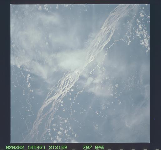
Spacecraft nadir point: 2.5° N, 20.2° E
Photo center point: 2.0° N, 20.0° E
Photo center point by machine learning:
Photo center point: 2.0° N, 20.0° E
Photo center point by machine learning:
Nadir to Photo Center: South
Spacecraft Altitude: 245 nautical miles (454km)
Country or Geographic Name: | DEM. REP. OF CONGO |
Features: | CONGO RIVER, VERY SOFT |
| Features Found Using Machine Learning: | |
Cloud Cover Percentage: | 50 (26-50)% |
Sun Elevation Angle: | 80° |
Sun Azimuth: | 185° |
Camera: | Hasselblad |
Focal Length: | 350mm |
Camera Tilt: | 7 degrees |
Format: | 5069: Kodak Elite 100S, E6 Reversal, Replaces Lumiere, Warmer in tone vs. Lumiere |
Film Exposure: | |
| Additional Information | |
| Width | Height | Annotated | Cropped | Purpose | Links |
|---|---|---|---|---|---|
| 4800 pixels | 4489 pixels | No | No | Download Image | |
| 515 pixels | 481 pixels | No | No | Download Image |
Download Packaged File
Download a Google Earth KML for this Image
View photo footprint information
Download a GeoTIFF for this photo
Image Caption: none
