STS108-717-85
| NASA Photo ID | STS108-717-85 |
| Focal Length | 110mm |
| Date taken | 2001.12.13 |
| Time taken | 18:27:04 GMT |
540 x 453 pixels 540 x 896 pixels 1031 x 1024 pixels 2063 x 2048 pixels 4127 x 4096 pixels 515 x 512 pixels 1281 x 1257 pixels 1305 x 1297 pixels 1281 x 1257 pixels 400 x 335 pixels 600 x 589 pixels
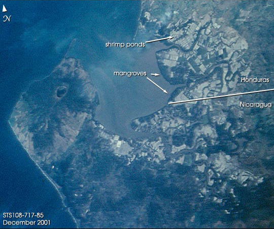
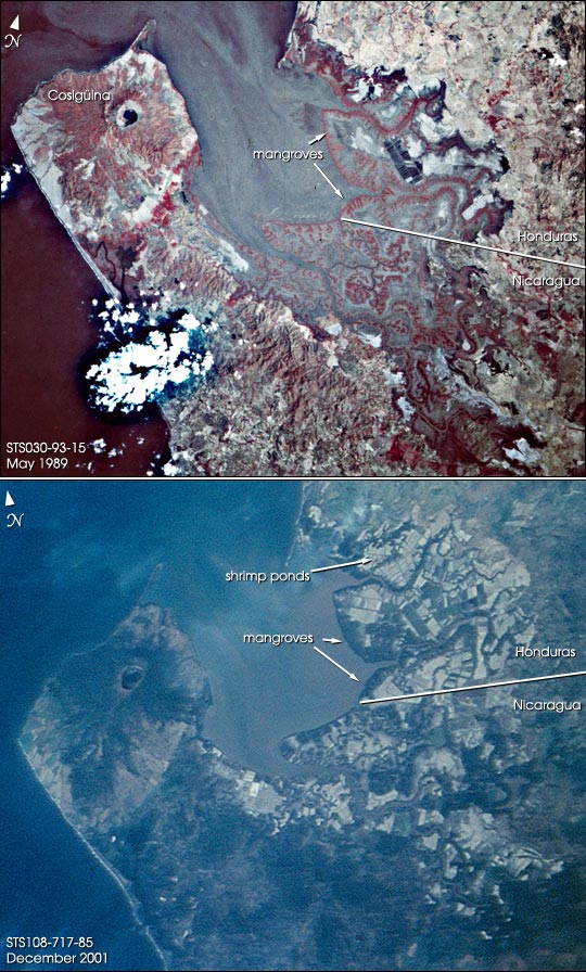


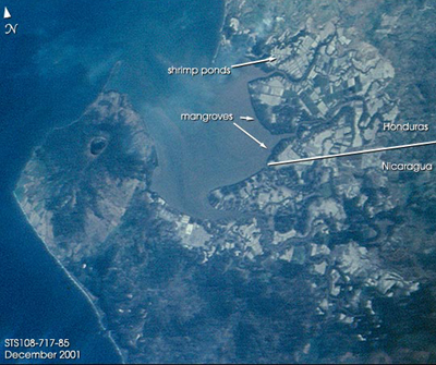
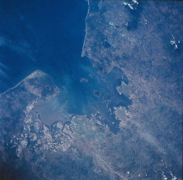
Photo center point: 13.0° N, 87.5° W
Photo center point by machine learning:
Country or Geographic Name: | NICARAGUA |
Features: | GULF OF FONSECA, MANGROVES, SEDIMENT |
| Features Found Using Machine Learning: | |
Cloud Cover Percentage: | 10 (1-10)% |
Sun Elevation Angle: | 56° |
Sun Azimuth: | 199° |
Camera: | Hasselblad |
Focal Length: | 110mm |
Camera Tilt: | 47 degrees |
Format: | 5069: Kodak Elite 100S, E6 Reversal, Replaces Lumiere, Warmer in tone vs. Lumiere |
Film Exposure: | |
| Additional Information | |
| Width | Height | Annotated | Cropped | Purpose | Links |
|---|---|---|---|---|---|
| 540 pixels | 453 pixels | Yes | Yes | NASA's Earth Observatory web site | Download Image |
| 540 pixels | 896 pixels | Yes | Yes | NASA's Earth Observatory web site | Download Image |
| 1031 pixels | 1024 pixels | No | No | Download Image | |
| 2063 pixels | 2048 pixels | No | No | Download Image | |
| 4127 pixels | 4096 pixels | No | No | Download Image | |
| 515 pixels | 512 pixels | No | No | Download Image | |
| 1281 pixels | 1257 pixels | No | Photographic Highlights | Download Image | |
| 1305 pixels | 1297 pixels | No | No | Download Image | |
| 1281 pixels | 1257 pixels | No | No | Download Image | |
| 400 pixels | 335 pixels | Yes | Photographic Highlights | Download Image | |
| 600 pixels | 589 pixels | No | No | Download Image |
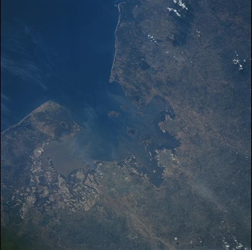
For decades, astronauts on space missions have documented land use changes
around the world. In this pair of images, astronauts track the development of
shrimp farming along the Honduran coastline of the Gulf of Fonseca between 1989
and 2001. Mariculture, primarily shrimp farming, has become a leading
agricultural effort in Honduras. The regional transformation of large tracts of
coastal swamps into shrimp farms blossomed throughout the 1990s. The top image
was taken with color infrared film in 1989. Dense vegetation, like the coastal
mangrove swamps and the forested slopes of Volcan Cosiguina show up as dark red.
The bottom image, taken with color visible film by the crew of the most recent
Space Shuttle mission in December 2001 shows that hundreds of square kilometers
of coastal swamp, primarily in Honduras, have been converted to shrimp ponds.
These appear as the light-colored, rectilinear land use pattern. The Honduras
shrimp farms were hit hard by flooding after Hurricane Mitch in 1998, and a
devastating virus in 1999-2000. It is not known how many of the ponds in this
view are still functional. A vigorous debate continues about the sustainability
of the shrimp farms and the impacts to the environment and coastal ecosystem
due to mangrove clearing and mariculture waste production.
Apart from the shrimp farms, the other prominent feature on these images is
the impressive volcano Cosiguina, which erupted explosively in 1859 (the
largest recorded eruption in the Western Hemisphere).
