STS107-E-5290

| NASA Photo ID | STS107-E-5290 |
| Focal Length | 400mm |
| Date taken | 2003.01.21 |
| Time taken | 08:26:16 GMT |
Resolutions offered for this image:
540 x 405 pixels 1000 x 660 pixels 3032 x 2064 pixels 639 x 435 pixels
540 x 405 pixels 1000 x 660 pixels 3032 x 2064 pixels 639 x 435 pixels

Cloud masks available for this image:
Spacecraft nadir point: 37.4° N, 61.3° E
Photo center point: 36.5° N, 59.5° E
Photo center point by machine learning:
Photo center point: 36.5° N, 59.5° E
Photo center point by machine learning:
Nadir to Photo Center:
Spacecraft Altitude: 145 nautical miles (269km)
Camera: | Kodak DCS760c Electronic Still Camera |
Focal Length: | 400mm |
Camera Tilt: | 40 degrees |
Format: | 3060E: 3060 x 2036 pixel CCD, RGBG array |
Film Exposure: | |
| Additional Information | |
| Width | Height | Annotated | Cropped | Purpose | Links |
|---|---|---|---|---|---|
| 540 pixels | 405 pixels | Yes | Yes | Earth From Space collection | Download Image |
| 1000 pixels | 660 pixels | No | No | NASA's Earth Observatory web site | Download Image |
| 3032 pixels | 2064 pixels | No | No | Download Image | |
| 639 pixels | 435 pixels | No | No | Download Image |
Download Packaged File
Download a Google Earth KML for this Image
View photo footprint information
Download a GeoTIFF for this photo
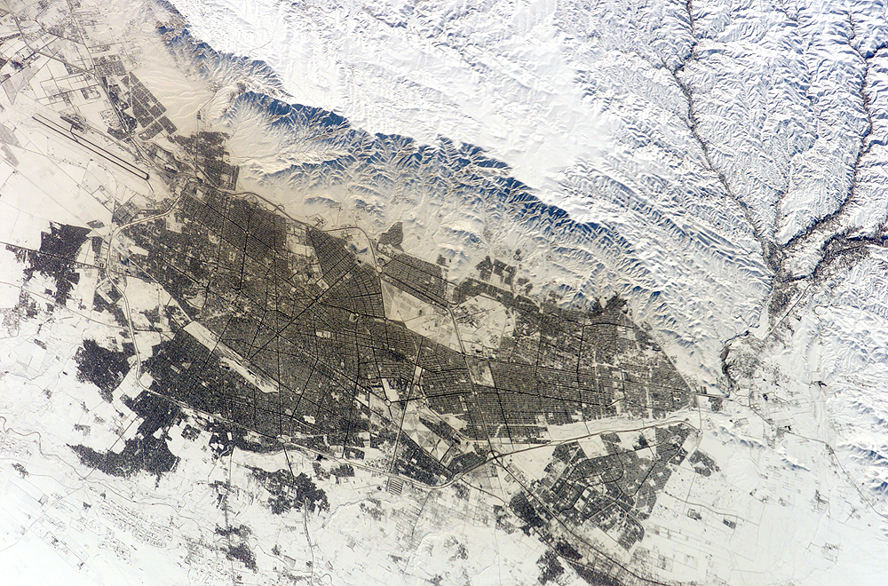
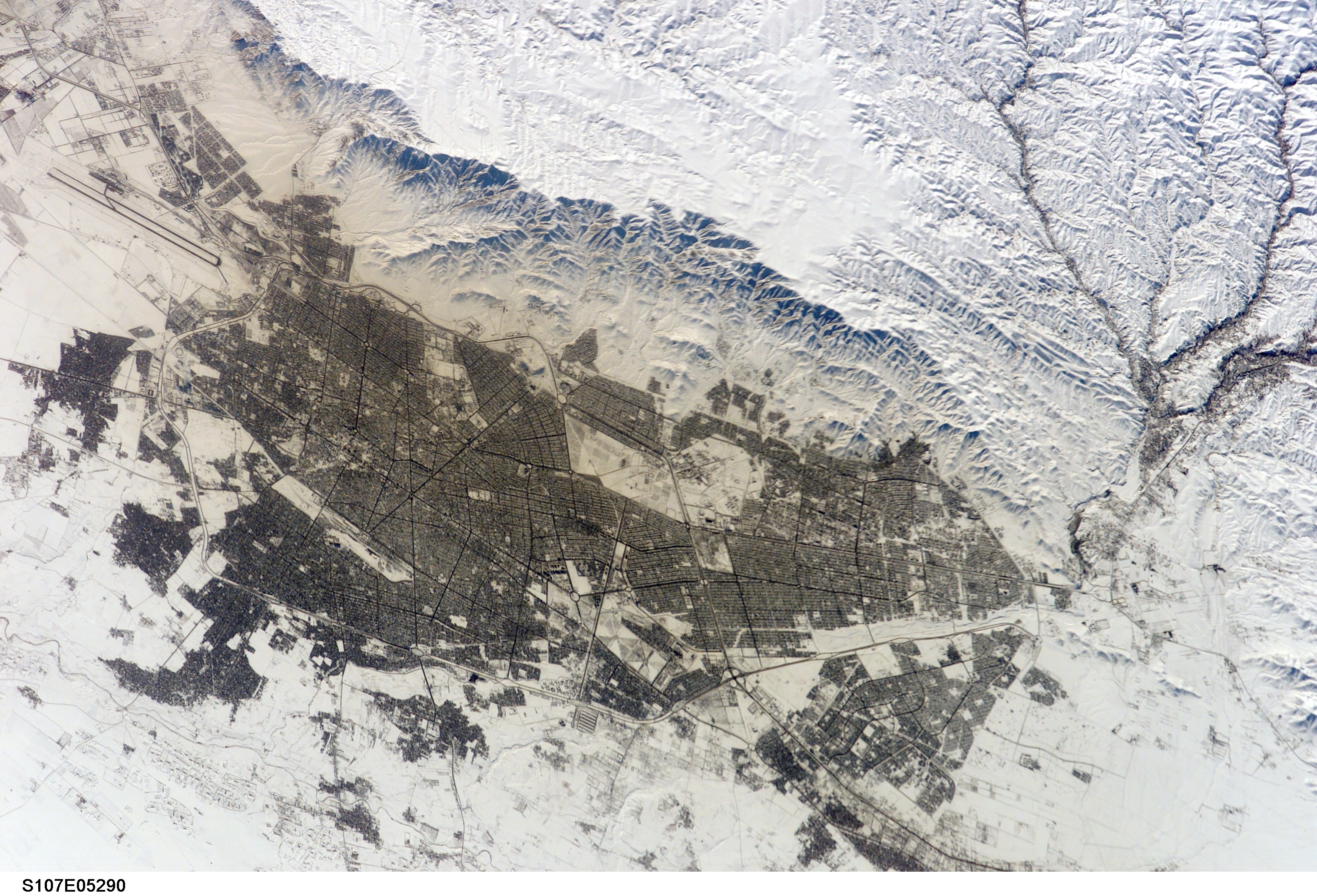
Image Caption: With a population of just over two million, Mashhad is Iran's second-largest city. It is located in the Kashaf River valley near the northeast corner of the country, not far away from the borders of Turkmenistan and Afganistan. Besides being the capital and center of commerce for Khorasan province, Mashhad is tourist center as well as a site of pilgrimage for millions to the shrine of martyred Shi'ate Imam Reza.
The crew of STS-107 acquired this snow-enhanced image just after noon (local time) on January 21, 2003. The long runways of the international airport, on the southeastern edge of the city, run parallel to the prevailing valley winds. Note how little snow is visible in the urbanized areas and the discoloration of snow in the surrounding area, probably due to wind-borne smoke generated by fuel burning in the city.
The crew of STS-107 acquired this snow-enhanced image just after noon (local time) on January 21, 2003. The long runways of the international airport, on the southeastern edge of the city, run parallel to the prevailing valley winds. Note how little snow is visible in the urbanized areas and the discoloration of snow in the surrounding area, probably due to wind-borne smoke generated by fuel burning in the city.
