STS106-707-51

| NASA Photo ID | STS106-707-51 |
| Focal Length | 40mm |
| Date taken | 2000.09.__ |
| Time taken | GMT |
Resolutions offered for this image:
1031 x 1024 pixels 2063 x 2048 pixels 4127 x 4096 pixels 515 x 512 pixels 1296 x 1284 pixels 400 x 396 pixels
1031 x 1024 pixels 2063 x 2048 pixels 4127 x 4096 pixels 515 x 512 pixels 1296 x 1284 pixels 400 x 396 pixels


Cloud masks available for this image:
Spacecraft nadir point:
Photo center point: 37.5° N, 22.5° E
Photo center point by machine learning:
Photo center point: 37.5° N, 22.5° E
Photo center point by machine learning:
Nadir to Photo Center:
Spacecraft Altitude: nautical miles (0km)
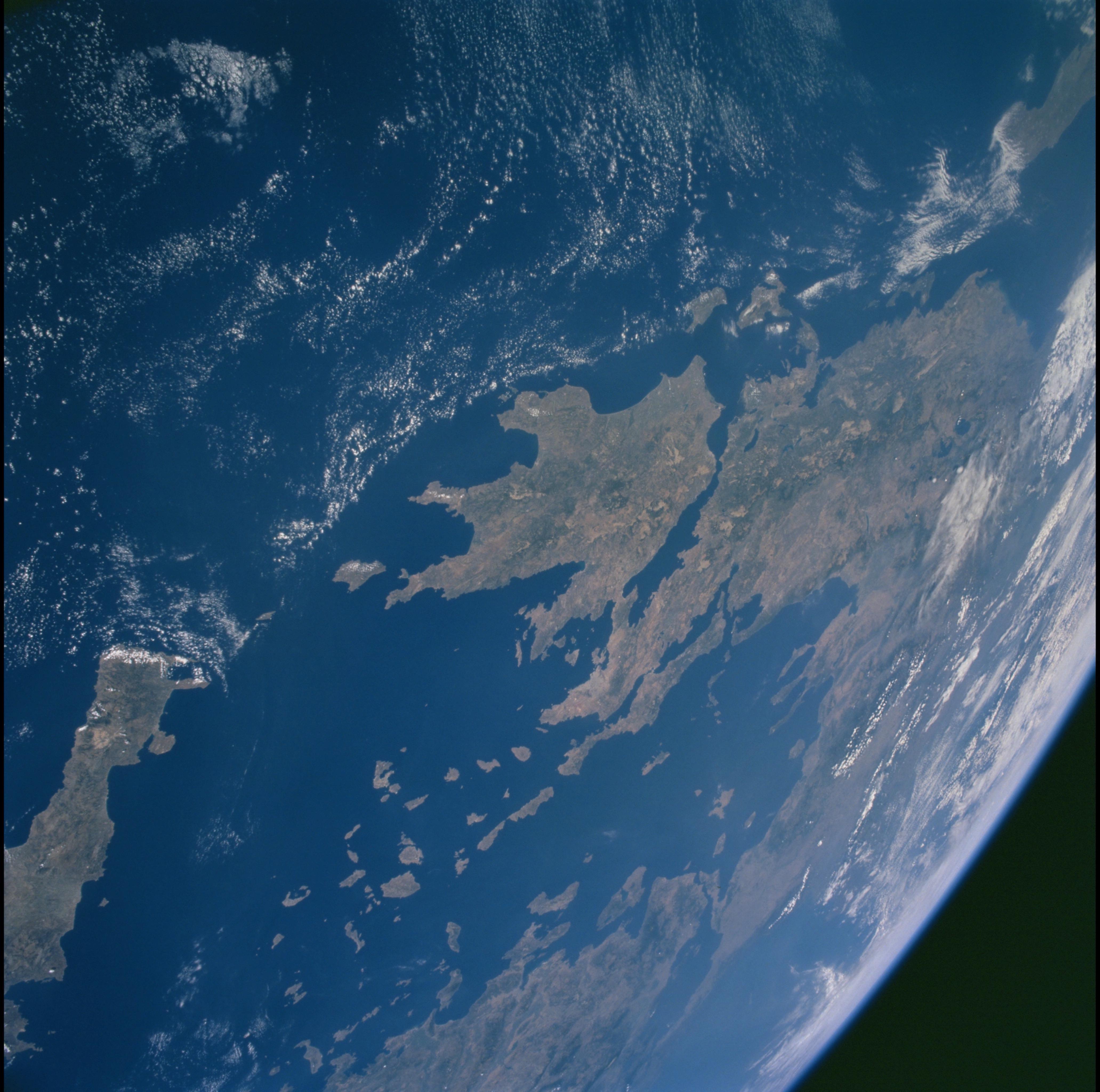
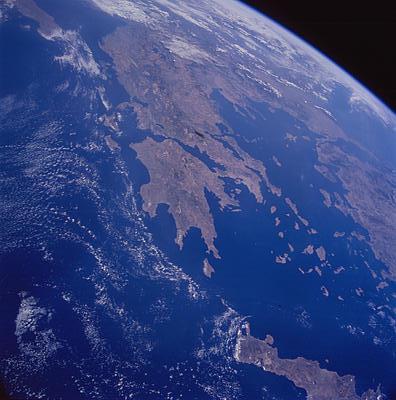
Country or Geographic Name: | GREECE |
Features: | PAN-PELOPONNISOS, ISLANDS |
| Features Found Using Machine Learning: | |
Cloud Cover Percentage: | 25 (11-25)% |
Sun Elevation Angle: | ° |
Sun Azimuth: | ° |
Camera: | Hasselblad |
Focal Length: | 40mm |
Camera Tilt: | High Oblique |
Format: | 5069: Kodak Elite 100S, E6 Reversal, Replaces Lumiere, Warmer in tone vs. Lumiere |
Film Exposure: | |
| Additional Information | |
| Width | Height | Annotated | Cropped | Purpose | Links |
|---|---|---|---|---|---|
| 1031 pixels | 1024 pixels | No | No | Download Image | |
| 2063 pixels | 2048 pixels | No | No | Download Image | |
| 4127 pixels | 4096 pixels | No | No | Download Image | |
| 515 pixels | 512 pixels | No | No | Download Image | |
| 1296 pixels | 1284 pixels | No | No | Download Image | |
| 400 pixels | 396 pixels | Download Image |
Download Packaged File
Download a Google Earth KML for this Image
View photo footprint information
Download a GeoTIFF for this photo
Image Caption: Source: Patricia W. Dickerson
Aegean Sea
Crete (foreground), the Cyclades Islands, Greece and Turkey lie along
the margin of the Eurasian and African tectonic plates; Africa is moving
northward and being driven down beneath Eurasia. As a result volcanic
islands, such as Santorini, develop and fault-bounded basisn such, as
the Gulf of Corinth, are formed. In addition, lavas and sediments that
were originally deposited on the Mediterranean seafloor are uplifted and
deformed. The light-colored masses that extend along a NW-trending line
from the Peloponnesos into the Balkans consist of such uplifted marine
sediments.
