STS106-314-23

| NASA Photo ID | STS106-314-23 |
| Focal Length | mm |
| Date taken | 2000.09.18 |
| Time taken | 05:29:55 GMT |
Resolutions offered for this image:
540 x 357 pixels 1536 x 1024 pixels 3072 x 2048 pixels 6144 x 4096 pixels 639 x 423 pixels 768 x 512 pixels
540 x 357 pixels 1536 x 1024 pixels 3072 x 2048 pixels 6144 x 4096 pixels 639 x 423 pixels 768 x 512 pixels


Cloud masks available for this image:
Spacecraft nadir point: 37.1° N, 88.4° E
Photo center point: 42.0° N, 82.5° E
Photo center point by machine learning:
Photo center point: 42.0° N, 82.5° E
Photo center point by machine learning:
Nadir to Photo Center: Northwest
Spacecraft Altitude: 204 nautical miles (378km)
Country or Geographic Name: | CHINA |
Features: | PAN-TAKLI MAKAN, ISS |
| Features Found Using Machine Learning: | |
Cloud Cover Percentage: | 10 (1-10)% |
Sun Elevation Angle: | 54° |
Sun Azimuth: | 167° |
Camera: | Nikon 35mm film camera |
Focal Length: | mm |
Camera Tilt: | High Oblique |
Format: | 5776: Portra 400VC, color negative, 35mm, ASA 400 |
Film Exposure: | |
| Additional Information | |
| Width | Height | Annotated | Cropped | Purpose | Links |
|---|---|---|---|---|---|
| 540 pixels | 357 pixels | Photographic Highlights | Download Image | ||
| 1536 pixels | 1024 pixels | No | No | Download Image | |
| 3072 pixels | 2048 pixels | No | No | Download Image | |
| 6144 pixels | 4096 pixels | No | No | Download Image | |
| 639 pixels | 423 pixels | No | No | Download Image | |
| 768 pixels | 512 pixels | No | No | Download Image |
Download Packaged File
Download a Google Earth KML for this Image
View photo footprint information
Download a GeoTIFF for this photo
Image Caption: Source: Julie A. Robinson
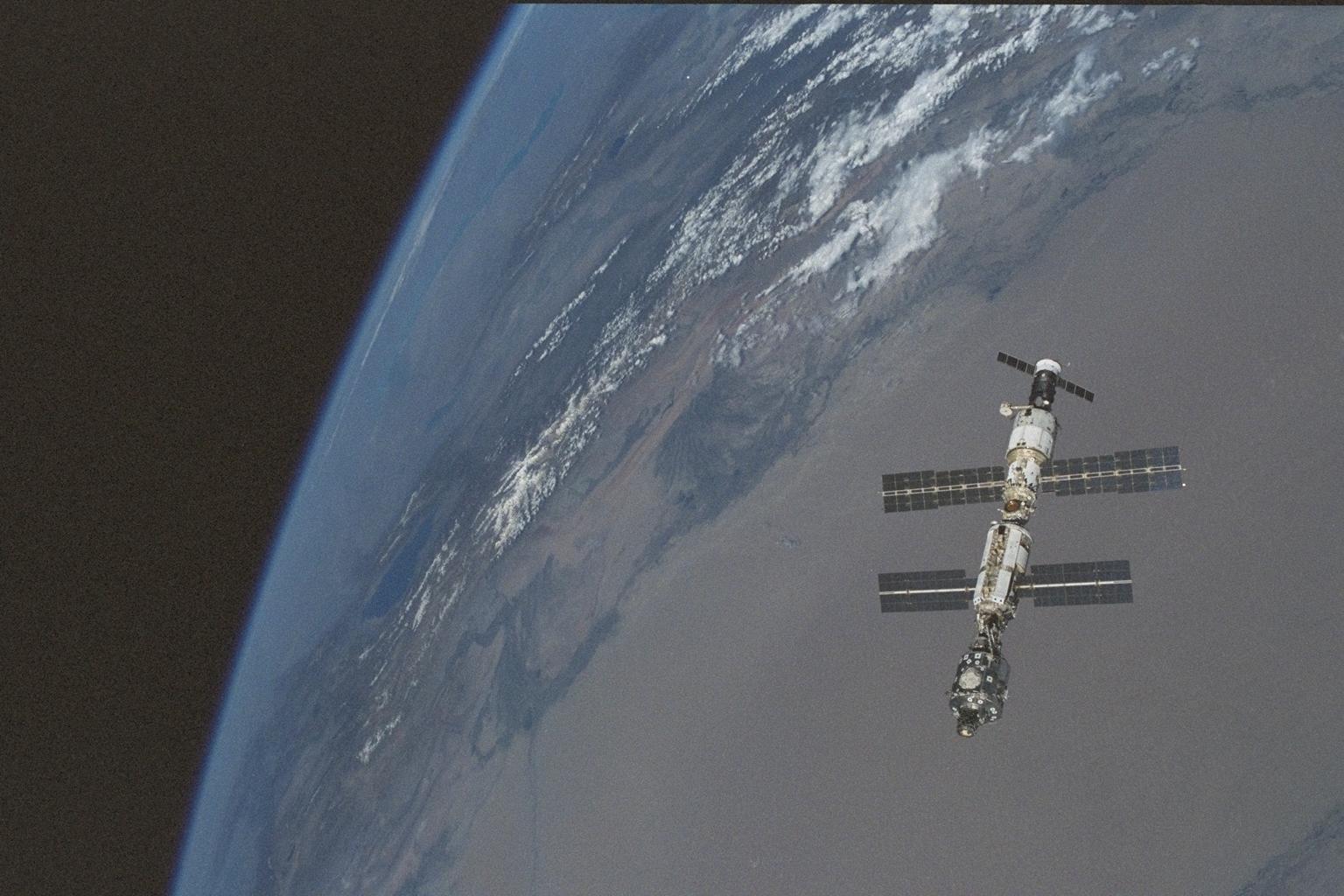
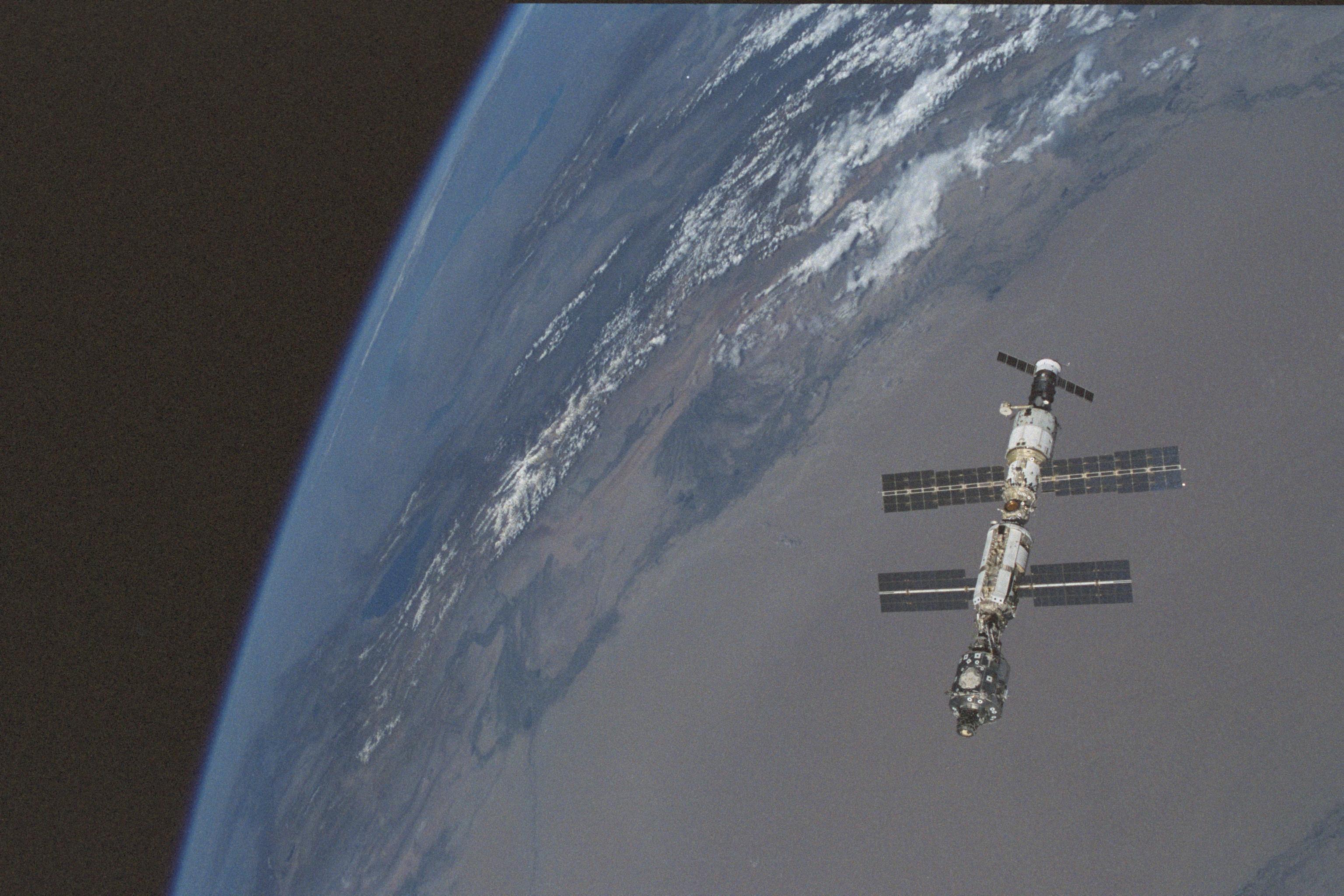
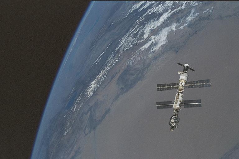
International Space Station over the Tarim Basin
The three modules of the International Space Station (Zarya, Unity and
Zvezda) are in orbit 204 nautical miles over the Taklimakan Desert of
northern China. Beyond the desert lie the snowcrested Tien Shan
mountains, erosion of these mountains produces dark-colored alluvial
fans at the north edge of the tan-colored desert. The long, narrow lake
seen far away at the horizon is Lake Balkash, Kazakhstan.
