STS104-711-42
| NASA Photo ID | STS104-711-42 |
| Focal Length | 350mm |
| Date taken | 2001.07.23 |
| Time taken | 11:53:11 GMT |
Resolutions offered for this image:
1031 x 1024 pixels 2063 x 2048 pixels 4127 x 4096 pixels 515 x 512 pixels 4096 x 4096 pixels 640 x 640 pixels 400 x 400 pixels
1031 x 1024 pixels 2063 x 2048 pixels 4127 x 4096 pixels 515 x 512 pixels 4096 x 4096 pixels 640 x 640 pixels 400 x 400 pixels


Cloud masks available for this image:
Spacecraft nadir point: 39.0° N, 74.3° W
Photo center point: 40.5° N, 74.0° W
Photo center point by machine learning:
Photo center point: 40.5° N, 74.0° W
Photo center point by machine learning:
Nadir to Photo Center: North
Spacecraft Altitude: 210 nautical miles (389km)
Country or Geographic Name: | USA-NEW YORK |
Features: | NEW YORK CITY AREA |
| Features Found Using Machine Learning: | |
Cloud Cover Percentage: | 10 (1-10)% |
Sun Elevation Angle: | 22° |
Sun Azimuth: | 81° |
Camera: | Hasselblad |
Focal Length: | 350mm |
Camera Tilt: | 24 degrees |
Format: | 5069: Kodak Elite 100S, E6 Reversal, Replaces Lumiere, Warmer in tone vs. Lumiere |
Film Exposure: | |
| Additional Information | |
| Width | Height | Annotated | Cropped | Purpose | Links |
|---|---|---|---|---|---|
| 1031 pixels | 1024 pixels | No | No | Download Image | |
| 2063 pixels | 2048 pixels | No | No | Download Image | |
| 4127 pixels | 4096 pixels | No | No | Download Image | |
| 515 pixels | 512 pixels | No | No | Download Image | |
| 4096 pixels | 4096 pixels | No | No | Public Affairs Office (PAO) | Download Image |
| 640 pixels | 640 pixels | No | No | Public Affairs Office (PAO) | Download Image |
| 400 pixels | 400 pixels | No | No | Photographic Highlights | Download Image |
Download Packaged File
Download a Google Earth KML for this Image
View photo footprint information
Download a GeoTIFF for this photo
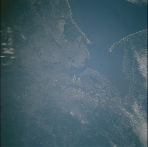
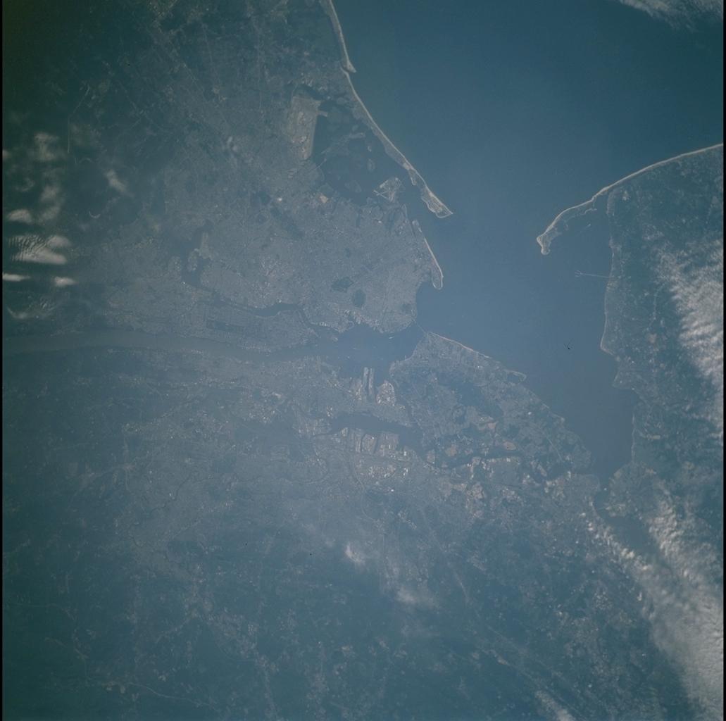
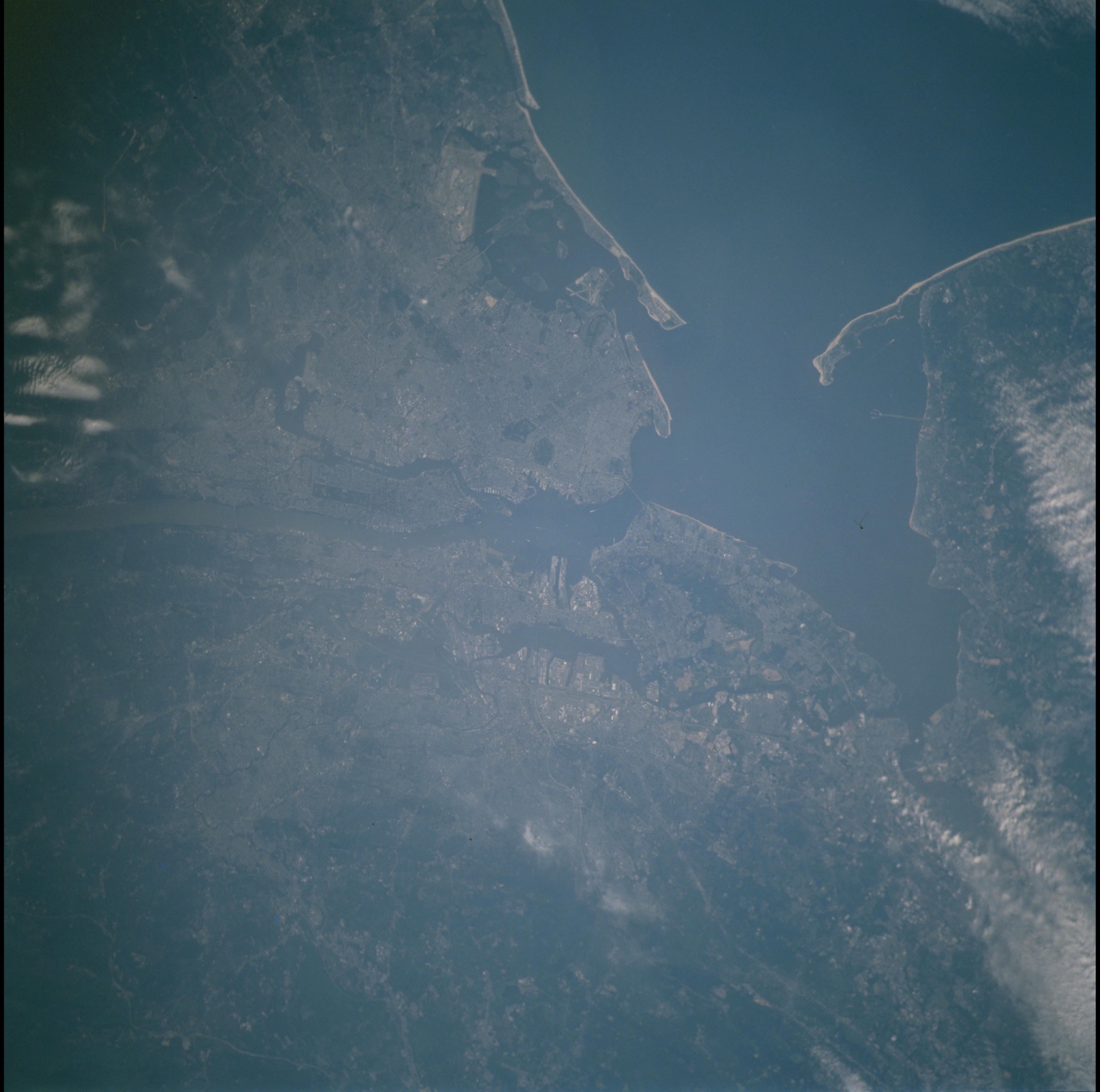
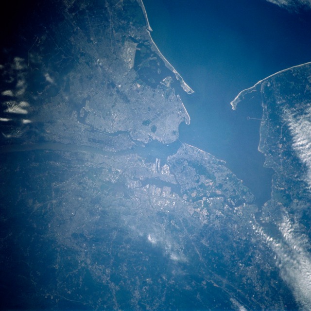
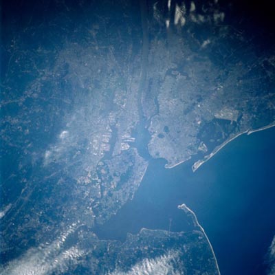
Image Caption: New York City Area
The largest city in the United States, and one of the largest cities in the world, New York City and its metropolitan area can be seen in this north-looking view. The city is located on New York Bay at the mouth of the Hudson River. The bay is divided into Upper (north) and Lower Bays (south), which is connected by the Narrows, a strait 3 miles (5 km) long and 1 mile (1.6 km) wide. The Verrazano-Narrows Bridge (discernible near the center of the image) spans the strait. Raritan Bay and Sandy Hook are visible near the bottom center of the image.
The largest city in the United States, and one of the largest cities in the world, New York City and its metropolitan area can be seen in this north-looking view. The city is located on New York Bay at the mouth of the Hudson River. The bay is divided into Upper (north) and Lower Bays (south), which is connected by the Narrows, a strait 3 miles (5 km) long and 1 mile (1.6 km) wide. The Verrazano-Narrows Bridge (discernible near the center of the image) spans the strait. Raritan Bay and Sandy Hook are visible near the bottom center of the image.
