STS104-710-60

| NASA Photo ID | STS104-710-60 |
| Focal Length | 250mm |
| Date taken | 2001.07.23 |
| Time taken | 05:42:56 GMT |
Resolutions offered for this image:
540 x 540 pixels 1031 x 1024 pixels 2067 x 2048 pixels 4135 x 4096 pixels 515 x 512 pixels 1019 x 1021 pixels 1295 x 1257 pixels 400 x 400 pixels
540 x 540 pixels 1031 x 1024 pixels 2067 x 2048 pixels 4135 x 4096 pixels 515 x 512 pixels 1019 x 1021 pixels 1295 x 1257 pixels 400 x 400 pixels


Cloud masks available for this image:
Spacecraft nadir point: 42.0° N, 14.3° E
Photo center point: 41.0° N, 15.0° E
Photo center point by machine learning:
Photo center point: 41.0° N, 15.0° E
Photo center point by machine learning:
Nadir to Photo Center: Southeast
Spacecraft Altitude: 210 nautical miles (389km)
Country or Geographic Name: | ITALY |
Features: | MOUNT VESUVIUS, NAPLES |
| Features Found Using Machine Learning: | |
Cloud Cover Percentage: | 10 (1-10)% |
Sun Elevation Angle: | 19° |
Sun Azimuth: | 80° |
Camera: | Hasselblad |
Focal Length: | 250mm |
Camera Tilt: | 19 degrees |
Format: | 5069: Kodak Elite 100S, E6 Reversal, Replaces Lumiere, Warmer in tone vs. Lumiere |
Film Exposure: | |
| Additional Information | |
| Width | Height | Annotated | Cropped | Purpose | Links |
|---|---|---|---|---|---|
| 540 pixels | 540 pixels | Yes | Yes | Earth From Space collection | Download Image |
| 1031 pixels | 1024 pixels | No | No | Download Image | |
| 2067 pixels | 2048 pixels | No | No | Download Image | |
| 4135 pixels | 4096 pixels | No | No | Download Image | |
| 515 pixels | 512 pixels | No | No | Download Image | |
| 1019 pixels | 1021 pixels | No | Yes | Photographic Highlights | Download Image |
| 1295 pixels | 1257 pixels | No | No | Download Image | |
| 400 pixels | 400 pixels | Yes | Yes | Photographic Highlights | Download Image |
Download Packaged File
Download a Google Earth KML for this Image
View photo footprint information
Download a GeoTIFF for this photo
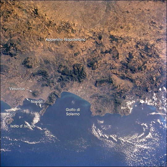
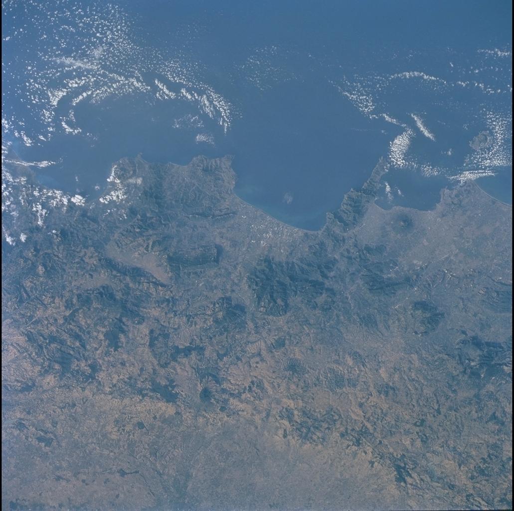
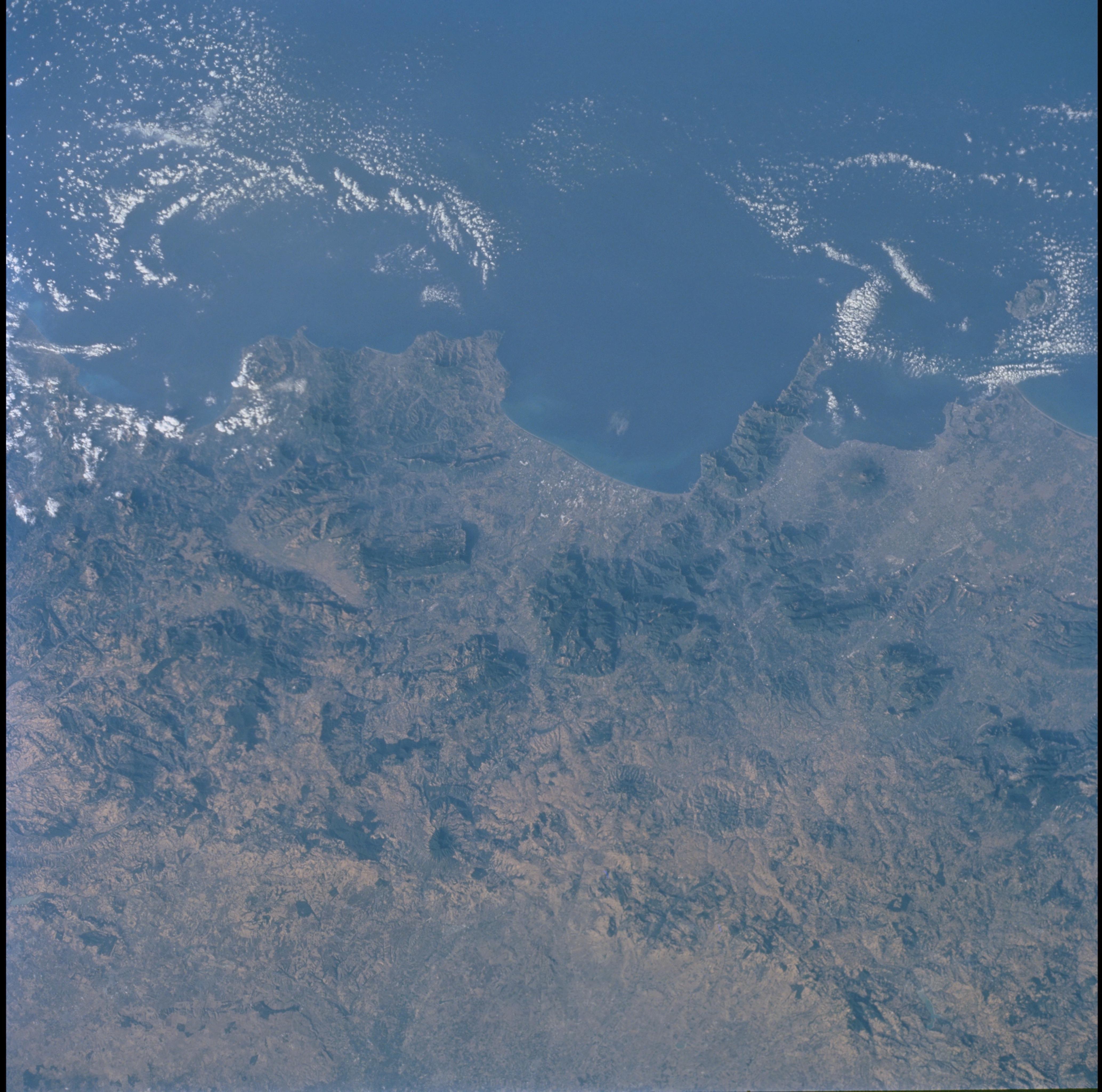
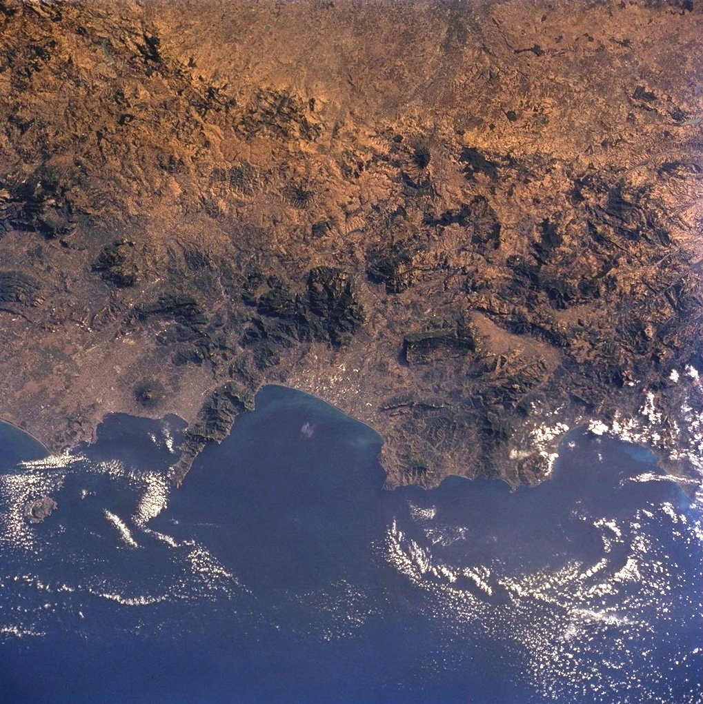
Image Caption: For more than 240 million years the region now known as Italy has been the scene of episodic volcanic activity. East-southeast of Napoli (Naples) stands the imposing cone of Vesuvius, which erupted explosively in 79 A.D. to bury Pompeii and Herculaneum. More recently, when the crew of Space Shuttle mission STS-104 captured this view, Mt. Etna (Sicily, not seen in this image, but photographed the day before) was spewing ash and gas thousands of meters into the air, some of which can be seen as a brownish smear over Isola d' Ischia and the Tyrrhenian Sea.
The Appenine ranges extend from northern Italy, down the boot of the peninsula and westward into Sicily. This photograph of the Appenino Napoletano is part of an 18-frame stereophoto mapping strip that spans the entire mountain chain. The almost 1200-km-long belt of volcanoes and folded/faulted mountains is a result of the ongoing collision of Africa and Eurasia, accompanied by the progressive closing of the Mediterranean Sea. Using overlapping pairs of stereophotos, and a special viewer, scientists can get a three-dimensional perspective on the ranges that surpasses any image viewed alone.
The Appenine ranges extend from northern Italy, down the boot of the peninsula and westward into Sicily. This photograph of the Appenino Napoletano is part of an 18-frame stereophoto mapping strip that spans the entire mountain chain. The almost 1200-km-long belt of volcanoes and folded/faulted mountains is a result of the ongoing collision of Africa and Eurasia, accompanied by the progressive closing of the Mediterranean Sea. Using overlapping pairs of stereophotos, and a special viewer, scientists can get a three-dimensional perspective on the ranges that surpasses any image viewed alone.
