STS103-732-5
| NASA Photo ID | STS103-732-5 |
| Focal Length | 250mm |
| Date taken | 1999.12.25 |
| Time taken | 06:47:06 GMT |
Resolutions offered for this image:
1031 x 1024 pixels 2063 x 2048 pixels 4127 x 4096 pixels 515 x 512 pixels 3216 x 3263 pixels 630 x 639 pixels
1031 x 1024 pixels 2063 x 2048 pixels 4127 x 4096 pixels 515 x 512 pixels 3216 x 3263 pixels 630 x 639 pixels


Cloud masks available for this image:
Spacecraft nadir point: 26.1° S, 13.3° E
Photo center point: 24.5° S, 15.5° E
Photo center point by machine learning:
Photo center point: 24.5° S, 15.5° E
Photo center point by machine learning:
Nadir to Photo Center: Northeast
Spacecraft Altitude: 328 nautical miles (607km)
Country or Geographic Name: | NAMIBIA |
Features: | NAMIB DESERT |
| Features Found Using Machine Learning: | |
Cloud Cover Percentage: | 10 (1-10)% |
Sun Elevation Angle: | 32° |
Sun Azimuth: | 103° |
Camera: | Hasselblad |
Focal Length: | 250mm |
Camera Tilt: | 26 degrees |
Format: | 5069: Kodak Elite 100S, E6 Reversal, Replaces Lumiere, Warmer in tone vs. Lumiere |
Film Exposure: | |
| Additional Information | |
| Width | Height | Annotated | Cropped | Purpose | Links |
|---|---|---|---|---|---|
| 1031 pixels | 1024 pixels | No | No | Download Image | |
| 2063 pixels | 2048 pixels | No | No | Download Image | |
| 4127 pixels | 4096 pixels | No | No | Download Image | |
| 515 pixels | 512 pixels | No | No | Download Image | |
| 3216 pixels | 3263 pixels | No | No | Public Affairs Office (PAO) | Download Image |
| 630 pixels | 639 pixels | No | No | Public Affairs Office (PAO) | Download Image |
Download Packaged File
Download a Google Earth KML for this Image
View photo footprint information
Download a GeoTIFF for this photo
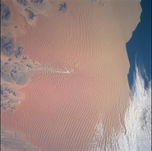
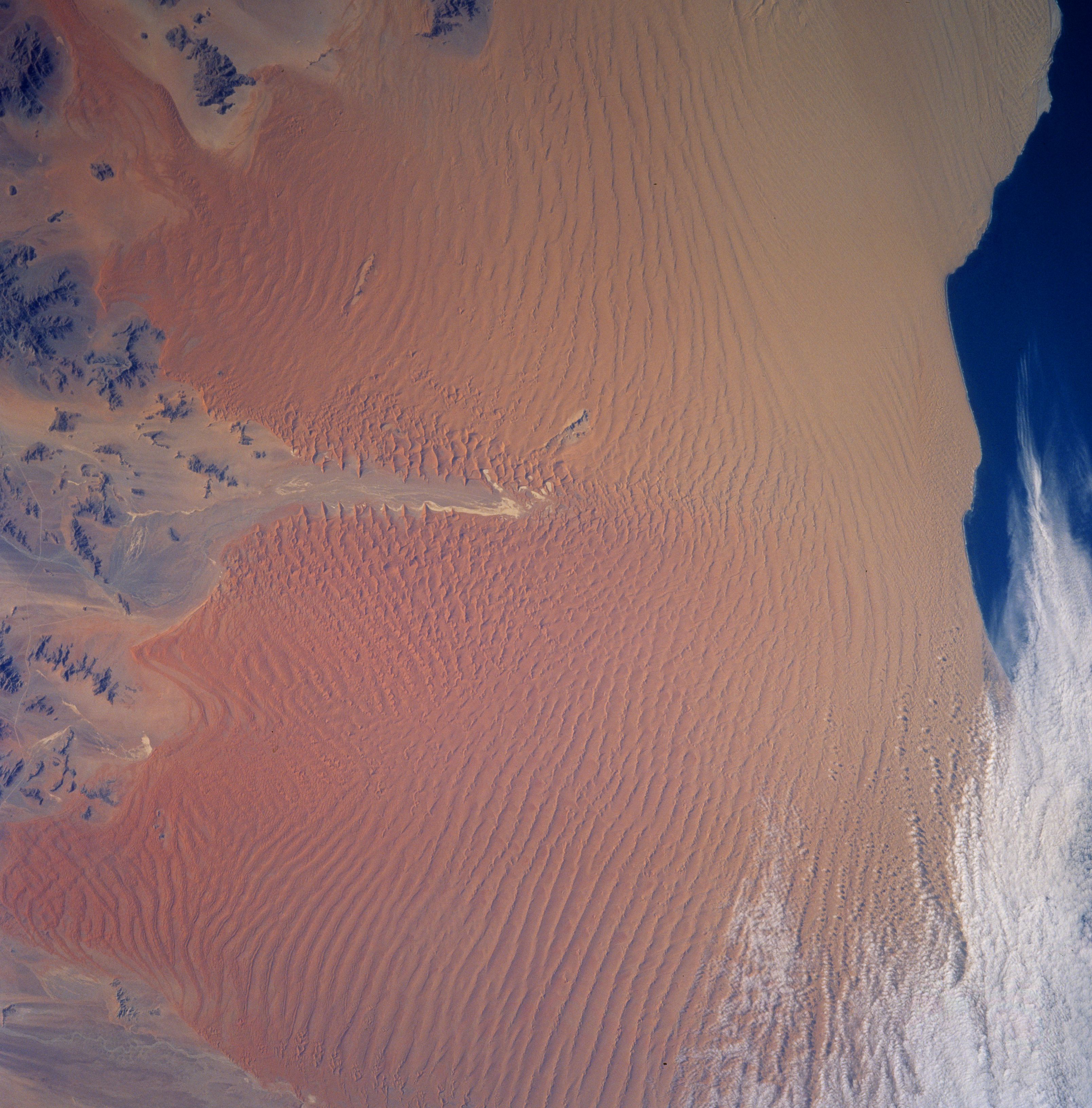
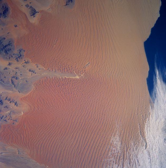
Image Caption: Sand dunes in the Namib Desert reflect the local wind direction and topography. The
Namib Desert extends for 1900 km (1200 miles) along the Atlantic coast and reaches
inland 128 km to 160 km (80 to 100 miles). Sand is transported from southern and
western coastal areas towards central, northern, and eastern parts of the desert. Dunes
along the coast tend to be cresentic or dune types that form in areas where the winds
come from one predominant direction. Linear dunes are the common dune type found
toward the interior of the Namib. Linear dunes are long, straight, and form in areas
where winds come from one predominant direction or two. Star dunes can be detected
clustered around the Sossus Vlei (vlei is a salt pan or mud flat) River. The Sossus Vlei
does not actually reach the Atlantic Ocean. Star dunes have radial arms and reflect
chaotic wind direction. Star dunes near the Sossus Vlei attain heights of 300 to 350 m
(1000 to 1167 ft).
