STS103-732-30

| NASA Photo ID | STS103-732-30 |
| Focal Length | 250mm |
| Date taken | 1999.12.25 |
| Time taken | 06:55:32 GMT |
Resolutions offered for this image:
1031 x 1024 pixels 2063 x 2048 pixels 4127 x 4096 pixels 515 x 512 pixels 3322 x 3312 pixels 639 x 638 pixels
1031 x 1024 pixels 2063 x 2048 pixels 4127 x 4096 pixels 515 x 512 pixels 3322 x 3312 pixels 639 x 638 pixels


Cloud masks available for this image:
Spacecraft nadir point: 16.2° S, 43.2° E
Photo center point: 16.0° S, 46.0° E
Photo center point by machine learning:
Photo center point: 16.0° S, 46.0° E
Photo center point by machine learning:
Nadir to Photo Center: East
Spacecraft Altitude: 325 nautical miles (602km)
Country or Geographic Name: | MADAGASCAR |
Features: | BETSIBOKA RIVER DELTA |
| Features Found Using Machine Learning: | |
Cloud Cover Percentage: | 25 (11-25)% |
Sun Elevation Angle: | 58° |
Sun Azimuth: | 109° |
Camera: | Hasselblad |
Focal Length: | 250mm |
Camera Tilt: | 27 degrees |
Format: | 5069: Kodak Elite 100S, E6 Reversal, Replaces Lumiere, Warmer in tone vs. Lumiere |
Film Exposure: | |
| Additional Information | |
| Width | Height | Annotated | Cropped | Purpose | Links |
|---|---|---|---|---|---|
| 1031 pixels | 1024 pixels | No | No | Download Image | |
| 2063 pixels | 2048 pixels | No | No | Download Image | |
| 4127 pixels | 4096 pixels | No | No | Download Image | |
| 515 pixels | 512 pixels | No | No | Download Image | |
| 3322 pixels | 3312 pixels | No | No | Public Affairs Office (PAO) | Download Image |
| 639 pixels | 638 pixels | No | No | Public Affairs Office (PAO) | Download Image |
Download Packaged File
Download a Google Earth KML for this Image
View photo footprint information
Download a GeoTIFF for this photo
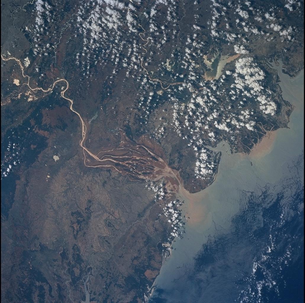
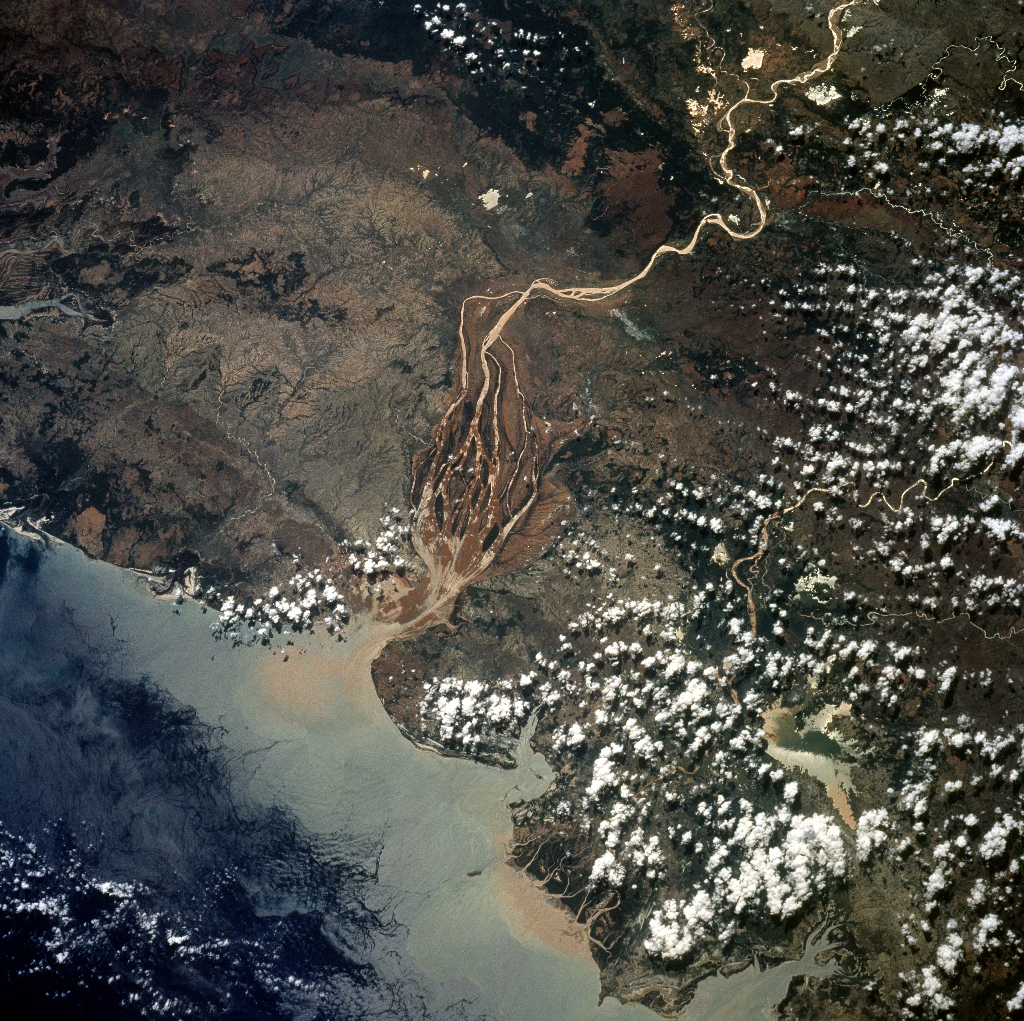
Image Caption: Large sediment plumes and freshwater lenses emerging into the Mozambique Channel
imply that Madagascar has had the benefit of recent rainfall. November to April is the
hot wet season for Madagascar and STS-103 astronauts took this photograph in
December 1999. At almost center is the Bombetoka Bay, located on the northwestern
coast and it is fed by the Betsiboka River. The city and major port of Mahajanga is under
clouds on the northeast side of the bay. The bright white color of the coast and parts of
rivers is caused by the reflectance of the sun (sun glitter).
