STS103-731-80
| NASA Photo ID | STS103-731-80 |
| Focal Length | 250mm |
| Date taken | 1999.12.24 |
| Time taken | 05:05:43 GMT |
Resolutions offered for this image:
1035 x 1024 pixels 2071 x 2048 pixels 4143 x 4096 pixels 517 x 512 pixels 4026 x 4026 pixels 909 x 1181 pixels 4026 x 4026 pixels 540 x 702 pixels
1035 x 1024 pixels 2071 x 2048 pixels 4143 x 4096 pixels 517 x 512 pixels 4026 x 4026 pixels 909 x 1181 pixels 4026 x 4026 pixels 540 x 702 pixels


Cloud masks available for this image:
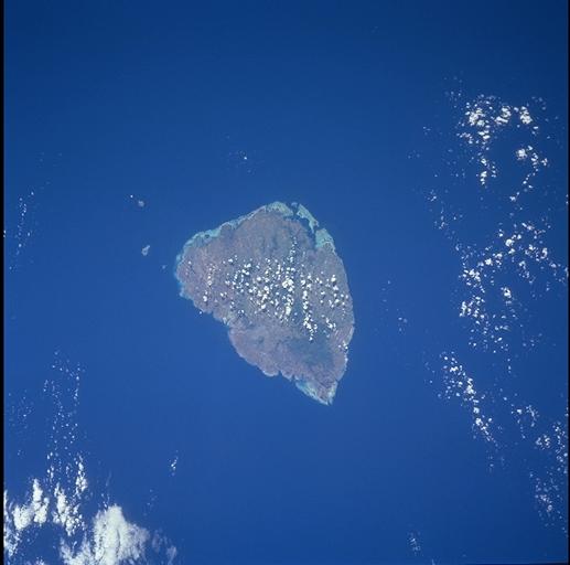
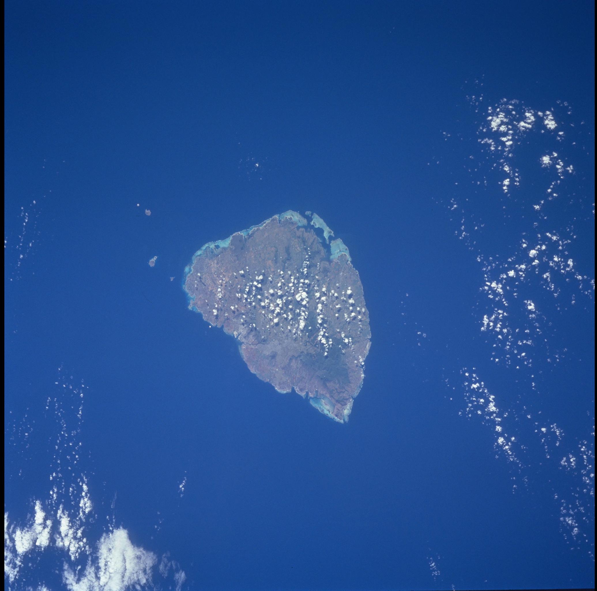
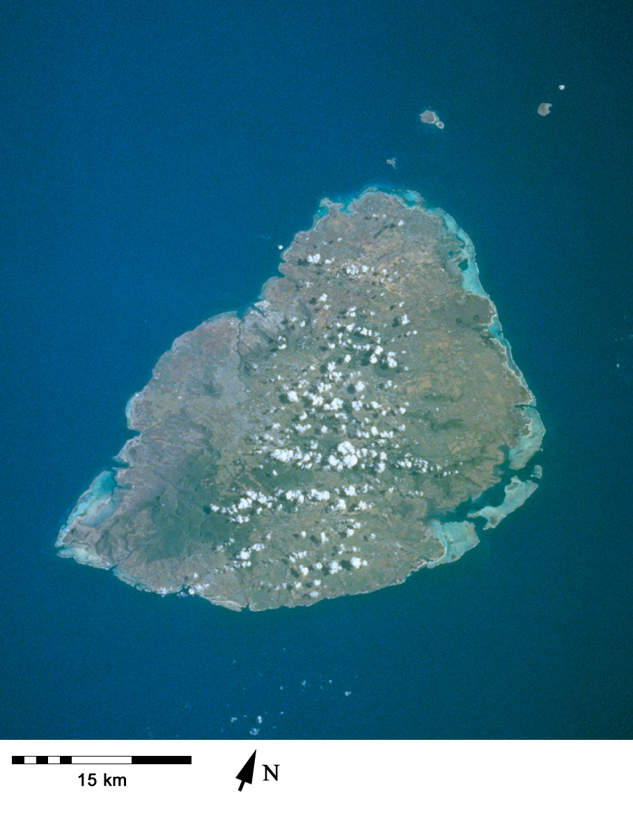
Spacecraft nadir point: 23.5° S, 57.9° E
Photo center point: 20.5° S, 57.5° E
Photo center point by machine learning:
Photo center point: 20.5° S, 57.5° E
Photo center point by machine learning:
Nadir to Photo Center: North
Spacecraft Altitude: 326 nautical miles (604km)
Country or Geographic Name: | MAURITIUS |
Features: | MAURITIUS |
| Features Found Using Machine Learning: | |
Cloud Cover Percentage: | 10 (1-10)% |
Sun Elevation Angle: | 48° |
Sun Azimuth: | 100° |
Camera: | Hasselblad |
Focal Length: | 250mm |
Camera Tilt: | 29 degrees |
Format: | 5069: Kodak Elite 100S, E6 Reversal, Replaces Lumiere, Warmer in tone vs. Lumiere |
Film Exposure: | |
| Additional Information | |
| Width | Height | Annotated | Cropped | Purpose | Links |
|---|---|---|---|---|---|
| 1035 pixels | 1024 pixels | No | No | Download Image | |
| 2071 pixels | 2048 pixels | No | No | Download Image | |
| 4143 pixels | 4096 pixels | No | No | Download Image | |
| 517 pixels | 512 pixels | No | No | Download Image | |
| 4026 pixels | 4026 pixels | No | No | Coral Reef Atlas Publication | Download Image |
| 909 pixels | 1181 pixels | Yes | Yes | Publisher Request | Download Image |
| 4026 pixels | 4026 pixels | No | No | Download Image | |
| 540 pixels | 702 pixels | Yes | Yes | Publisher Request | Download Image |
Download Packaged File
Download a Google Earth KML for this Image
View photo footprint information
Download a GeoTIFF for this photo
Image Caption: Mauritius has fringing reefs on most of its coastline, but also a barrier reef in the southeast [STS103-731-80, 1999].
