STS103-708-81

| NASA Photo ID | STS103-708-81 |
| Focal Length | 40mm |
| Date taken | 1999.12.25 |
| Time taken | 06:55:15 GMT |
Resolutions offered for this image:
1028 x 1024 pixels 2050 x 2048 pixels 4100 x 4096 pixels 514 x 512 pixels 4096 x 4087 pixels 640 x 638 pixels
1028 x 1024 pixels 2050 x 2048 pixels 4100 x 4096 pixels 514 x 512 pixels 4096 x 4087 pixels 640 x 638 pixels


Cloud masks available for this image:
Spacecraft nadir point: 16.6° S, 42.2° E
Photo center point: 18.0° S, 46.0° E
Photo center point by machine learning:
Photo center point: 18.0° S, 46.0° E
Photo center point by machine learning:
Nadir to Photo Center: East
Spacecraft Altitude: 325 nautical miles (602km)
Country or Geographic Name: | MADAGASCAR |
Features: | PAN-ENTIRE ISLAND |
| Features Found Using Machine Learning: | |
Cloud Cover Percentage: | 25 (11-25)% |
Sun Elevation Angle: | 57° |
Sun Azimuth: | 108° |
Camera: | Hasselblad |
Focal Length: | 40mm |
Camera Tilt: | High Oblique |
Format: | 5069: Kodak Elite 100S, E6 Reversal, Replaces Lumiere, Warmer in tone vs. Lumiere |
Film Exposure: | |
| Additional Information | |
| Width | Height | Annotated | Cropped | Purpose | Links |
|---|---|---|---|---|---|
| 1028 pixels | 1024 pixels | No | No | Download Image | |
| 2050 pixels | 2048 pixels | No | No | Download Image | |
| 4100 pixels | 4096 pixels | No | No | Download Image | |
| 514 pixels | 512 pixels | No | No | Download Image | |
| 4096 pixels | 4087 pixels | No | No | Public Affairs Office (PAO) | Download Image |
| 640 pixels | 638 pixels | No | No | Public Affairs Office (PAO) | Download Image |
Download Packaged File
Download a Google Earth KML for this Image
View photo footprint information
Download a GeoTIFF for this photo
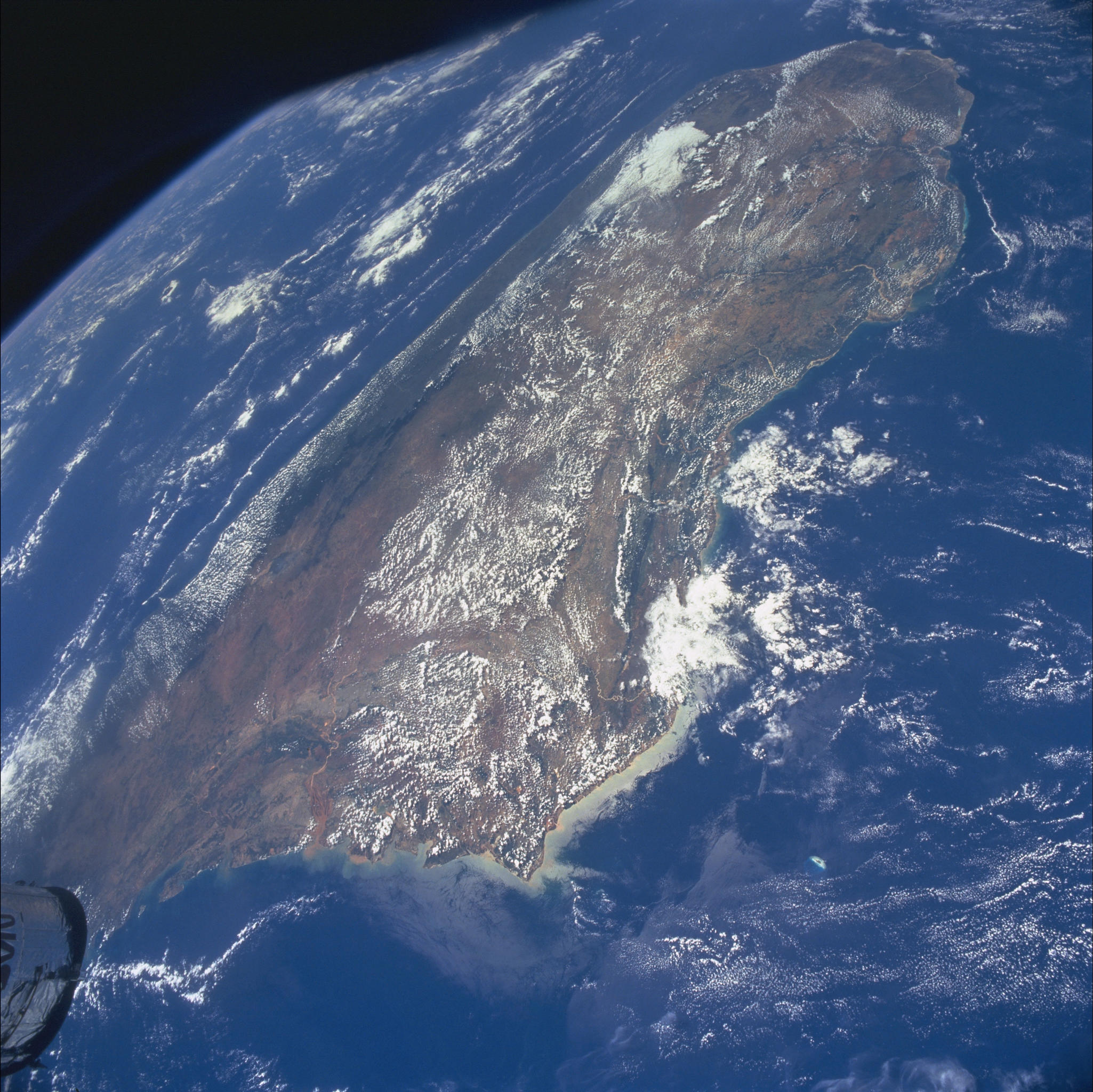
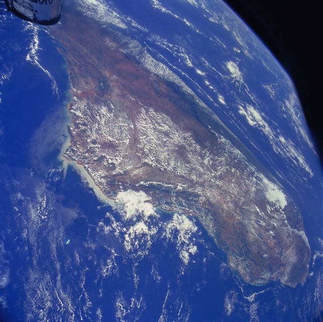
Image Caption: An almost complete panoramic view of the fourth largest island in the world,
Madagascar. The distinctive red color of Madagascar is due to the composition of its
soil. The central plateau and eastern coast are composed of gneiss, granite, and quartz.
These rocks decompose into a laterite, or red soil that is leached of soluble minerals and
of alumina and silica but retain the oxides and hydroxides of iron.
Madagascar was once almost completely covered by forests. Burning the forests to clear
land for dry rice cultivation has denuded much of the island, especially in the central
highlands. As a result of this deforestation increased erosion had lead to higher amounts
of sediment being carried in the rivers, making them appear red instead of shades of blue.
