STS103-501-161
| NASA Photo ID | STS103-501-161 |
| Focal Length | 90mm |
| Date taken | 1999.12.26 |
| Time taken | 00:59:14 GMT |
Resolutions offered for this image:
540 x 425 pixels 1303 x 1024 pixels 2607 x 2048 pixels 5215 x 4096 pixels 651 x 512 pixels 5347 x 4328 pixels 640 x 518 pixels
540 x 425 pixels 1303 x 1024 pixels 2607 x 2048 pixels 5215 x 4096 pixels 651 x 512 pixels 5347 x 4328 pixels 640 x 518 pixels


Cloud masks available for this image:
Spacecraft nadir point: 20.6° N, 157.7° W
Photo center point: 20.5° N, 156.0° W
Photo center point by machine learning:
Photo center point: 20.5° N, 156.0° W
Photo center point by machine learning:
Nadir to Photo Center: East
Spacecraft Altitude: 316 nautical miles (585km)
Camera: | Linhof |
Focal Length: | 90mm |
Camera Tilt: | 18 degrees |
Format: | 5069: Kodak Elite 100S, E6 Reversal, Replaces Lumiere, Warmer in tone vs. Lumiere |
Film Exposure: | |
| Additional Information | |
| Width | Height | Annotated | Cropped | Purpose | Links |
|---|---|---|---|---|---|
| 540 pixels | 425 pixels | Photographic Highlights | Download Image | ||
| 1303 pixels | 1024 pixels | No | No | Download Image | |
| 2607 pixels | 2048 pixels | No | No | Download Image | |
| 5215 pixels | 4096 pixels | No | No | Download Image | |
| 651 pixels | 512 pixels | No | No | Download Image | |
| 5347 pixels | 4328 pixels | No | No | Public Affairs Office (PAO) | Download Image |
| 640 pixels | 518 pixels | No | No | Public Affairs Office (PAO) | Download Image |
Download Packaged File
Download a Google Earth KML for this Image
View photo footprint information
Download a GeoTIFF for this photo
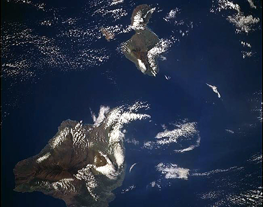
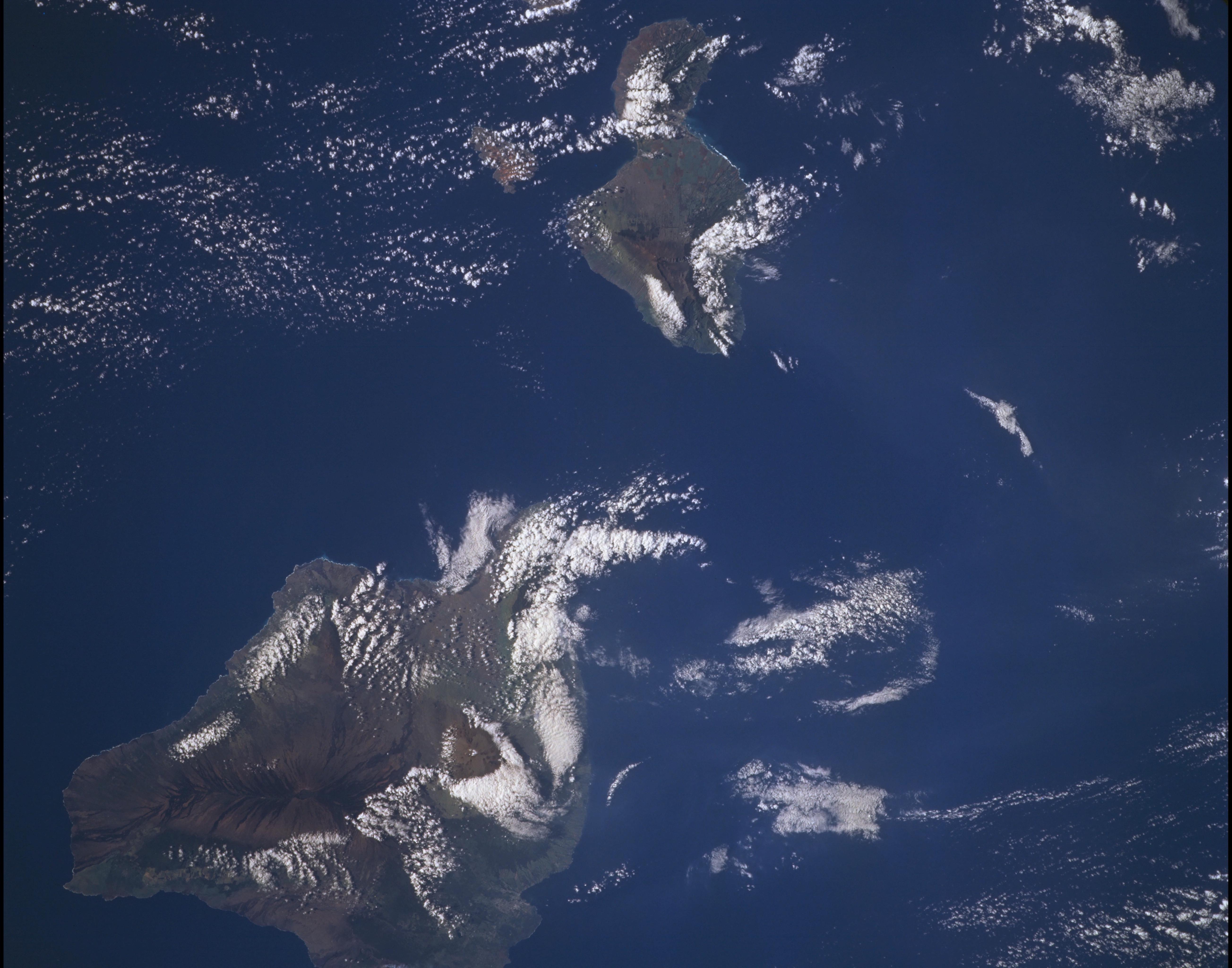
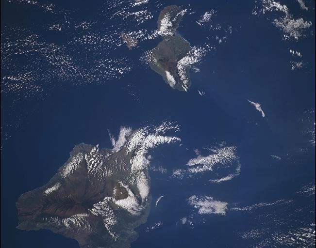
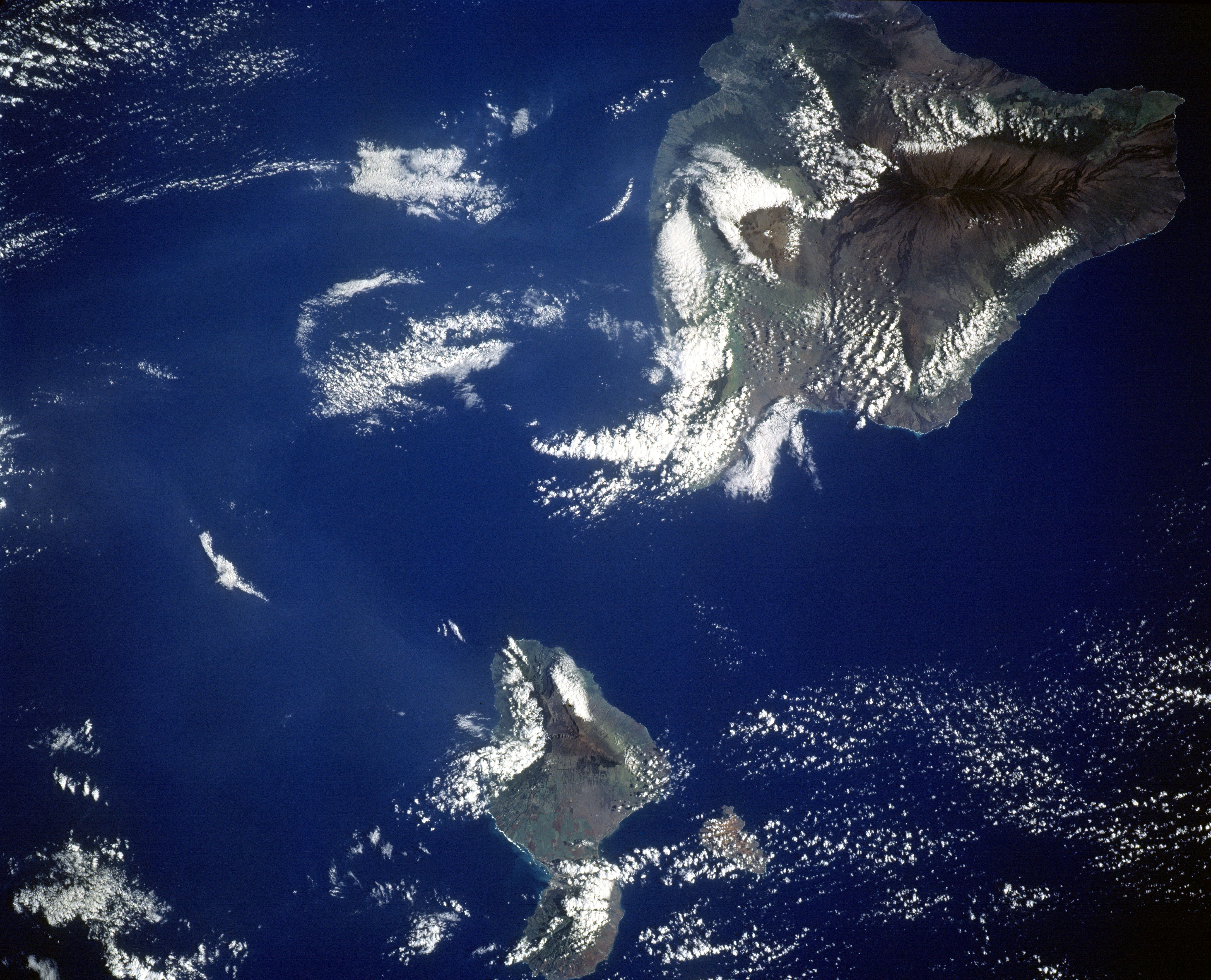
Image Caption: The youngest Hawaiian Island, Hawaii, and the second youngest, Maui, were
photographed by the STS-103 crew on December 26, 1999. The Hawaiian Islands owe
their existence to a hot spot, or deep source of magma that has burned through the floor
of the Pacific Ocean. Most of the Island of Hawaii still resides over the hot spot and as a
result is the site of two active volcanoes. Mauna Loa, the prominent volcano with dark
lava flows emanating from its rift axis, is 4,169 m (13, 678 ft) above sea level and has
erupted 40 times since 1832. Flows have threatened the city of Hilo, northeast of Mauna
Loa and in the "notch" along the coast, as recently as 1984.
