STS102-367-29

| NASA Photo ID | STS102-367-29 |
| Focal Length | mm |
| Date taken | 2001.03.12 |
| Time taken | 10:24:06 GMT |
Cloud masks available for this image:
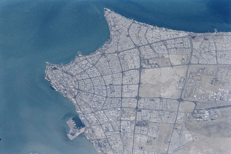
Spacecraft nadir point: 27.0° N, 46.7° E
Photo center point: 29.5° N, 48.0° E
Photo center point by machine learning:
Photo center point: 29.5° N, 48.0° E
Photo center point by machine learning:
Nadir to Photo Center: Northeast
Spacecraft Altitude: 199 nautical miles (369km)
Country or Geographic Name: | KUWAIT |
Features: | KUWAIT CITY |
| Features Found Using Machine Learning: | |
Cloud Cover Percentage: | 10 (1-10)% |
Sun Elevation Angle: | 54° |
Sun Azimuth: | 216° |
Camera: | |
Focal Length: | mm |
Camera Tilt: | 40 degrees |
Format: | |
Film Exposure: | |
| Additional Information | |
| Width | Height | Annotated | Cropped | Purpose | Links |
|---|---|---|---|---|---|
| 768 pixels | 512 pixels | No | No | Download Image | |
| 800 pixels | 534 pixels | No | No | Download Image |
Download Packaged File
Download a Google Earth KML for this Image
View photo footprint information
Download a GeoTIFF for this photo
Image Caption: none
