STS101-720-61
| NASA Photo ID | STS101-720-61 |
| Focal Length | 100mm |
| Date taken | 2000.05.26 |
| Time taken | 23:12:39 GMT |
Resolutions offered for this image:
1035 x 1024 pixels 2071 x 2048 pixels 4143 x 4096 pixels 517 x 512 pixels 1295 x 1279 pixels 400 x 395 pixels
1035 x 1024 pixels 2071 x 2048 pixels 4143 x 4096 pixels 517 x 512 pixels 1295 x 1279 pixels 400 x 395 pixels


Cloud masks available for this image:
Spacecraft nadir point: 51.7° N, 103.1° E
Photo center point: 51.5° N, 104.5° E
Photo center point by machine learning:
Photo center point: 51.5° N, 104.5° E
Photo center point by machine learning:
Nadir to Photo Center: East
Spacecraft Altitude: 200 nautical miles (370km)
Camera: | Hasselblad |
Focal Length: | 100mm |
Camera Tilt: | 23 degrees |
Format: | 5069: Kodak Elite 100S, E6 Reversal, Replaces Lumiere, Warmer in tone vs. Lumiere |
Film Exposure: | |
| Additional Information | |
| Width | Height | Annotated | Cropped | Purpose | Links |
|---|---|---|---|---|---|
| 1035 pixels | 1024 pixels | No | No | Download Image | |
| 2071 pixels | 2048 pixels | No | No | Download Image | |
| 4143 pixels | 4096 pixels | No | No | Download Image | |
| 517 pixels | 512 pixels | No | No | Download Image | |
| 1295 pixels | 1279 pixels | No | Photographic Highlights | Download Image | |
| 400 pixels | 395 pixels | No | Photographic Highlights | Download Image |
Download Packaged File
Download a Google Earth KML for this Image
View photo footprint information
Download a GeoTIFF for this photo
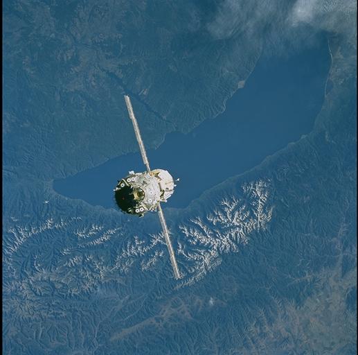
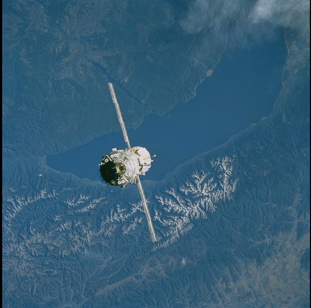
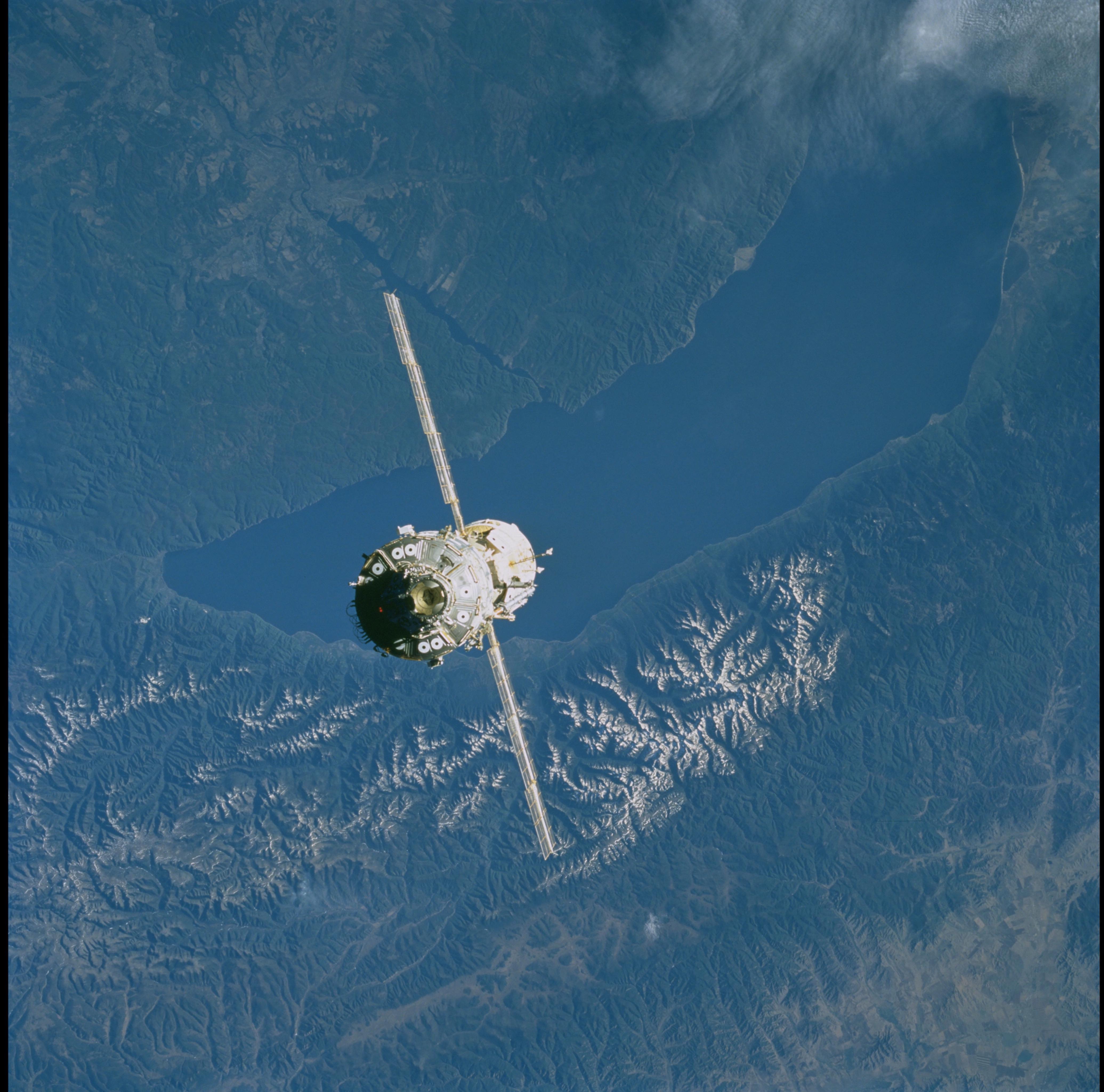
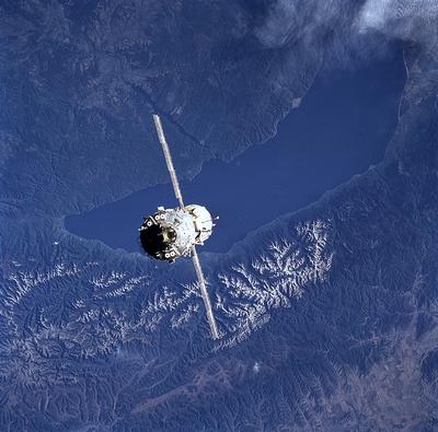
Image Caption: Lake Baykal Rift & Transform Fault
Lake Baykal, largest fresh-water lake in the world, occupies a rift
valley (graben) that is 75 km wide and ~600 km long. The city of Irkutsk
is on the banks of the Angara River, above the Space Station. A
200-km-long transform fault zone connects the Baykal rift valley with
the Lake Hovsgol rift farther west (see STS101-720-58; these two photos
form a stereo pair). Lavas erupted from volcanoes at the junction of
Baykal rift faults and the transform fault zone - for example, the
circular features southwest of Irkutsk - have brought chunks of mantle
rock to the surface.
