STS101-720-58

| NASA Photo ID | STS101-720-58 |
| Focal Length | 100mm |
| Date taken | 2000.05.26 |
| Time taken | 23:11:53 GMT |
Resolutions offered for this image:
1035 x 1024 pixels 2071 x 2048 pixels 4143 x 4096 pixels 517 x 512 pixels 1290 x 1275 pixels 400 x 395 pixels
1035 x 1024 pixels 2071 x 2048 pixels 4143 x 4096 pixels 517 x 512 pixels 1290 x 1275 pixels 400 x 395 pixels


Cloud masks available for this image:
Spacecraft nadir point: 51.6° N, 98.5° E
Photo center point: 51.5° N, 100.0° E
Photo center point by machine learning:
Photo center point: 51.5° N, 100.0° E
Photo center point by machine learning:
Nadir to Photo Center: East
Spacecraft Altitude: 200 nautical miles (370km)
Country or Geographic Name: | MONGOLIA |
Features: | ISS, MTS., HOVSGOL LAKE |
| Features Found Using Machine Learning: | |
Cloud Cover Percentage: | 10 (1-10)% |
Sun Elevation Angle: | 15° |
Sun Azimuth: | 74° |
Camera: | Hasselblad |
Focal Length: | 100mm |
Camera Tilt: | 24 degrees |
Format: | 5069: Kodak Elite 100S, E6 Reversal, Replaces Lumiere, Warmer in tone vs. Lumiere |
Film Exposure: | |
| Additional Information | |
| Width | Height | Annotated | Cropped | Purpose | Links |
|---|---|---|---|---|---|
| 1035 pixels | 1024 pixels | No | No | Download Image | |
| 2071 pixels | 2048 pixels | No | No | Download Image | |
| 4143 pixels | 4096 pixels | No | No | Download Image | |
| 517 pixels | 512 pixels | No | No | Download Image | |
| 1290 pixels | 1275 pixels | No | Photographic Highlights | Download Image | |
| 400 pixels | 395 pixels | No | Photographic Highlights | Download Image |
Download Packaged File
Download a Google Earth KML for this Image
View photo footprint information
Download a GeoTIFF for this photo
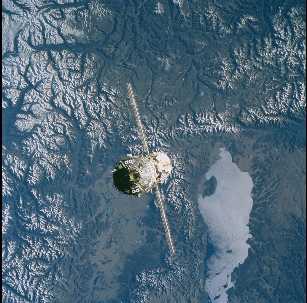
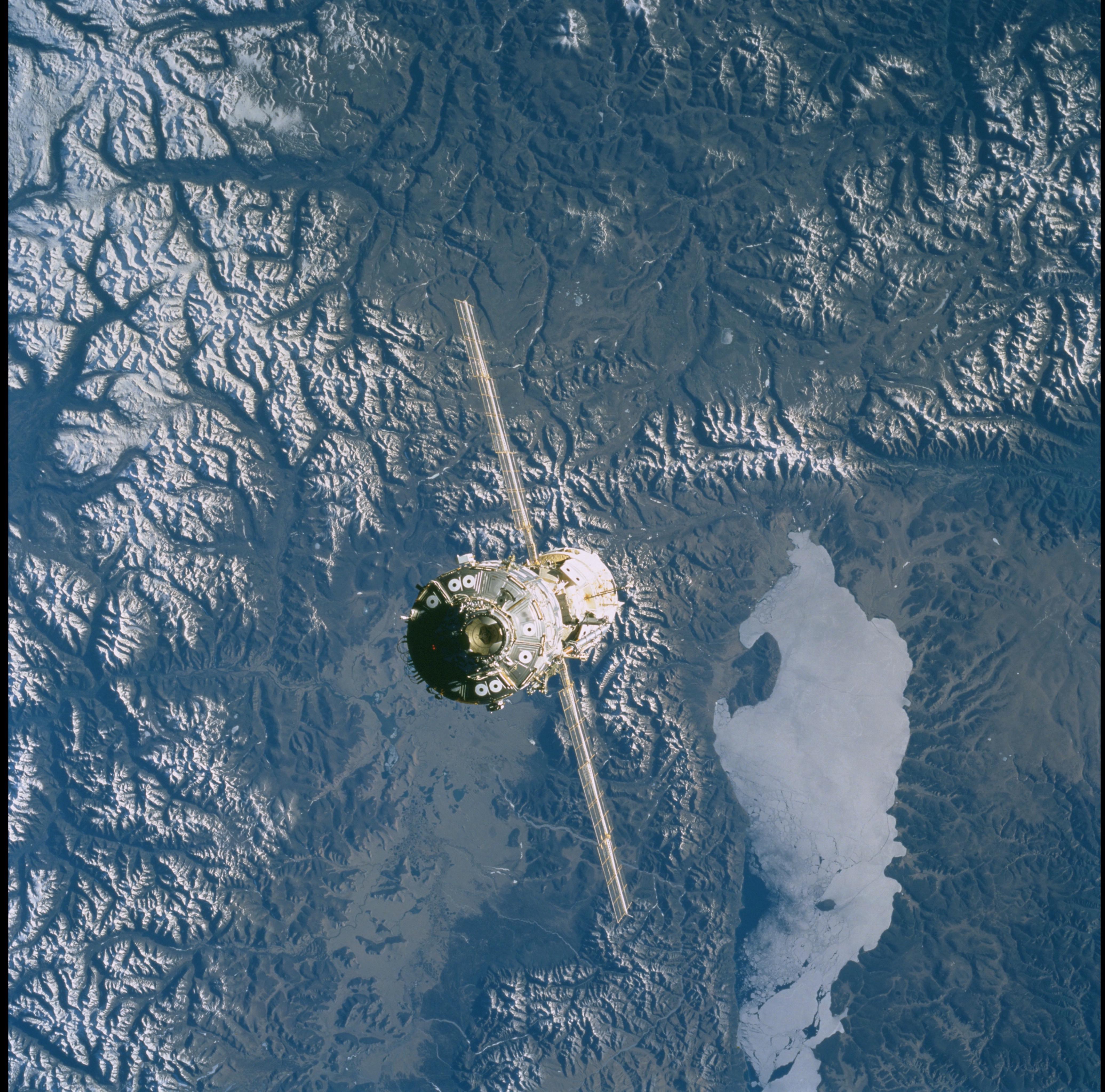
Image Caption: Lake Hovsgol Rift & Transform Fault
Lake Hovsgol, north-central Mongolia, occupies a rift valley (graben)
that is linked with the Baykal rift system, 200 km farther east in the
southeastern Russian Federation. This exceptional view shows not only
Hovsgol but also another rift valley to the west, which is of similar
size but lacks a lake; the eastern and western margins of both are
normal faults that drop the valley floors down. A straight,
east-trending transform fault zone bounds the valleys on the north; this
transform zone extends eastward, linking the Hovsgol complex with the
great Baykal rift. Photos STS101-720-58 and STS101-720-61 form a stereo
pair; structural details of this remote and seldom-imaged region are now
being mapped for publication by Office of Earth Sciences staff and
Russian colleagues in Irkutsk.
