STS101-718-3
| NASA Photo ID | STS101-718-3 |
| Focal Length | 250mm |
| Date taken | 2000.05.27 |
| Time taken | 02:52:59 GMT |
Resolutions offered for this image:
1031 x 1024 pixels 2063 x 2048 pixels 4127 x 4096 pixels 515 x 512 pixels 1289 x 1304 pixels 399 x 404 pixels
1031 x 1024 pixels 2063 x 2048 pixels 4127 x 4096 pixels 515 x 512 pixels 1289 x 1304 pixels 399 x 404 pixels


Cloud masks available for this image:
Spacecraft nadir point: 38.1° S, 176.0° E
Photo center point: 39.0° S, 175.5° E
Photo center point by machine learning:
Photo center point: 39.0° S, 175.5° E
Photo center point by machine learning:
Nadir to Photo Center: Southwest
Spacecraft Altitude: 206 nautical miles (382km)
Country or Geographic Name: | NEW ZEALAND-NI |
Features: | RUAPEHU & TONGARIRO VOL. |
| Features Found Using Machine Learning: | |
Cloud Cover Percentage: | 10 (1-10)% |
Sun Elevation Angle: | 20° |
Sun Azimuth: | 320° |
Camera: | Hasselblad |
Focal Length: | 250mm |
Camera Tilt: | 17 degrees |
Format: | 5069: Kodak Elite 100S, E6 Reversal, Replaces Lumiere, Warmer in tone vs. Lumiere |
Film Exposure: | |
| Additional Information | |
| Width | Height | Annotated | Cropped | Purpose | Links |
|---|---|---|---|---|---|
| 1031 pixels | 1024 pixels | No | No | Download Image | |
| 2063 pixels | 2048 pixels | No | No | Download Image | |
| 4127 pixels | 4096 pixels | No | No | Download Image | |
| 515 pixels | 512 pixels | No | No | Download Image | |
| 1289 pixels | 1304 pixels | No | Photographic Highlights | Download Image | |
| 399 pixels | 404 pixels | No | Photographic Highlights | Download Image |
Download Packaged File
Download a Google Earth KML for this Image
View photo footprint information
Download a GeoTIFF for this photo
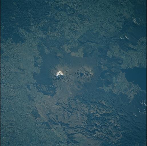
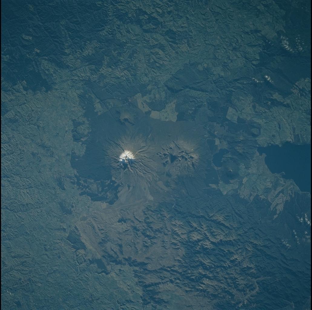
Image Caption: Ruapehu & Tongariro Volcanoes, New Zealand
Ruapehu (snow-capped) and Tongariro are active volcanoes that lie along
a northeasterly line through North Island, New Zealand. Between the
southern shore of Lake Taupo and smaller Lake Rotoaira is
another volcanic cone; White Island in the Bay of Plenty (200 km farther
northeast) is the last subaerial volcano in the line at present (see STS
101-718-9). As the Pacific plate descends beneath the eastern edge of
North Island, the crust of the overriding Australian/Indian plate is
stretched. Lava rises through the weakened crust and a line of active
volcanoes develops. Geothermal heat from volcanic sources is harnessed
for power generation on North Island.
