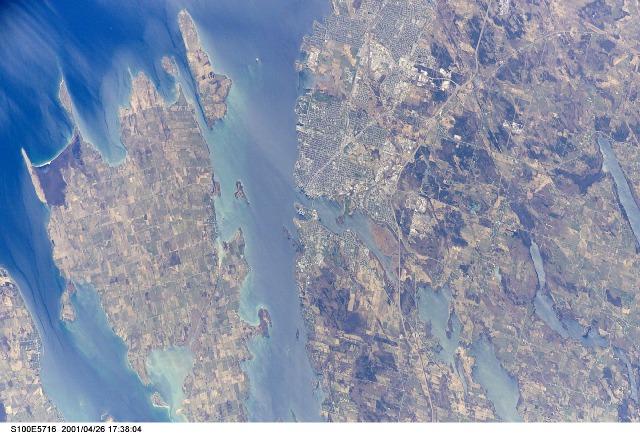
STS100-E-5716
| NASA Photo ID | STS100-E-5716 |
| Focal Length | 400mm |
| Date taken | 2001.04.26 |
| Time taken | 17:38:04 GMT |
Cloud masks available for this image:
Spacecraft nadir point: 45.6° N, 77.7° W
Photo center point: 44.0° N, 76.0° W
Photo center point by machine learning:
Photo center point: 44.0° N, 76.0° W
Photo center point by machine learning:
Nadir to Photo Center: Southeast
Spacecraft Altitude: 205 nautical miles (380km)
Country or Geographic Name: | CANADA-O |
Features: | KINGSTON, ST. LAWRENCE R |
| Features Found Using Machine Learning: | |
Cloud Cover Percentage: | 10 (1-10)% |
Sun Elevation Angle: | 58° |
Sun Azimuth: | 194° |
Camera: | Kodak DCS660 Electronic Still Camera |
Focal Length: | 400mm |
Camera Tilt: | 34 degrees |
Format: | 3060E: 3060 x 2036 pixel CCD, RGBG array |
Film Exposure: | |
| Additional Information | |
| Width | Height | Annotated | Cropped | Purpose | Links |
|---|---|---|---|---|---|
| 3040 pixels | 2064 pixels | No | No | Download Image | |
| 640 pixels | 434 pixels | No | No | Download Image |
Download Packaged File
Download a Google Earth KML for this Image
View photo footprint information
Download a GeoTIFF for this photo
Image Caption: none
