STS099-729-86
| NASA Photo ID | STS099-729-86 |
| Focal Length | 250mm |
| Date taken | 2000.02.__ |
| Time taken | GMT |
Resolutions offered for this image:
1035 x 1024 pixels 2071 x 2048 pixels 4143 x 4096 pixels 517 x 512 pixels
1035 x 1024 pixels 2071 x 2048 pixels 4143 x 4096 pixels 517 x 512 pixels


Cloud masks available for this image:
Spacecraft nadir point:
Photo center point: 26.5° N, 80.5° W
Photo center point by machine learning:
Photo center point: 26.5° N, 80.5° W
Photo center point by machine learning:
Nadir to Photo Center:
Spacecraft Altitude: nautical miles (0km)
Country or Geographic Name: | USA-FLORIDA |
Features: | PAN-LOWER PENINSULA |
| Features Found Using Machine Learning: | |
Cloud Cover Percentage: | 10 (1-10)% |
Sun Elevation Angle: | ° |
Sun Azimuth: | ° |
Camera: | Hasselblad |
Focal Length: | 250mm |
Camera Tilt: | High Oblique |
Format: | 5069: Kodak Elite 100S, E6 Reversal, Replaces Lumiere, Warmer in tone vs. Lumiere |
Film Exposure: | |
| Additional Information | |
| Width | Height | Annotated | Cropped | Purpose | Links |
|---|---|---|---|---|---|
| 1035 pixels | 1024 pixels | No | No | Download Image | |
| 2071 pixels | 2048 pixels | No | No | Download Image | |
| 4143 pixels | 4096 pixels | No | No | Download Image | |
| 517 pixels | 512 pixels | No | No | Download Image |
Download Packaged File
Download a Google Earth KML for this Image
View photo footprint information
Download a GeoTIFF for this photo
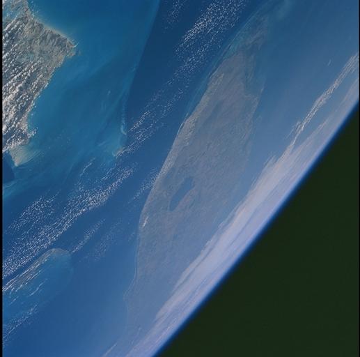
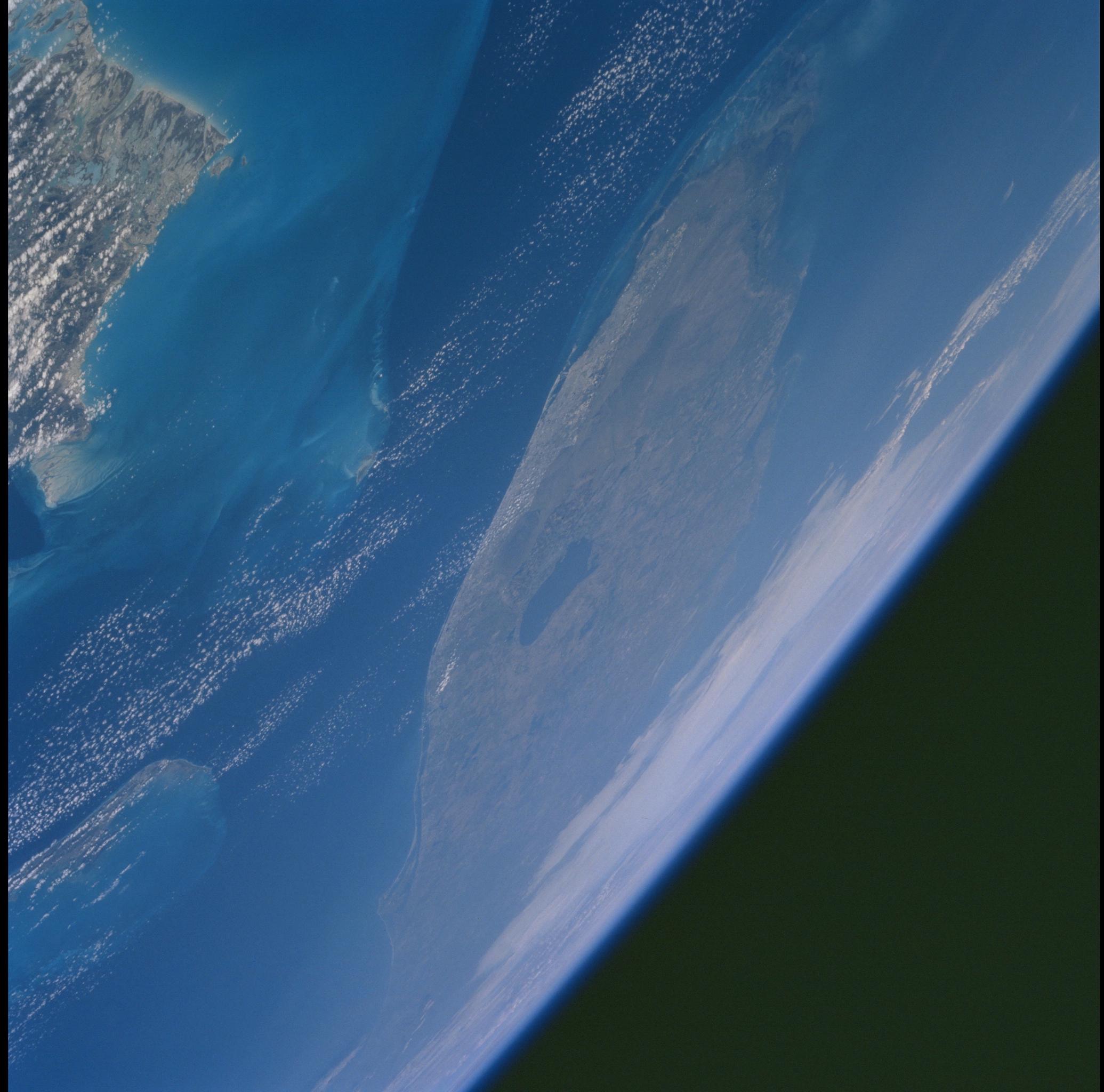
Image Caption: South Florida
The city of Miami encroaches the eastern edge of the Everglades in
Florida. The Everglades is an International Biosphere Reserve World
Heritage Site. This subtropical wilderness encompasses a relatively flat
(does not exceed 2.4 m above sea level) saw-grass marsh region of 10,000
sq km (4,000 sq miles). The only source of water in the Everglades is
from rainfall. The flow of water is detectable in this image, slowly
moving from Lake Okeechobee to Florida Bay; the light blue, shallow area
(less than 3 m) between the mainland and the Keys; and the southwestern
Florida coast.
