STS099-727-54
| NASA Photo ID | STS099-727-54 |
| Focal Length | 100mm |
| Date taken | 2000.02.15 |
| Time taken | 18:25:22 GMT |
Resolutions offered for this image:
1031 x 1024 pixels 2063 x 2048 pixels 4127 x 4096 pixels 515 x 512 pixels 1305 x 1282 pixels 1290 x 1280 pixels 400 x 394 pixels 635 x 625 pixels
1031 x 1024 pixels 2063 x 2048 pixels 4127 x 4096 pixels 515 x 512 pixels 1305 x 1282 pixels 1290 x 1280 pixels 400 x 394 pixels 635 x 625 pixels


Cloud masks available for this image:
Spacecraft nadir point: 36.0° N, 105.5° W
Photo center point: 36.5° N, 105.5° W
Photo center point by machine learning:
Photo center point: 36.5° N, 105.5° W
Photo center point by machine learning:
Nadir to Photo Center: North
Spacecraft Altitude: 127 nautical miles (235km)
Country or Geographic Name: | USA-NEW MEXICO |
Features: | SAN LUIS VALLEY |
| Features Found Using Machine Learning: | |
Cloud Cover Percentage: | 10 (1-10)% |
Sun Elevation Angle: | 40° |
Sun Azimuth: | 164° |
Camera: | Hasselblad |
Focal Length: | 100mm |
Camera Tilt: | 13 degrees |
Format: | 5069: Kodak Elite 100S, E6 Reversal, Replaces Lumiere, Warmer in tone vs. Lumiere |
Film Exposure: | |
| Additional Information | |
| Width | Height | Annotated | Cropped | Purpose | Links |
|---|---|---|---|---|---|
| 1031 pixels | 1024 pixels | No | No | Download Image | |
| 2063 pixels | 2048 pixels | No | No | Download Image | |
| 4127 pixels | 4096 pixels | No | No | Download Image | |
| 515 pixels | 512 pixels | No | No | Download Image | |
| 1305 pixels | 1282 pixels | No | No | Download Image | |
| 1290 pixels | 1280 pixels | No | No | Download Image | |
| 400 pixels | 394 pixels | No | No | Download Image | |
| 635 pixels | 625 pixels | Download Image |
Download Packaged File
Download a Google Earth KML for this Image
View photo footprint information
Download a GeoTIFF for this photo
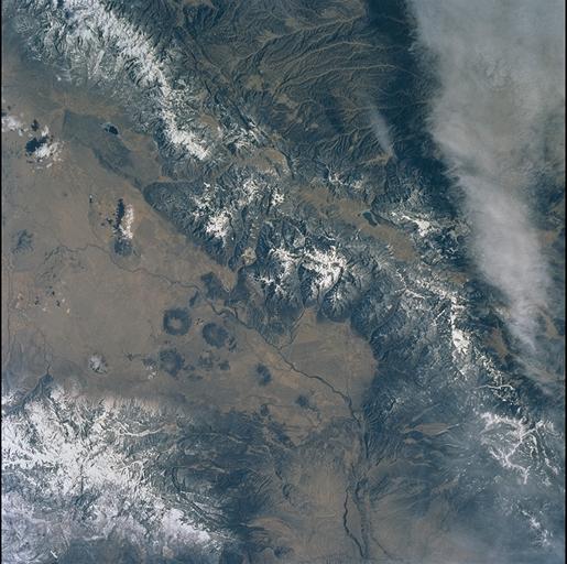
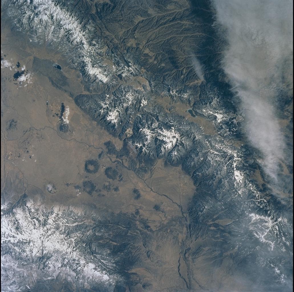
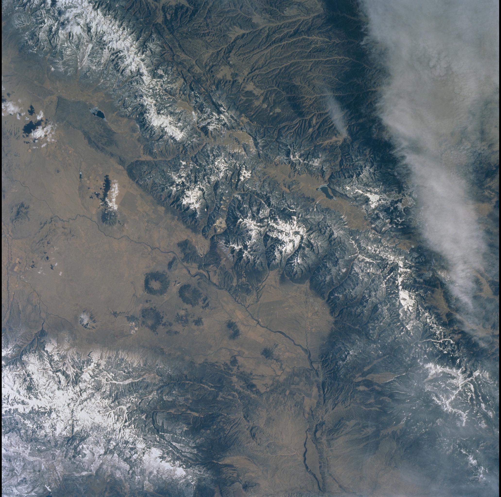
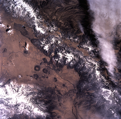
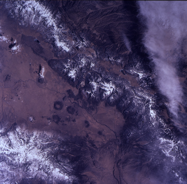
Image Caption: Northern Rio Grande Rift
The Sangre de Cristo range of Colorado and New Mexico flanks the
southern San Luis valley, one of the broad valleys of the northern Rio
Grande rift. The Rio Grande, the sinuous dark line roughly parallel to
the mountain front, flows south- then southwestward (this view is to the
NE). The southwesterly reach of the river follows the Embudo transverse
fault zone, which separates the San Luis basin (north) from the Espanola
basin (south). Rift faults and the Embudo zone intersect in a complex
structural knot around Taos, in the embayment in the mountain range.
This excellent photo shows the subtle but distinct northeastward
extension of the Embudo zone to the mouth of Rio Pueblo canyon at the
range front. Buried faults of similar trend were located geophysically
by astronaut candidate crews who assisted in a ground-water assessment
of the Taos valley (summer, 1999).
