STS099-727-45

| NASA Photo ID | STS099-727-45 |
| Focal Length | 100mm |
| Date taken | 2000.02.15 |
| Time taken | 16:58:50 GMT |
Resolutions offered for this image:
1031 x 1024 pixels 2063 x 2048 pixels 4127 x 4096 pixels 515 x 512 pixels
1031 x 1024 pixels 2063 x 2048 pixels 4127 x 4096 pixels 515 x 512 pixels


Cloud masks available for this image:
Spacecraft nadir point: 43.4° N, 73.8° W
Photo center point: 40.5° N, 73.0° W
Photo center point by machine learning:
Photo center point: 40.5° N, 73.0° W
Photo center point by machine learning:
Nadir to Photo Center: South
Spacecraft Altitude: 127 nautical miles (235km)
Country or Geographic Name: | USA-NEW YORK |
Features: | PAN-LONG ISLAND, SUNGLINT |
| Features Found Using Machine Learning: | |
Cloud Cover Percentage: | 10 (1-10)% |
Sun Elevation Angle: | 34° |
Sun Azimuth: | 177° |
Camera: | Hasselblad |
Focal Length: | 100mm |
Camera Tilt: | High Oblique |
Format: | 5069: Kodak Elite 100S, E6 Reversal, Replaces Lumiere, Warmer in tone vs. Lumiere |
Film Exposure: | |
| Additional Information | |
| Width | Height | Annotated | Cropped | Purpose | Links |
|---|---|---|---|---|---|
| 1031 pixels | 1024 pixels | No | No | Download Image | |
| 2063 pixels | 2048 pixels | No | No | Download Image | |
| 4127 pixels | 4096 pixels | No | No | Download Image | |
| 515 pixels | 512 pixels | No | No | Download Image |
Download Packaged File
Download a Google Earth KML for this Image
View photo footprint information
Download a GeoTIFF for this photo
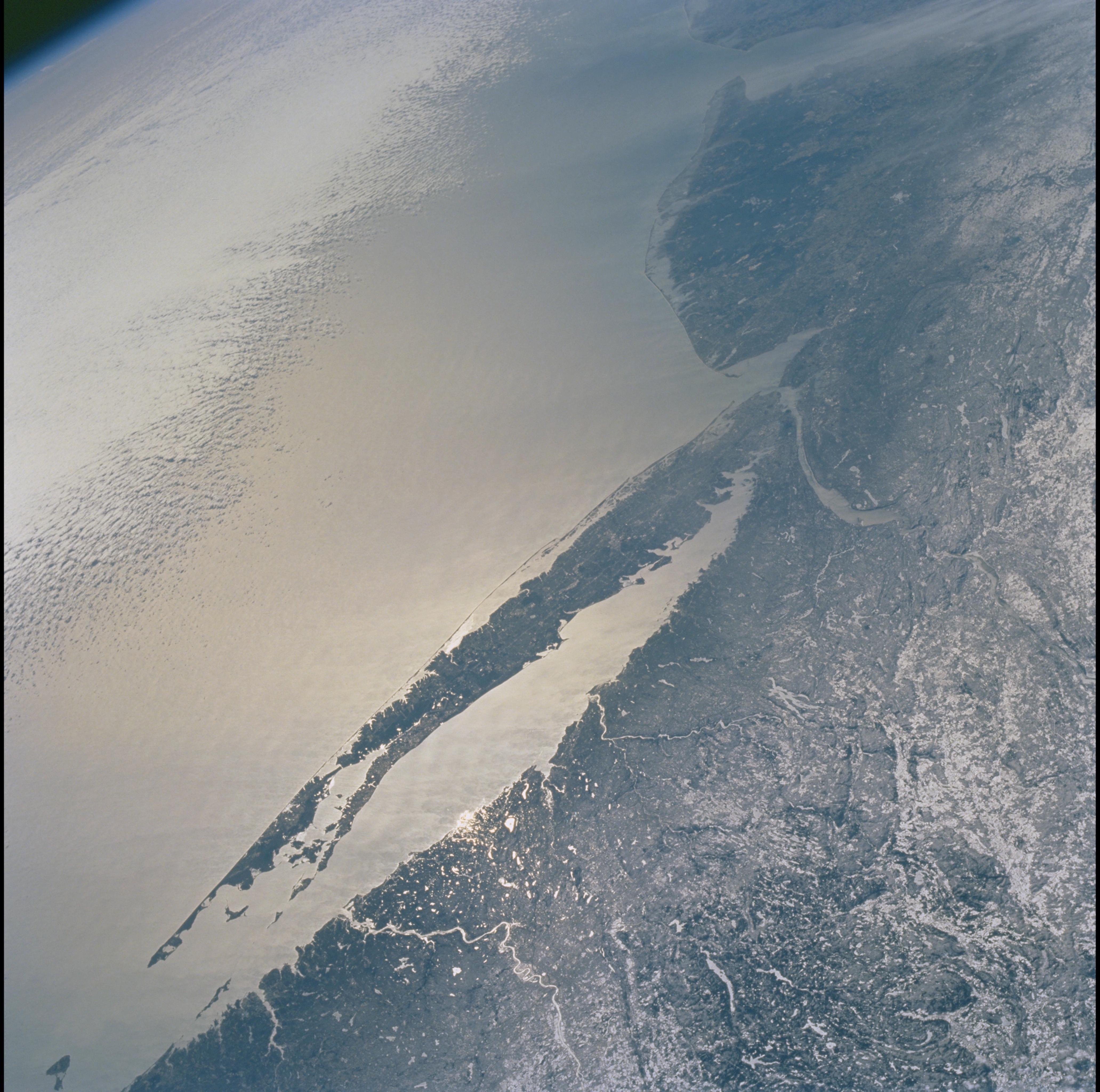
Image Caption: Long Island, New York
The entire length of Long Island, New York is visible in partial
sunglint from Lower Bay to Block Island Sound. The origin and shape of
Long Island is due to continental collision and glaciers that once
dominated the landscape. A collision between North America and Africa
about 300 million years ago caused the Appalachian Mountains to rise.
Streams carried sediment from the eroding Appalachians and also carved a
valley that would one day become Long Island Sound. Retreating ice
sheets 22,000 years ago allowed the land to rebound, the highest points
becoming Long Island.
