STS099-706-90

| NASA Photo ID | STS099-706-90 |
| Focal Length | 250mm |
| Date taken | 2000.02.12 |
| Time taken | GMT |
Resolutions offered for this image:
1031 x 1024 pixels 2063 x 2048 pixels 4127 x 4096 pixels 515 x 512 pixels
1031 x 1024 pixels 2063 x 2048 pixels 4127 x 4096 pixels 515 x 512 pixels


Cloud masks available for this image:
Spacecraft nadir point:
Photo center point: 51.0° N, 79.5° W
Photo center point by machine learning:
Photo center point: 51.0° N, 79.5° W
Photo center point by machine learning:
Nadir to Photo Center:
Spacecraft Altitude: 125 nautical miles (231km)
Country or Geographic Name: | CANADA-O |
Features: | HANNAH BAY, ICE |
| Features Found Using Machine Learning: | |
Cloud Cover Percentage: | 10 (1-10)% |
Sun Elevation Angle: | 55° |
Sun Azimuth: | 164° |
Camera: | Hasselblad |
Focal Length: | 250mm |
Camera Tilt: | |
Format: | 5069: Kodak Elite 100S, E6 Reversal, Replaces Lumiere, Warmer in tone vs. Lumiere |
Film Exposure: | |
| Additional Information | |
| Width | Height | Annotated | Cropped | Purpose | Links |
|---|---|---|---|---|---|
| 1031 pixels | 1024 pixels | No | No | Download Image | |
| 2063 pixels | 2048 pixels | No | No | Download Image | |
| 4127 pixels | 4096 pixels | No | No | Download Image | |
| 515 pixels | 512 pixels | No | No | Download Image |
Download Packaged File
Download a Google Earth KML for this Image
View photo footprint information
Download a GeoTIFF for this photo
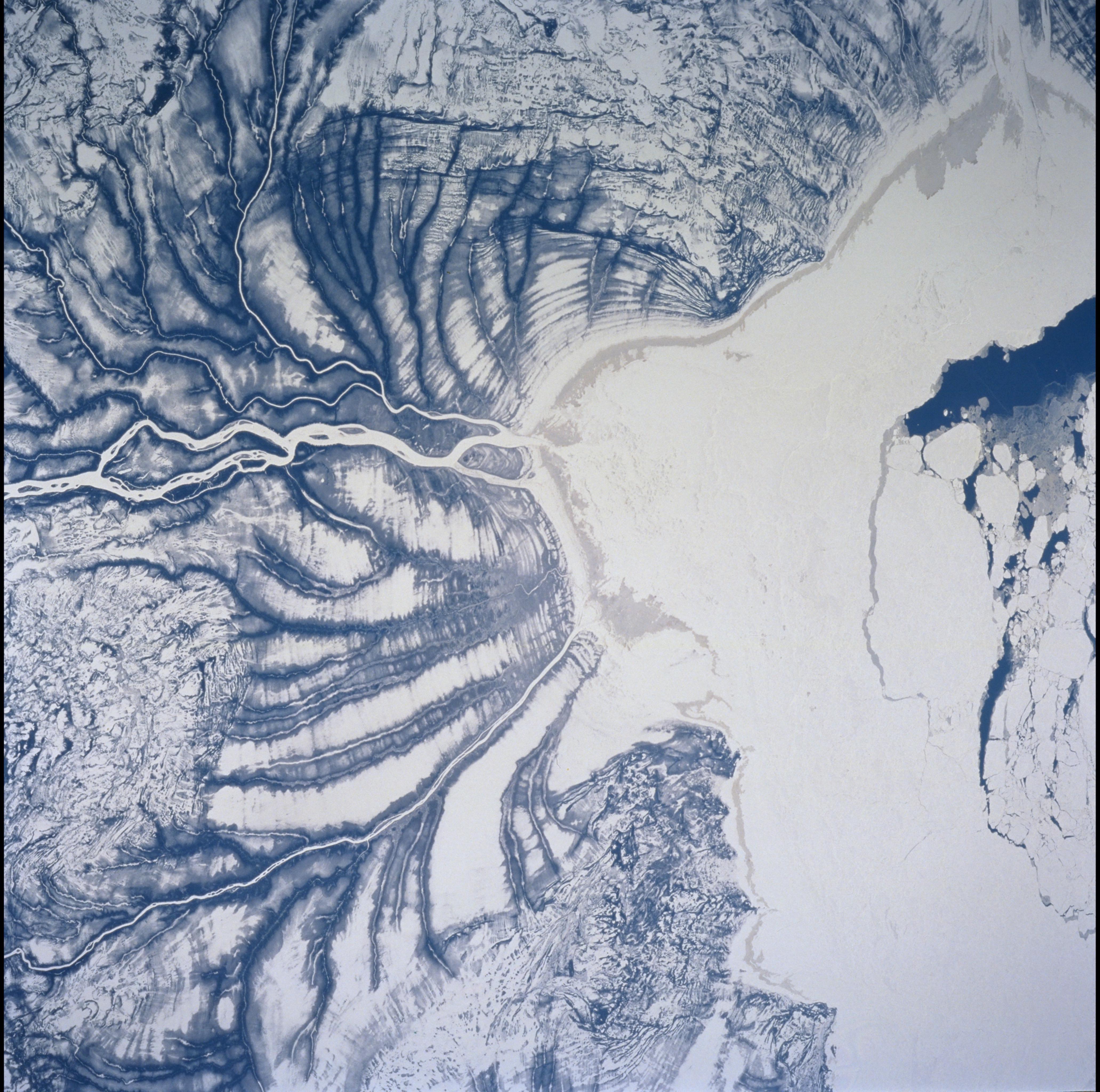
Image Caption: St James Bay, Ontario, Shorelines
Numerous shorelines around Hudson and St. James Bays are distinctive in
winter because of snow cover. The area shown in this Shuttle image is
located in Hannah Bay, in the southern part of St. James Bay. The river
is the Harricanaw River. Shorelines along the bay were created when the
overlying glaciers retreated and the land underneath rebounded causing
the Hudson/St James Bay waters to retreat northward. These ridges are
100 to 200 m in width and heights can reach up to 7 m. The land along
St. James Bay consists mainly of tidal flats and salt marshes.
