STS099-703-7
| NASA Photo ID | STS099-703-7 |
| Focal Length | 100mm |
| Date taken | 2000.02.12 |
| Time taken | 19:01:54 GMT |
Resolutions offered for this image:
1035 x 1024 pixels 2071 x 2048 pixels 4143 x 4096 pixels 517 x 512 pixels
1035 x 1024 pixels 2071 x 2048 pixels 4143 x 4096 pixels 517 x 512 pixels


Cloud masks available for this image:
Spacecraft nadir point: 20.6° N, 111.4° W
Photo center point: 19.0° N, 110.5° W
Photo center point by machine learning:
Photo center point: 19.0° N, 110.5° W
Photo center point by machine learning:
Nadir to Photo Center: Southeast
Spacecraft Altitude: 126 nautical miles (233km)
Country or Geographic Name: | MEXICO |
Features: | ISLA SOCORRO, CLOUD WAKE |
| Features Found Using Machine Learning: | |
Cloud Cover Percentage: | 25 (11-25)% |
Sun Elevation Angle: | 55° |
Sun Azimuth: | 164° |
Camera: | Hasselblad |
Focal Length: | 100mm |
Camera Tilt: | 41 degrees |
Format: | 5069: Kodak Elite 100S, E6 Reversal, Replaces Lumiere, Warmer in tone vs. Lumiere |
Film Exposure: | |
| Additional Information | |
| Width | Height | Annotated | Cropped | Purpose | Links |
|---|---|---|---|---|---|
| 1035 pixels | 1024 pixels | No | No | Download Image | |
| 2071 pixels | 2048 pixels | No | No | Download Image | |
| 4143 pixels | 4096 pixels | No | No | Download Image | |
| 517 pixels | 512 pixels | No | No | Download Image |
Download Packaged File
Download a Google Earth KML for this Image
View photo footprint information
Download a GeoTIFF for this photo
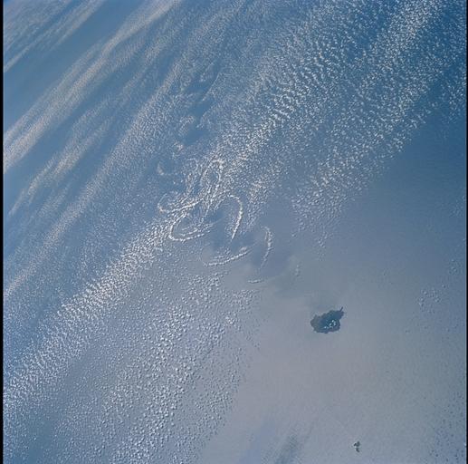
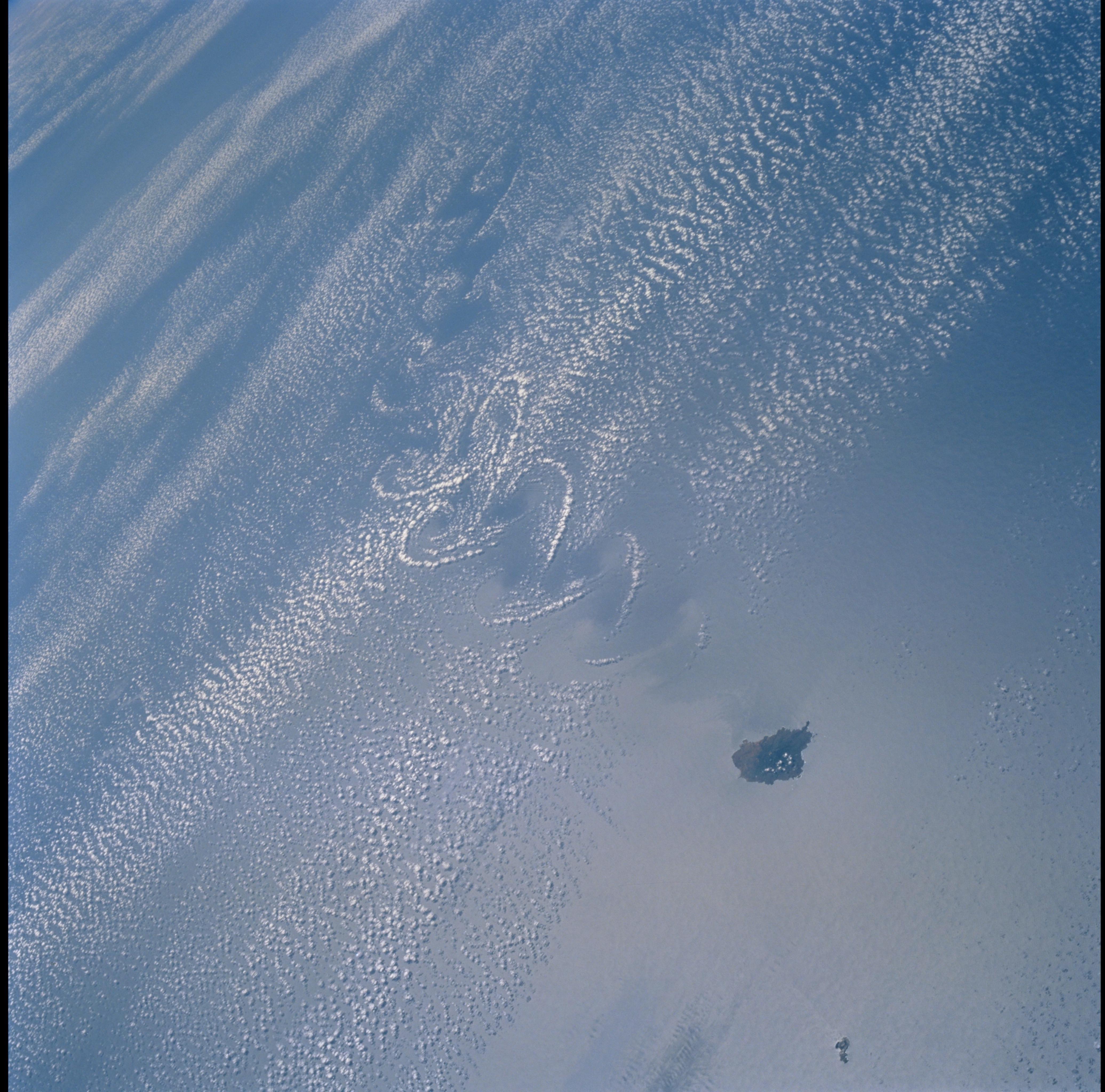
Image Caption: Socorro Island Wake Cloud Pattern
A distinct cumulus cloud pattern marks the an island wake within a weak
northerly wind field in the vicinity of Isla Socorro, south of the Baja Peninsula of
Mexico. A smaller companion island, San Benedicto, is visible to the north-
northeast. Socorro rises to just over 3,400 feet and disrupts the winds which
apparently are not strong or persistent enough to form closed vortices.
