STS099-702-45

| NASA Photo ID | STS099-702-45 |
| Focal Length | 100mm |
| Date taken | 2000.02.__ |
| Time taken | GMT |
Resolutions offered for this image:
1031 x 1024 pixels 2063 x 2048 pixels 4127 x 4096 pixels 515 x 512 pixels 1311 x 1289 pixels 400 x 393 pixels
1031 x 1024 pixels 2063 x 2048 pixels 4127 x 4096 pixels 515 x 512 pixels 1311 x 1289 pixels 400 x 393 pixels


Cloud masks available for this image:
Spacecraft nadir point:
Photo center point: 7.5° N, 38.5° E
Photo center point by machine learning:
Photo center point: 7.5° N, 38.5° E
Photo center point by machine learning:
Nadir to Photo Center:
Spacecraft Altitude: nautical miles (0km)
Country or Geographic Name: | ETHIOPIA |
Features: | RIFT LAKES |
| Features Found Using Machine Learning: | |
Cloud Cover Percentage: | 10 (1-10)% |
Sun Elevation Angle: | ° |
Sun Azimuth: | ° |
Camera: | Hasselblad |
Focal Length: | 100mm |
Camera Tilt: | |
Format: | 5069: Kodak Elite 100S, E6 Reversal, Replaces Lumiere, Warmer in tone vs. Lumiere |
Film Exposure: | |
| Additional Information | |
| Width | Height | Annotated | Cropped | Purpose | Links |
|---|---|---|---|---|---|
| 1031 pixels | 1024 pixels | No | No | Download Image | |
| 2063 pixels | 2048 pixels | No | No | Download Image | |
| 4127 pixels | 4096 pixels | No | No | Download Image | |
| 515 pixels | 512 pixels | No | No | Download Image | |
| 1311 pixels | 1289 pixels | No | No | Download Image | |
| 400 pixels | 393 pixels | No | No | Download Image |
Download Packaged File
Download a Google Earth KML for this Image
View photo footprint information
Download a GeoTIFF for this photo
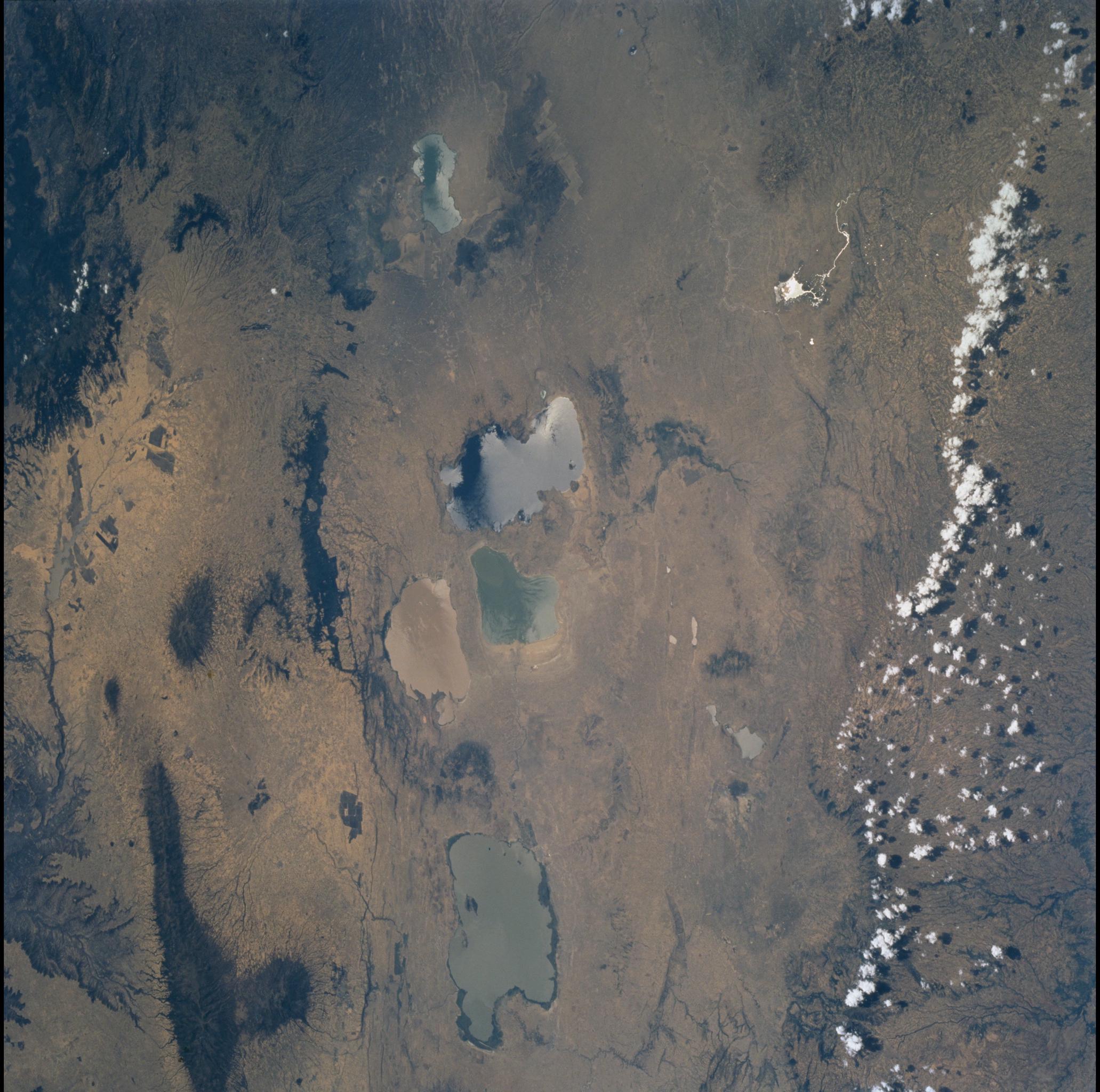
Image Caption: Ethiopian Rift
The Ethiopian rift is a relatively young part of the vast East African
rift system, which stretches from the Mediterranean coast to Mozambique
on the Indian Ocean. Continental crust is still being pulled apart in
this region -- an ocean basin has not yet formed, as has occurred in the
Gulf of Aden and the Red Sea. Fault-bounded depressions in the rift
valley are filled with lakes (sharp, straight lake shorelines), which
are not yet connected by through-flowing streams. The northernmost is
Lake Ziway; Lakes Langano (east), Abiyata (west), and Shala (south) form
the cluster of three; still farther south is Lake Awasa. Volcanic vents
are aligned along rift-valley faults (dark shield-shaped area in NE);
successive lava flows from such fissure vents eventually build extensive
basalt plateaus, as in the adjacent Ethiopian Highlands.
