STS098-E-5323

| NASA Photo ID | STS098-E-5323 |
| Focal Length | mm |
| Date taken | 2001.02.16 |
| Time taken | 19:40:36 GMT |
Cloud masks available for this image:
Spacecraft nadir point: 28.3° N, 80.8° W
Photo center point: 21.5° N, 81.5° W
Photo center point by machine learning:
Photo center point: 21.5° N, 81.5° W
Photo center point by machine learning:
Nadir to Photo Center: South
Spacecraft Altitude: 203 nautical miles (376km)
Country or Geographic Name: | CUBA |
Features: | CAYO LARGO, REEF |
| Features Found Using Machine Learning: | |
Cloud Cover Percentage: | 10 (1-10)% |
Sun Elevation Angle: | 40° |
Sun Azimuth: | 221° |
Camera: | |
Focal Length: | mm |
Camera Tilt: | High Oblique |
Format: | 3060E: 3060 x 2036 pixel CCD, RGBG array |
Film Exposure: | |
| Additional Information | |
| Width | Height | Annotated | Cropped | Purpose | Links |
|---|---|---|---|---|---|
| 540 pixels | 366 pixels | Photographic Highlights | Download Image | ||
| 3040 pixels | 2064 pixels | No | No | Download Image | |
| 640 pixels | 434 pixels | No | No | Download Image |
Download Packaged File
Download a Google Earth KML for this Image
View photo footprint information
Download a GeoTIFF for this photo
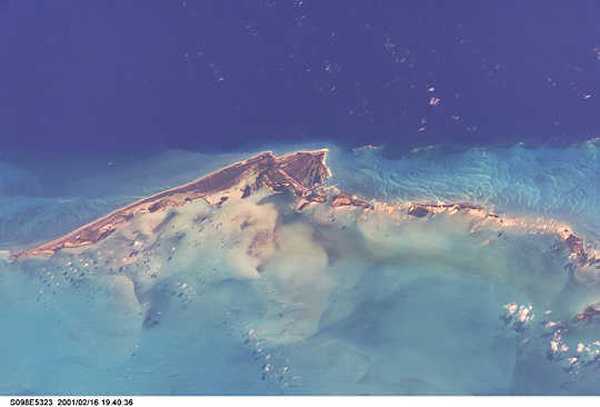
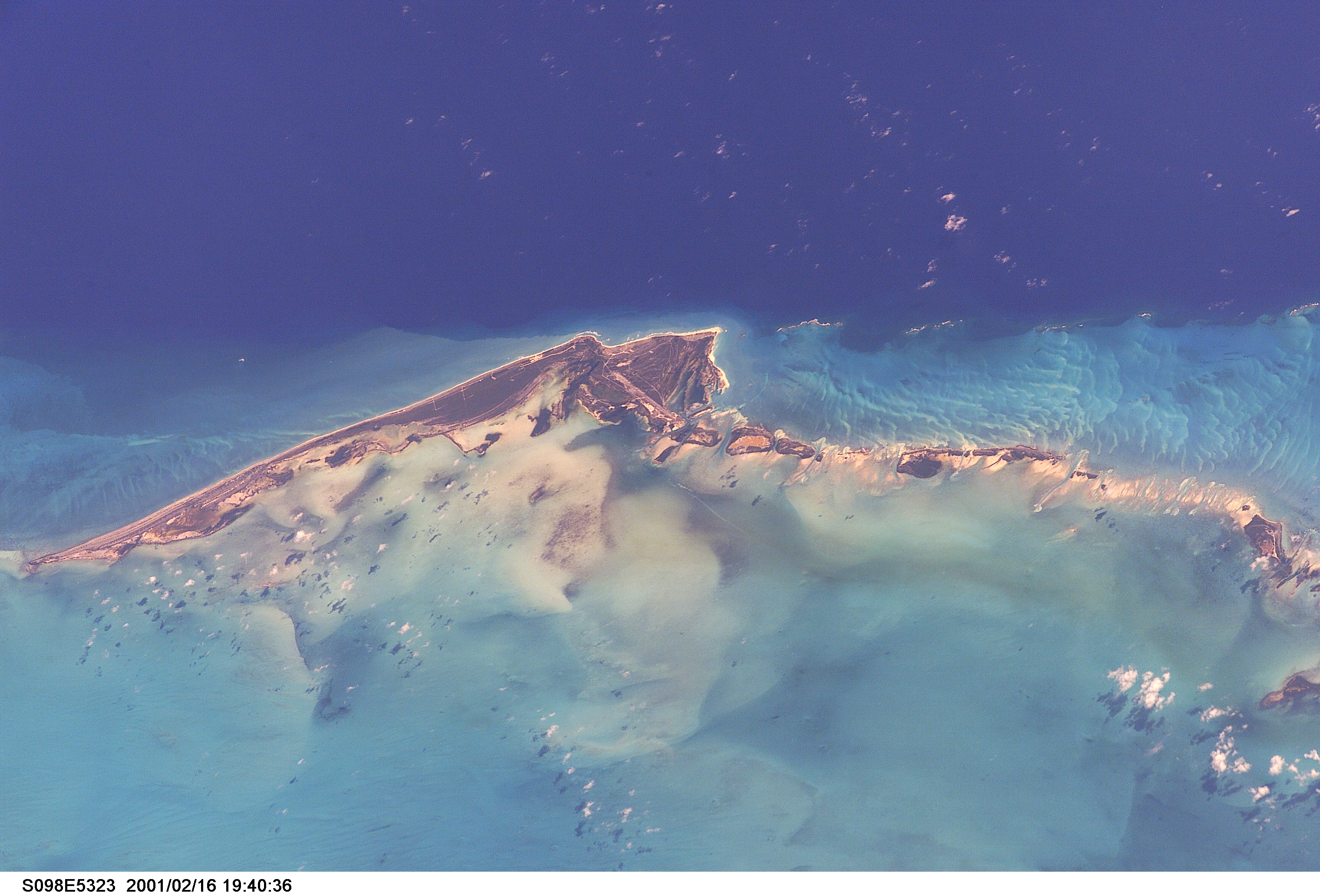
Image Caption: Cayo Largo, Cuba
Off the southwest coast of Cuba, Cayo Largo is one of a chain of 672 cays of the Archipelago de los Canarreos. It is a barrier island with a beach of very fine white sand. The lighter colored water on the bottom half of the picture is the shallow Golfo de Cazones and the darker water on the top half of the picture is the Caribbean Sea, with north toward the bottom of the photo. Between some of the smaller cays and the Caribbean is a shallow area bordered by a barrier reef (right side of the photo). Wetland areas on the gulf side of the islands are important habitats for waterbirds and aquatic life. The exceptional beach and coral reef diving opportunities make this an active tourist destination that is likely to experience further development.
Off the southwest coast of Cuba, Cayo Largo is one of a chain of 672 cays of the Archipelago de los Canarreos. It is a barrier island with a beach of very fine white sand. The lighter colored water on the bottom half of the picture is the shallow Golfo de Cazones and the darker water on the top half of the picture is the Caribbean Sea, with north toward the bottom of the photo. Between some of the smaller cays and the Caribbean is a shallow area bordered by a barrier reef (right side of the photo). Wetland areas on the gulf side of the islands are important habitats for waterbirds and aquatic life. The exceptional beach and coral reef diving opportunities make this an active tourist destination that is likely to experience further development.
