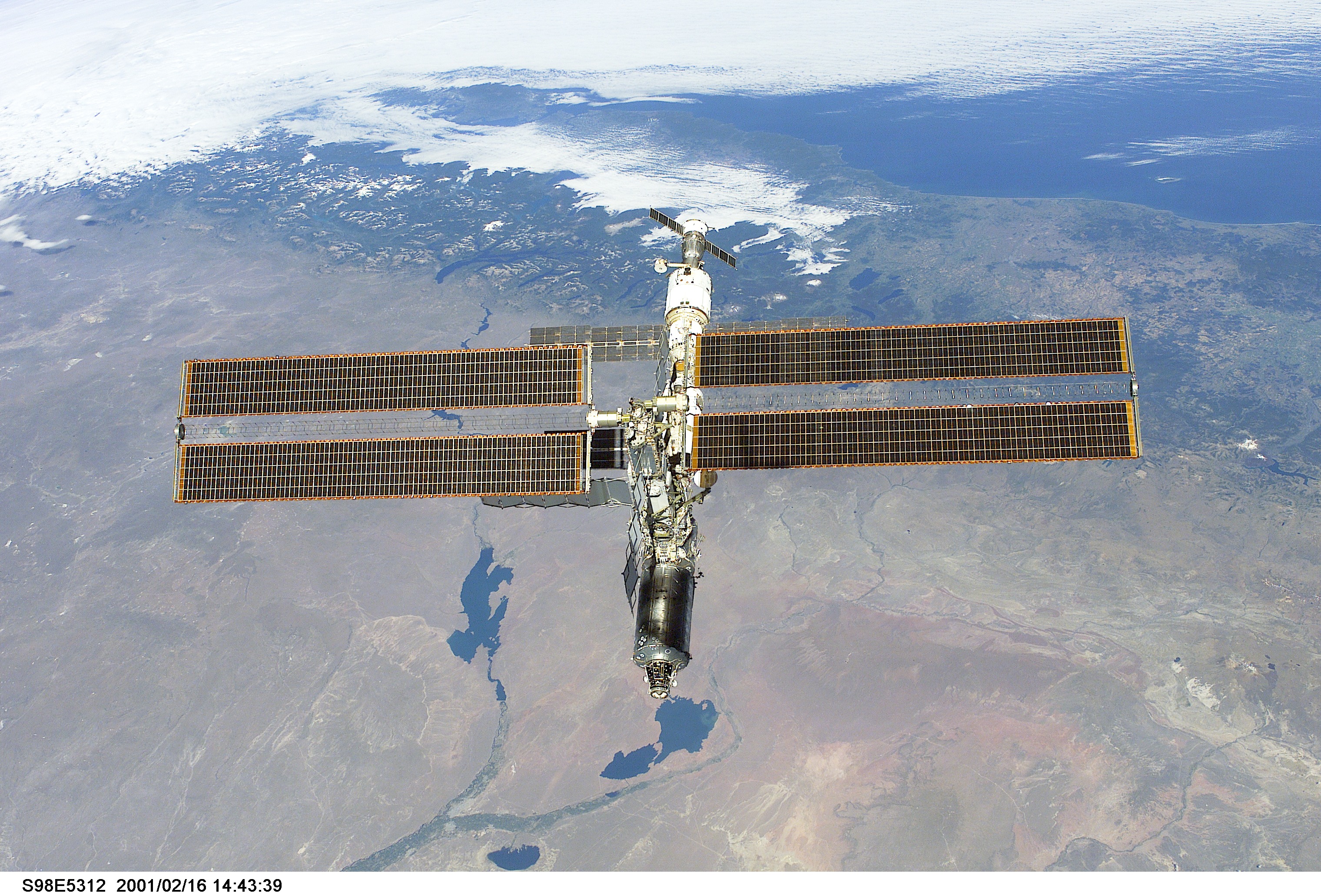
STS098-E-5312

| NASA Photo ID | STS098-E-5312 |
| Focal Length | mm |
| Date taken | 2001.02.16 |
| Time taken | 14:43:39 GMT |
Cloud masks available for this image:
Spacecraft nadir point: 32.8° S, 61.1° W
Photo center point: 38.5° S, 70.0° W
Photo center point by machine learning:
Photo center point: 38.5° S, 70.0° W
Photo center point by machine learning:
Nadir to Photo Center: Southwest
Spacecraft Altitude: 211 nautical miles (391km)
Camera: | |
Focal Length: | mm |
Camera Tilt: | High Oblique |
Format: | 3060E: 3060 x 2036 pixel CCD, RGBG array |
Film Exposure: | |
| Additional Information | |
| Width | Height | Annotated | Cropped | Purpose | Links |
|---|---|---|---|---|---|
| 3040 pixels | 2064 pixels | No | No | Download Image | |
| 640 pixels | 434 pixels | No | No | Download Image |
Download Packaged File
Download a Google Earth KML for this Image
View photo footprint information
Download a GeoTIFF for this photo
Image Caption: none
