STS098-716-34
| NASA Photo ID | STS098-716-34 |
| Focal Length | 250mm |
| Date taken | 2001.02.18 |
| Time taken | 14:47:22 GMT |
Resolutions offered for this image:
1031 x 1024 pixels 2063 x 2048 pixels 4127 x 4096 pixels 640 x 640 pixels 515 x 512 pixels 4096 x 4096 pixels
1031 x 1024 pixels 2063 x 2048 pixels 4127 x 4096 pixels 640 x 640 pixels 515 x 512 pixels 4096 x 4096 pixels

Cloud masks available for this image:
Spacecraft nadir point: 47.7° N, 16.6° E
Photo center point: 47.5° N, 12.5° E
Photo center point by machine learning:
Photo center point: 47.5° N, 12.5° E
Photo center point by machine learning:
Nadir to Photo Center: West
Spacecraft Altitude: 196 nautical miles (363km)
Camera: | Hasselblad |
Focal Length: | 250mm |
Camera Tilt: | 52 degrees |
Format: | 5069: Kodak Elite 100S, E6 Reversal, Replaces Lumiere, Warmer in tone vs. Lumiere |
Film Exposure: | |
| Additional Information | |
| Width | Height | Annotated | Cropped | Purpose | Links |
|---|---|---|---|---|---|
| 1031 pixels | 1024 pixels | No | No | Download Image | |
| 2063 pixels | 2048 pixels | No | No | Download Image | |
| 4127 pixels | 4096 pixels | No | No | Download Image | |
| 640 pixels | 640 pixels | No | No | Photographic Highlights | Download Image |
| 515 pixels | 512 pixels | No | No | Download Image | |
| 4096 pixels | 4096 pixels | No | No | Public Affairs Office (PAO) | Download Image |
Download Packaged File
Download a Google Earth KML for this Image
View photo footprint information
Download a GeoTIFF for this photo
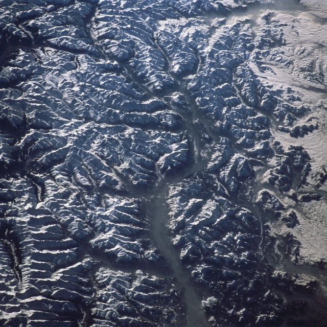
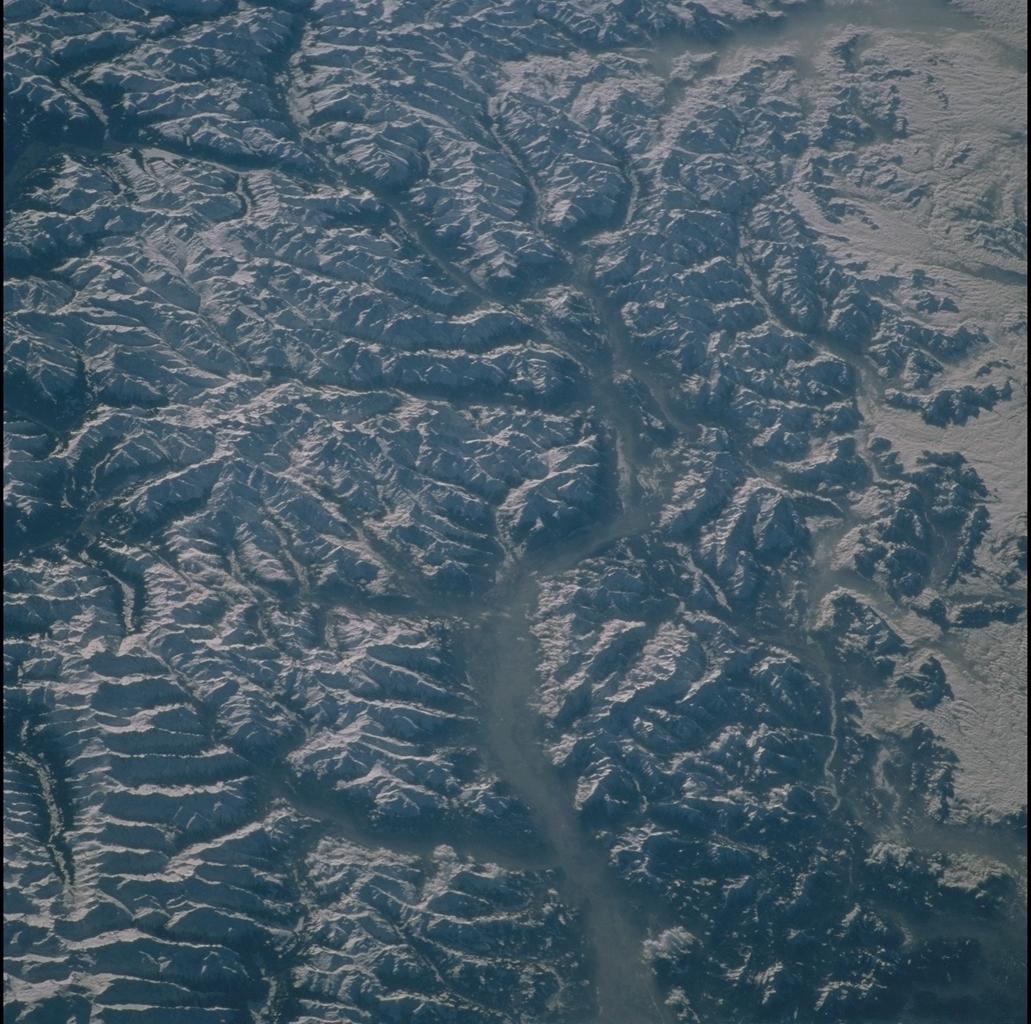
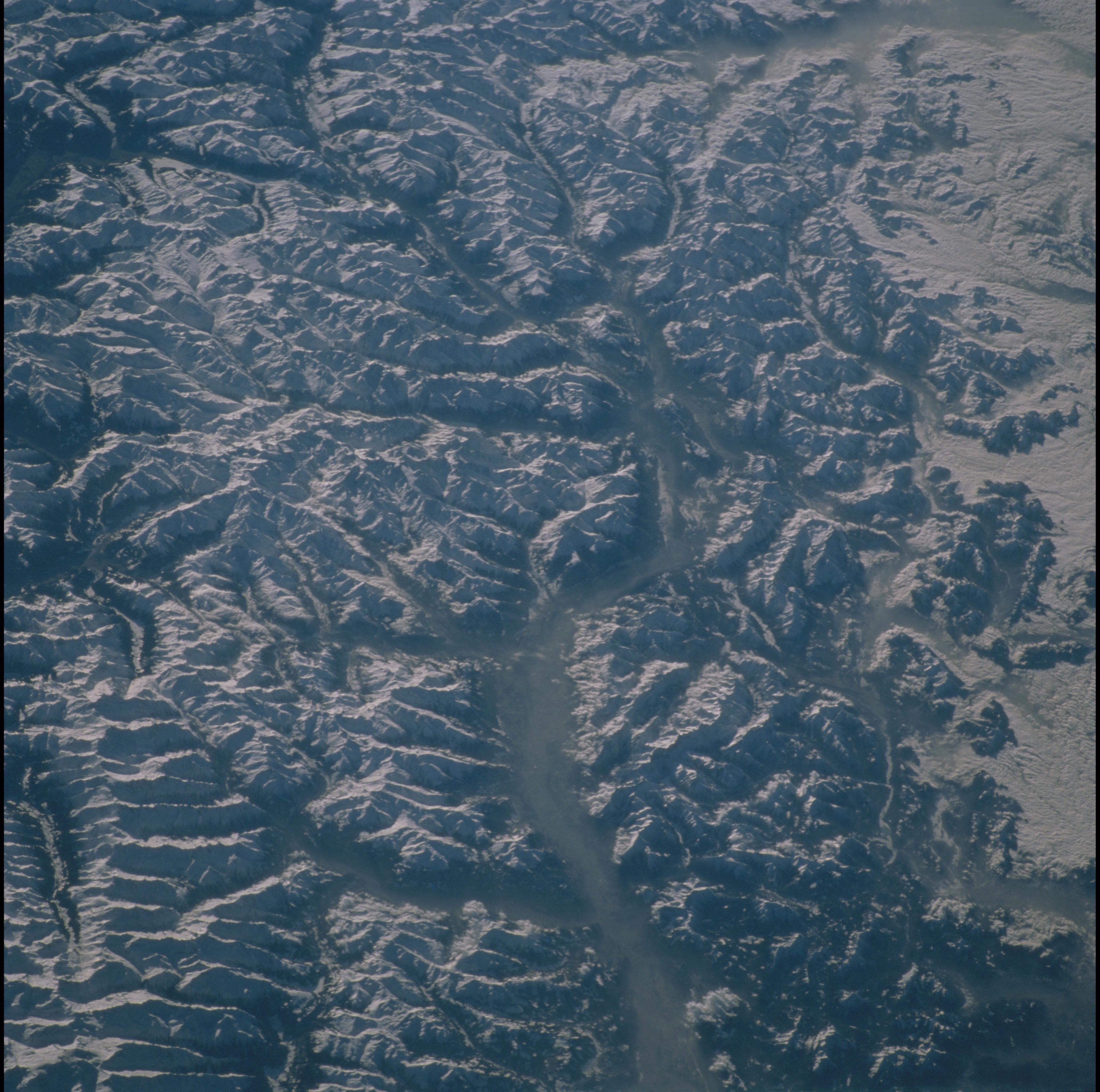
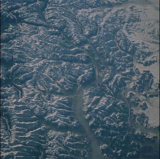
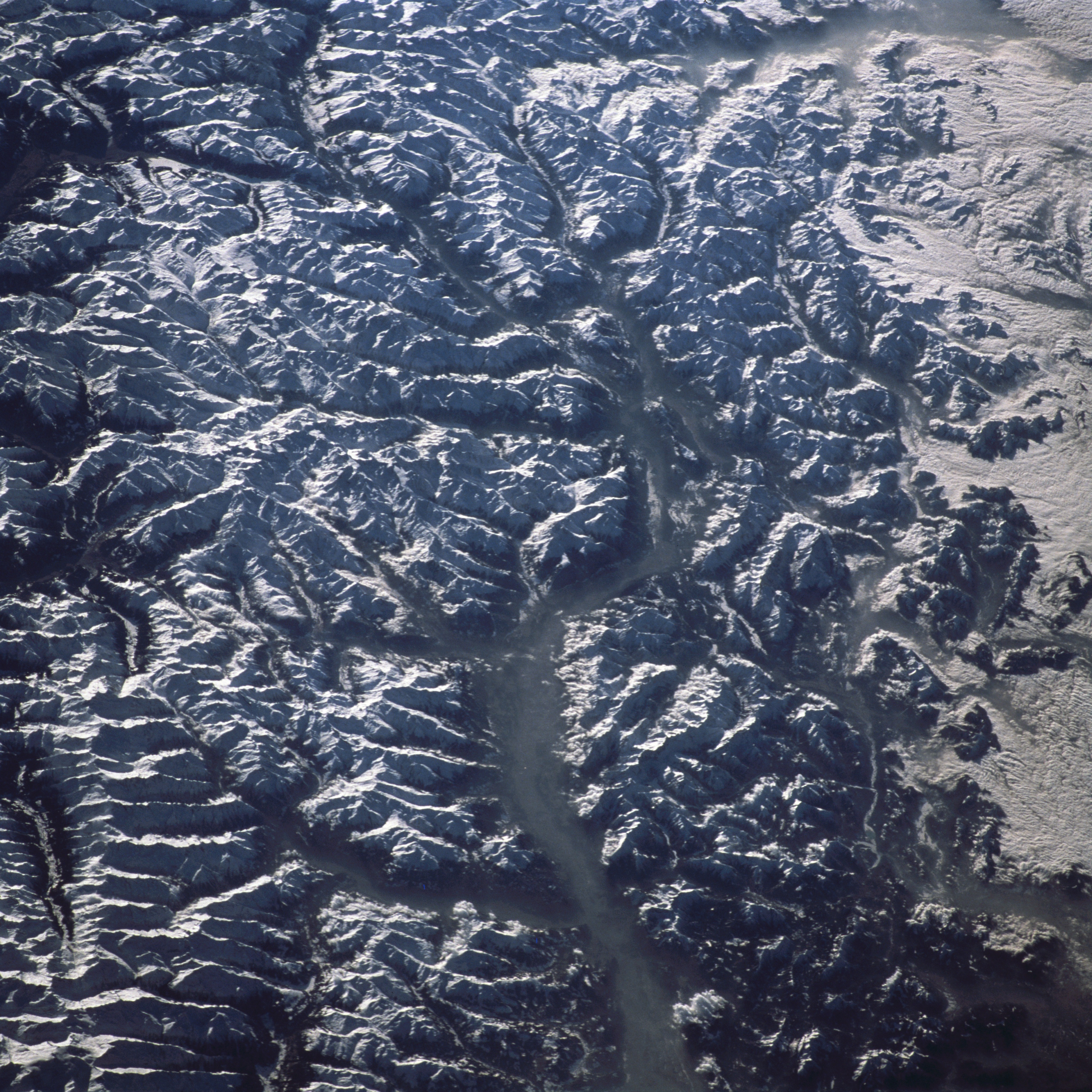
Image Caption: Tyrolean Alps and Inn River Valley, Austria
The valley of the Inn River transects this westward view of the Tyrolean Alps, Austria. Rietzer Grieskogel (2887 m) is the peak at the center of the frame; the confluence of the Sill River in the Wipptal (tal = valley) and the Inn, site of the city of Innsbruck, is just east of the mountain. The Ziller River flows in next large valley to the east. The majestic Alpine chain stretches from Iberia to the Caucasus and was created by the collision of the African and Eurasian tectonic plates beginning about 145 million years ago.
The valley of the Inn River transects this westward view of the Tyrolean Alps, Austria. Rietzer Grieskogel (2887 m) is the peak at the center of the frame; the confluence of the Sill River in the Wipptal (tal = valley) and the Inn, site of the city of Innsbruck, is just east of the mountain. The Ziller River flows in next large valley to the east. The majestic Alpine chain stretches from Iberia to the Caucasus and was created by the collision of the African and Eurasian tectonic plates beginning about 145 million years ago.
