STS097-717-89
| NASA Photo ID | STS097-717-89 |
| Focal Length | 250mm |
| Date taken | 2000.12.__ |
| Time taken | GMT |
Resolutions offered for this image:
1031 x 1024 pixels 2063 x 2048 pixels 4127 x 4096 pixels 515 x 512 pixels 1833 x 1904 pixels 385 x 400 pixels
1031 x 1024 pixels 2063 x 2048 pixels 4127 x 4096 pixels 515 x 512 pixels 1833 x 1904 pixels 385 x 400 pixels

Cloud masks available for this image:
Spacecraft nadir point:
Photo center point: 24.5° S, 16.0° E
Photo center point by machine learning:
Photo center point: 24.5° S, 16.0° E
Photo center point by machine learning:
Nadir to Photo Center:
Spacecraft Altitude: nautical miles (0km)
Country or Geographic Name: | NAMIBIA |
Features: | NAMIB DESERT |
| Features Found Using Machine Learning: | |
Cloud Cover Percentage: | 10 (1-10)% |
Sun Elevation Angle: | ° |
Sun Azimuth: | ° |
Camera: | Hasselblad |
Focal Length: | 250mm |
Camera Tilt: | |
Format: | 5069: Kodak Elite 100S, E6 Reversal, Replaces Lumiere, Warmer in tone vs. Lumiere |
Film Exposure: | |
| Additional Information | |
| Width | Height | Annotated | Cropped | Purpose | Links |
|---|---|---|---|---|---|
| 1031 pixels | 1024 pixels | No | No | Download Image | |
| 2063 pixels | 2048 pixels | No | No | Download Image | |
| 4127 pixels | 4096 pixels | No | No | Download Image | |
| 515 pixels | 512 pixels | No | No | Download Image | |
| 1833 pixels | 1904 pixels | No | Download Image | ||
| 385 pixels | 400 pixels | No | Photographic Highlights | Download Image |
Download Packaged File
Download a Google Earth KML for this Image
View photo footprint information
Download a GeoTIFF for this photo
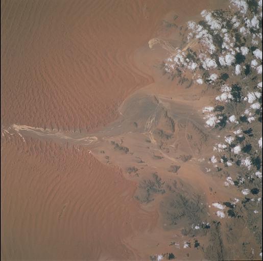
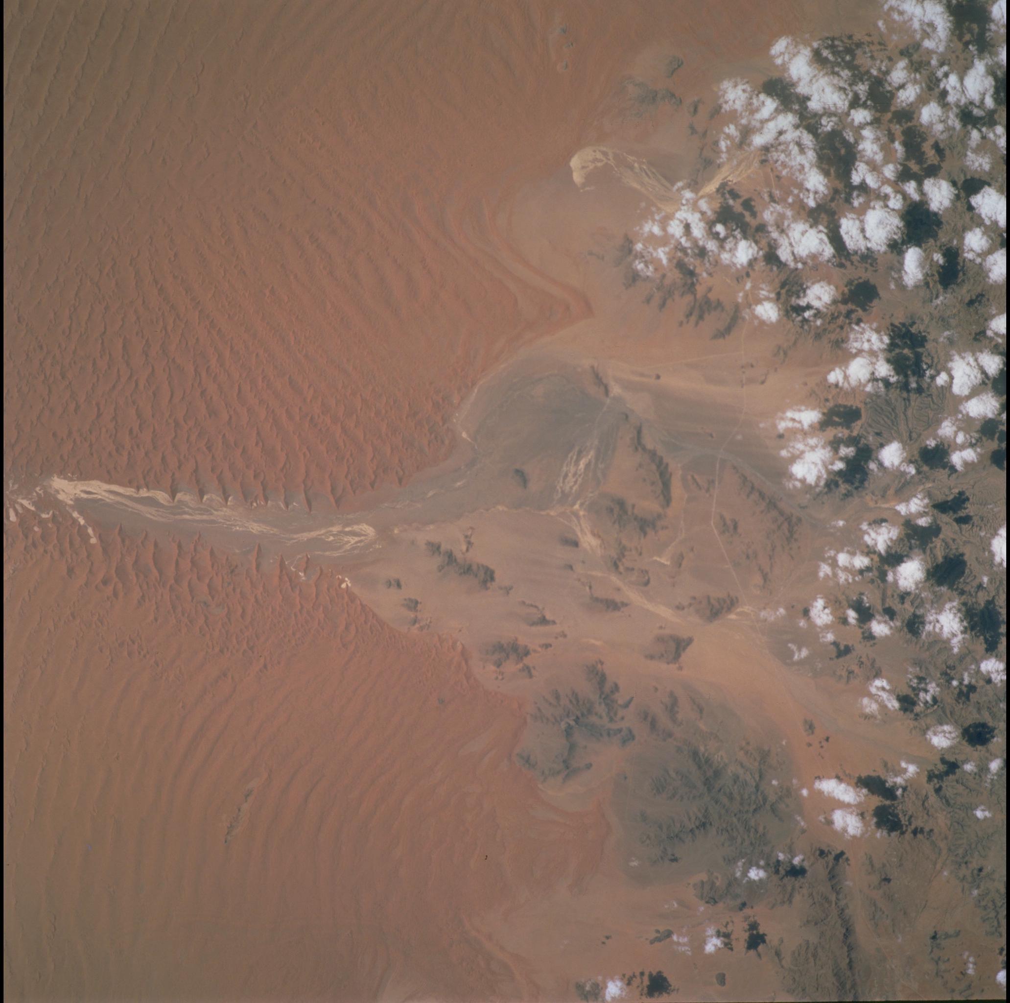
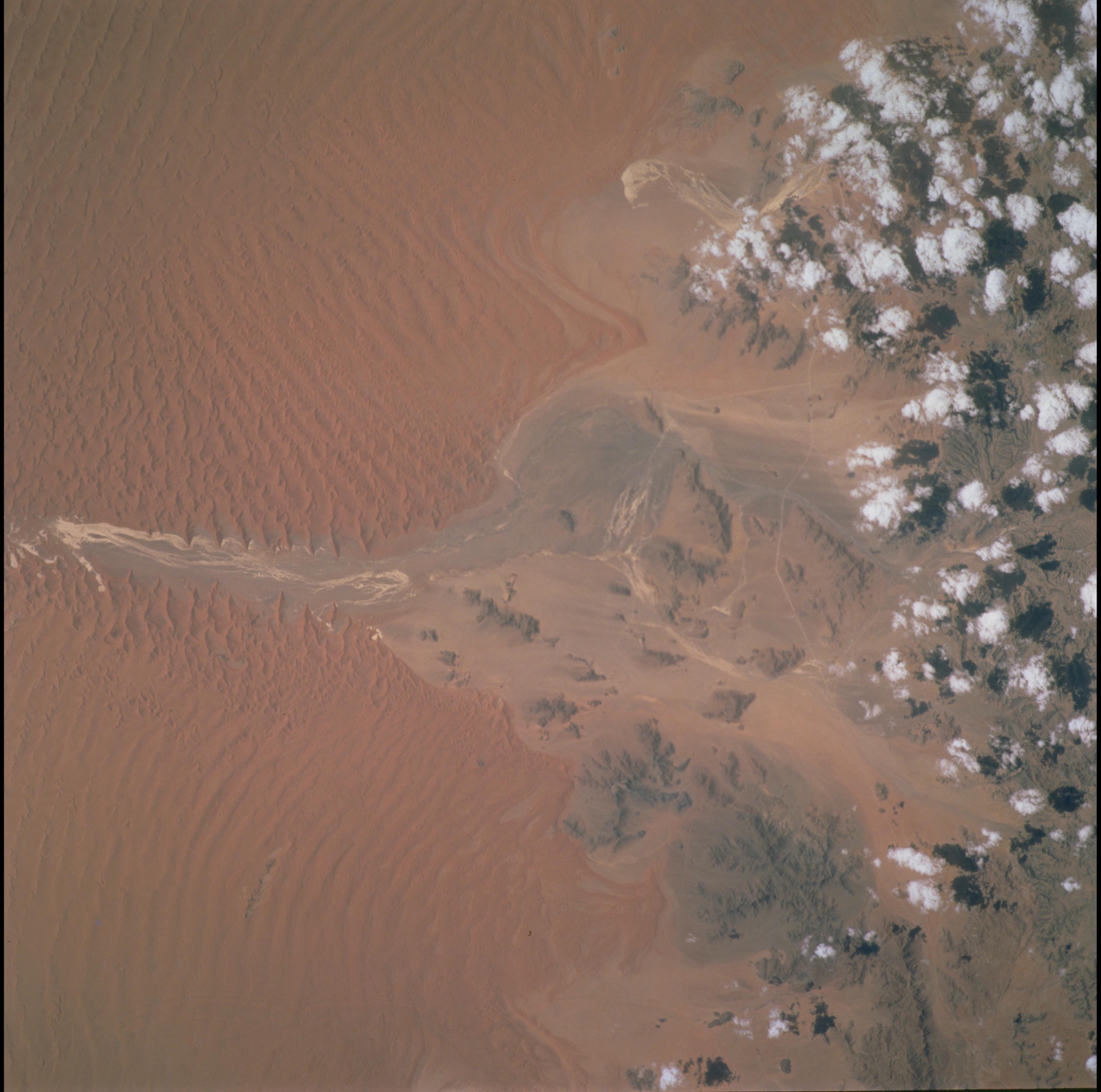
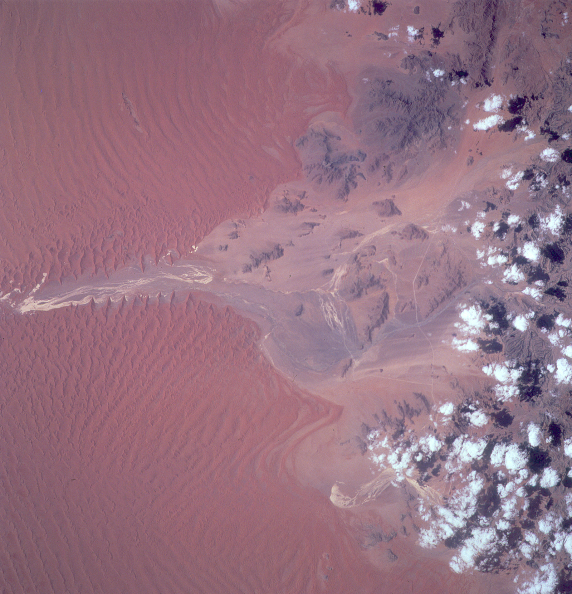
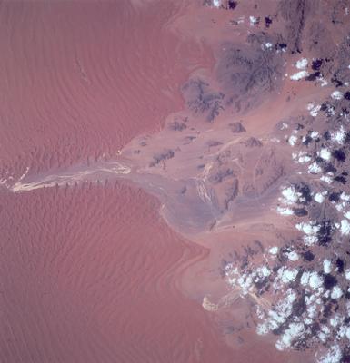
Image Caption: Sossus Vlei, Namibia
The long, parallel, deep red dunes at Sossus Vlei ("vlei" is Dutch for marsh),
central Namibia, are constructed by the prevailing winds moving northward up
the coast. Along the course of the ephemeral stream (white strands at center),
the ground-water table is at or near the land surface, and the damp sand
disrupts or prevents dune formation. Where winds are deflected around bedrock
outliers, smaller and less continuous dunes result. Similar aeolian features
can be seen in images of the floor of Hebes Chasma, Herschel impact basin, and
the north polar region of Mars, taken with the Mars Orbital Camera.
