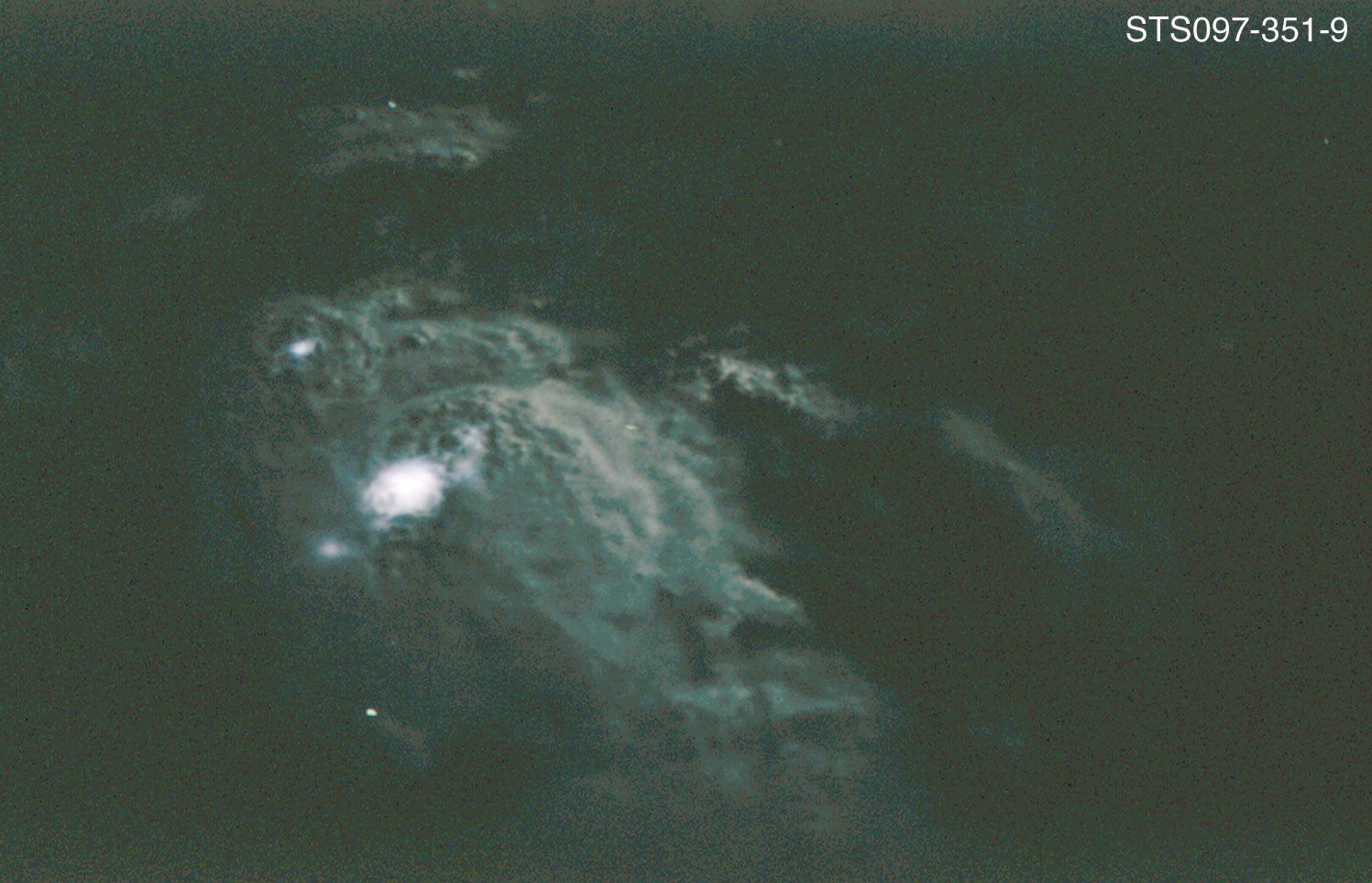
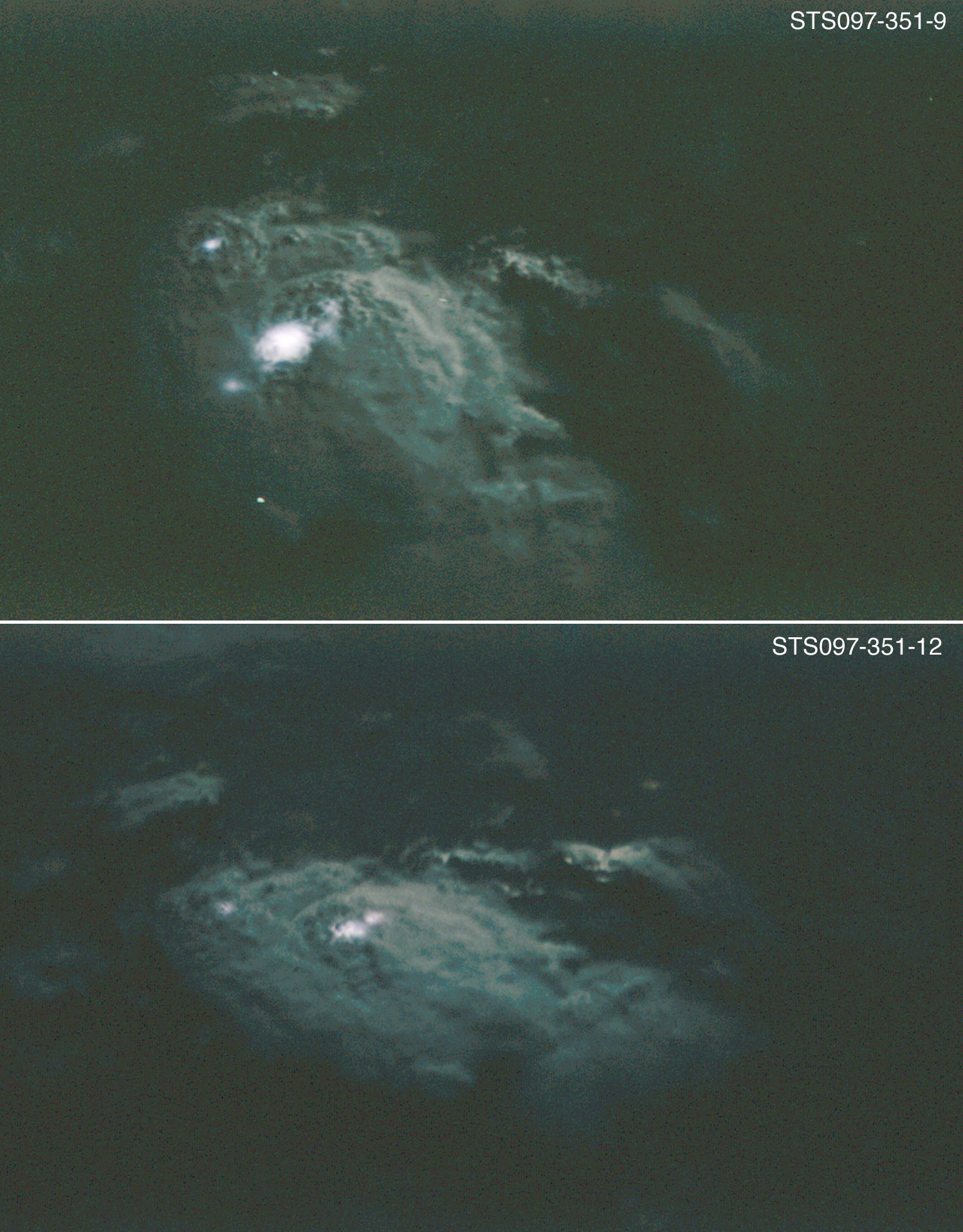
STS097-351-9
| NASA Photo ID | STS097-351-9 |
| Focal Length | mm |
| Date taken | 2000.12.11 |
| Time taken | 03:34:08 GMT |
Resolutions offered for this image:
540 x 356 pixels 1497 x 963 pixels 1497 x 1914 pixels 540 x 348 pixels 540 x 690 pixels 3070 x 2044 pixels 515 x 342 pixels 2405 x 1635 pixels
540 x 356 pixels 1497 x 963 pixels 1497 x 1914 pixels 540 x 348 pixels 540 x 690 pixels 3070 x 2044 pixels 515 x 342 pixels 2405 x 1635 pixels

Cloud masks available for this image:
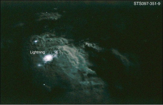
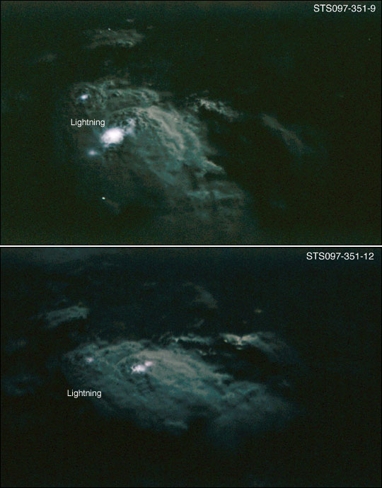
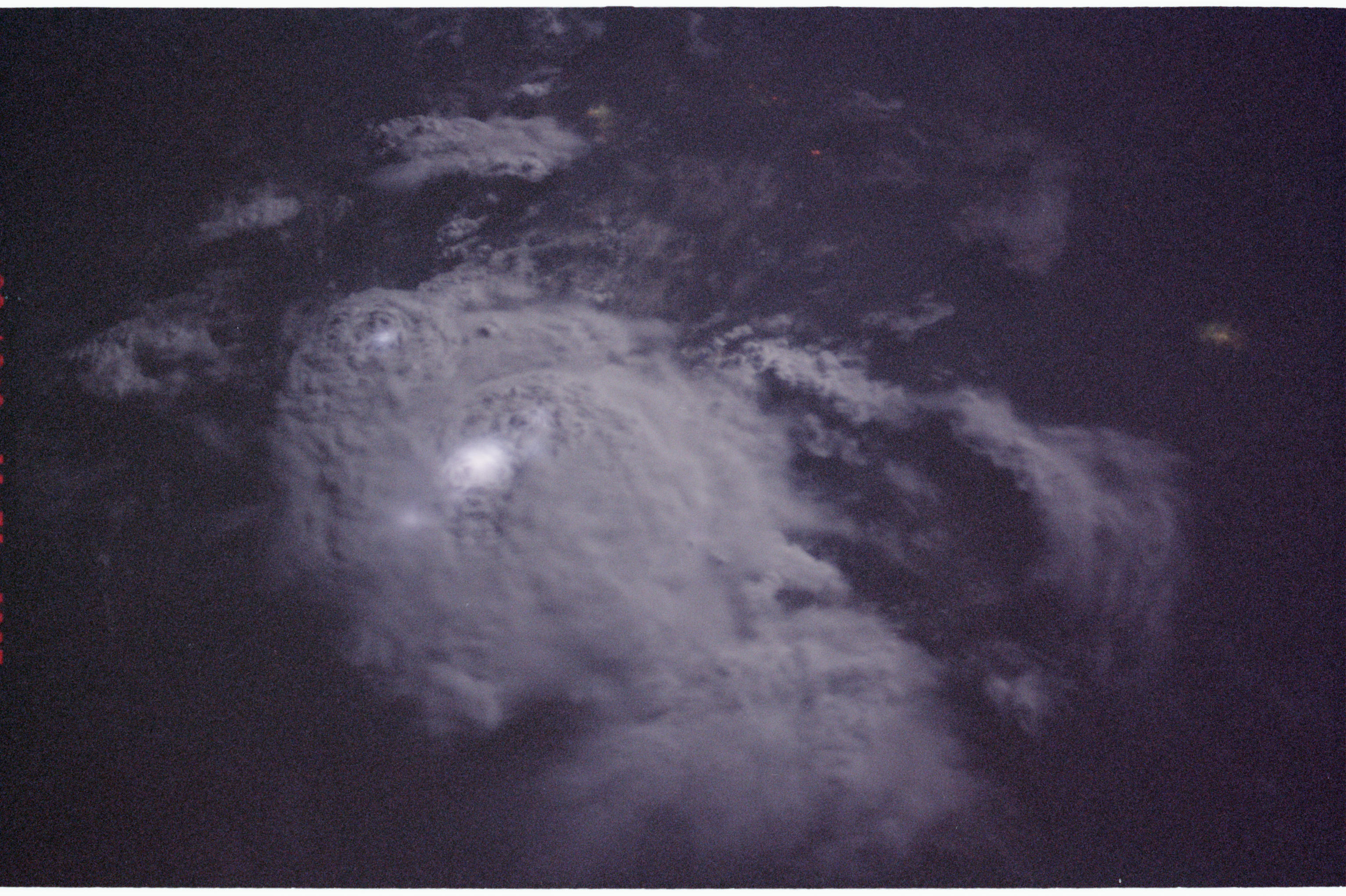
Spacecraft nadir point: 6.3° N, 2.1° E
Photo center point:
Photo center point by machine learning:
Photo center point:
Photo center point by machine learning:
Nadir to Photo Center:
Spacecraft Altitude: 197 nautical miles (365km)
Country or Geographic Name: | AFRICA |
Features: | NIGHT THUNDERSTORM |
| Features Found Using Machine Learning: | |
Cloud Cover Percentage: | |
Sun Elevation Angle: | -32° |
Sun Azimuth: | 113° |
Camera: | Nikon 35mm film camera |
Focal Length: | mm |
Camera Tilt: | |
Format: | 5755: Portra 160NC, color negative, 35mm, ASA 160 |
Film Exposure: | |
| Additional Information | |
| Width | Height | Annotated | Cropped | Purpose | Links |
|---|---|---|---|---|---|
| 540 pixels | 356 pixels | Photographic Highlights | Download Image | ||
| 1497 pixels | 963 pixels | Yes | NASA's Earth Observatory web site | Download Image | |
| 1497 pixels | 1914 pixels | Yes | NASA's Earth Observatory web site | Download Image | |
| 540 pixels | 348 pixels | Yes | NASA's Earth Observatory web site | Download Image | |
| 540 pixels | 690 pixels | Yes | NASA's Earth Observatory web site | Download Image | |
| 3070 pixels | 2044 pixels | No | No | Download Image | |
| 515 pixels | 342 pixels | No | No | Download Image | |
| 2405 pixels | 1635 pixels | No | No | NASA's Earth Observatory web site | Download Image |
Download Packaged File
Download a Google Earth KML for this Image
View photo footprint information
Download a GeoTIFF for this photo
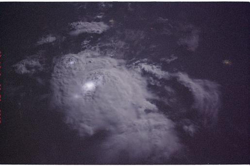
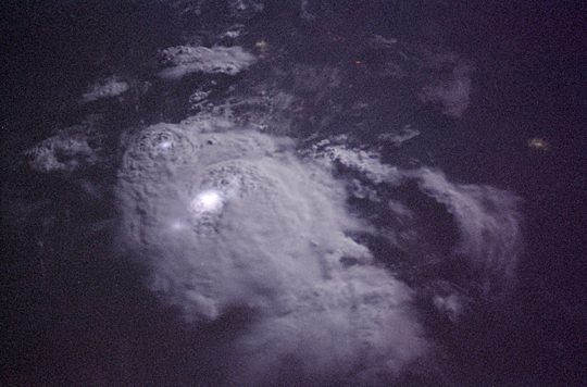
Image Caption: These two images were taken 9 seconds apart as the STS-97 Space Shuttle flew over equatorial Africa east of Lake Volta on December 11, 2000. The top of the large thunderstorm, roughly 20 km across, is illuminated by a full moon and frequent bursts of lightning. Because the Space Shuttle travels at about 7 km/sec, the astronaut perspectives on this storm system becomes more oblique over the 9-second interval between photographs. The images were taken with a Nikon 35 mm camera equipped with a 400 mm lens and high-speed (800 ISO) color negative film.
Images are STS097-351-9 and STS097-351-12.
Images are STS097-351-9 and STS097-351-12.
