STS096-719-39
| NASA Photo ID | STS096-719-39 |
| Focal Length | 100mm |
| Date taken | 1999.06.04 |
| Time taken | 21:52:36 GMT |
Resolutions offered for this image:
1034 x 1024 pixels 2069 x 2048 pixels 4139 x 4096 pixels 517 x 512 pixels
1034 x 1024 pixels 2069 x 2048 pixels 4139 x 4096 pixels 517 x 512 pixels


Cloud masks available for this image:
Spacecraft nadir point: 48.5° N, 155.6° E
Photo center point: 49.5° N, 154.5° E
Photo center point by machine learning:
Photo center point: 49.5° N, 154.5° E
Photo center point by machine learning:
Nadir to Photo Center: Northwest
Spacecraft Altitude: 210 nautical miles (389km)
Country or Geographic Name: | RUSSIAN FEDERATION |
Features: | ONEKOTAN ISLAND |
| Features Found Using Machine Learning: | |
Cloud Cover Percentage: | 15 (11-25)% |
Sun Elevation Angle: | 39° |
Sun Azimuth: | 100° |
Camera: | Hasselblad |
Focal Length: | 100mm |
Camera Tilt: | 23 degrees |
Format: | 5069: Kodak Elite 100S, E6 Reversal, Replaces Lumiere, Warmer in tone vs. Lumiere |
Film Exposure: | Out of Focus |
| Additional Information | |
| Width | Height | Annotated | Cropped | Purpose | Links |
|---|---|---|---|---|---|
| 1034 pixels | 1024 pixels | No | No | Download Image | |
| 2069 pixels | 2048 pixels | No | No | Download Image | |
| 4139 pixels | 4096 pixels | No | No | Download Image | |
| 517 pixels | 512 pixels | No | No | Download Image |
Download Packaged File
Download a Google Earth KML for this Image
View photo footprint information
Download a GeoTIFF for this photo
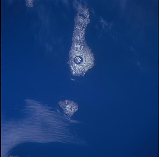
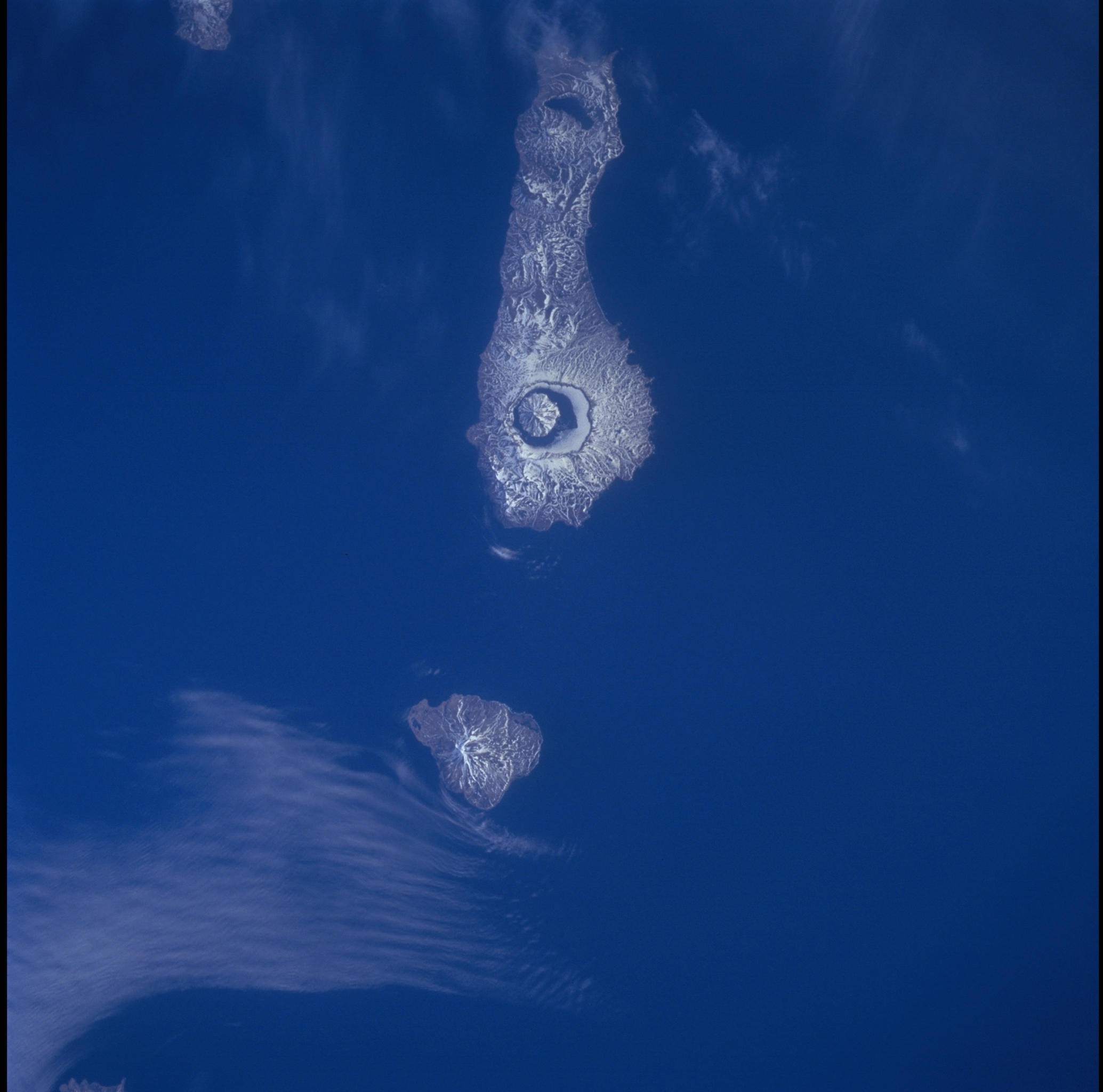
Image Caption: The Kuril island chain is a line of volcanoes connecting northern Japan (Hokkaido)
with the Kamchatkan peninsula, and separating the Pacific plate from the Eurasian plate.
Onekotan (35 mi. long) is one of the northernmost of the Kurils, seen here under a
dusting of snow, with the large southern caldera at the big end of the island clearly
visible. The caldera contains a lake, seen here largely ice-free, with a new central
volcanic dome projecting through the lake. The small island immediately south is
Kharimkotan I.
