STS096-714-75
| NASA Photo ID | STS096-714-75 |
| Focal Length | 250mm |
| Date taken | 1999.06.04 |
| Time taken | 08:05:35 GMT |
Resolutions offered for this image:
1029 x 1024 pixels 2050 x 2048 pixels 4101 x 4096 pixels 515 x 512 pixels
1029 x 1024 pixels 2050 x 2048 pixels 4101 x 4096 pixels 515 x 512 pixels


Cloud masks available for this image:
Spacecraft nadir point: 41.7° N, 24.1° E
Photo center point: 40.5° N, 24.0° E
Photo center point by machine learning:
Photo center point: 40.5° N, 24.0° E
Photo center point by machine learning:
Nadir to Photo Center: South
Spacecraft Altitude: 211 nautical miles (391km)
Country or Geographic Name: | GREECE |
Features: | SINGITIKOS BAY |
| Features Found Using Machine Learning: | |
Cloud Cover Percentage: | 5 (1-10)% |
Sun Elevation Angle: | 56° |
Sun Azimuth: | 113° |
Camera: | Hasselblad |
Focal Length: | 250mm |
Camera Tilt: | 19 degrees |
Format: | 5069: Kodak Elite 100S, E6 Reversal, Replaces Lumiere, Warmer in tone vs. Lumiere |
Film Exposure: | Normal |
| Additional Information | |
| Width | Height | Annotated | Cropped | Purpose | Links |
|---|---|---|---|---|---|
| 1029 pixels | 1024 pixels | No | No | Download Image | |
| 2050 pixels | 2048 pixels | No | No | Download Image | |
| 4101 pixels | 4096 pixels | No | No | Download Image | |
| 515 pixels | 512 pixels | No | No | Download Image |
Download Packaged File
Download a Google Earth KML for this Image
View photo footprint information
Download a GeoTIFF for this photo
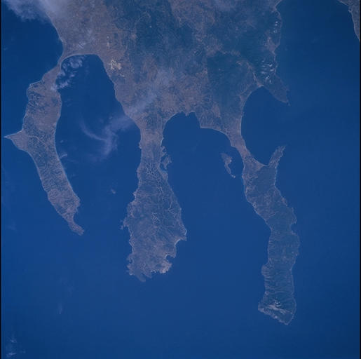
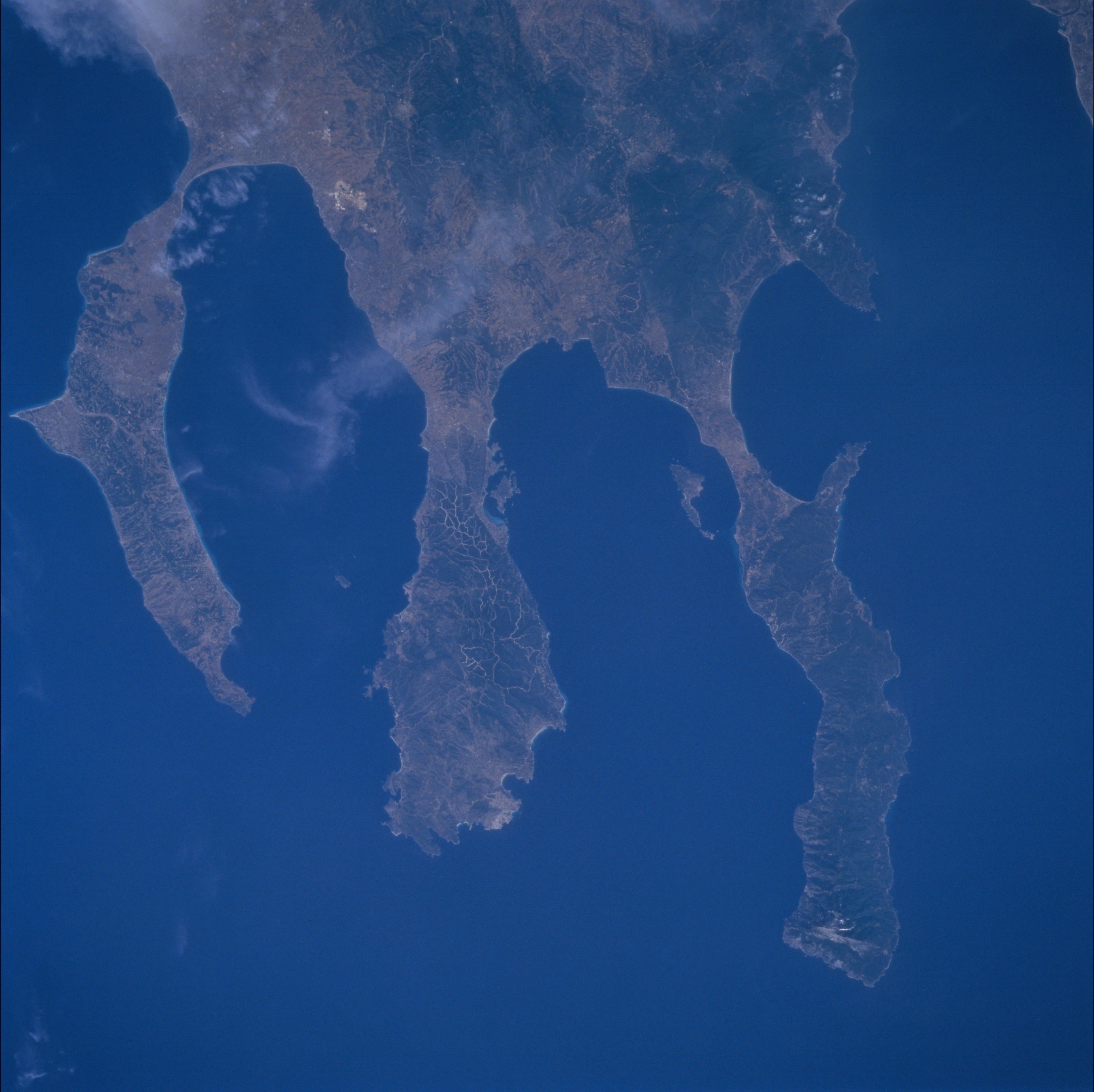
Image Caption: Chalcidice peninsula itself has three promontories known as (left to
right), Kassandra, Sithonia and Akti, which appear prominently from
low earth orbit. The 30-mile long eastern promontory of Akti (right)
is renowned in Greece as a center of twenty Orthodox Christian
monasteries, classed under the constitution as semiautonomous
communities. The monasteries lie along the coast at the foot of
famous Mt. Athos (also known as the Holy Mountain) which appears as
the devegetated high point near the tip of the promontory. In his
"massive invasion" of Greece in 480 BC, Persian King Xerxes I
excavated a canal at the narrow (1.5 mi. wide) base of the Akti
"finger" to avoid leading his fleet around the dangerous seas on the
tip of the finger. The now-filled remains of the canal can be seen in
this view.
