STS096-701-90
| NASA Photo ID | STS096-701-90 |
| Focal Length | 250mm |
| Date taken | 1999.05.30 |
| Time taken | 05:05:46 GMT |
Resolutions offered for this image:
1025 x 1008 pixels 2047 x 2015 pixels 4094 x 4029 pixels 512 x 504 pixels
1025 x 1008 pixels 2047 x 2015 pixels 4094 x 4029 pixels 512 x 504 pixels

Cloud masks available for this image:
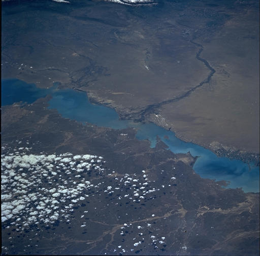
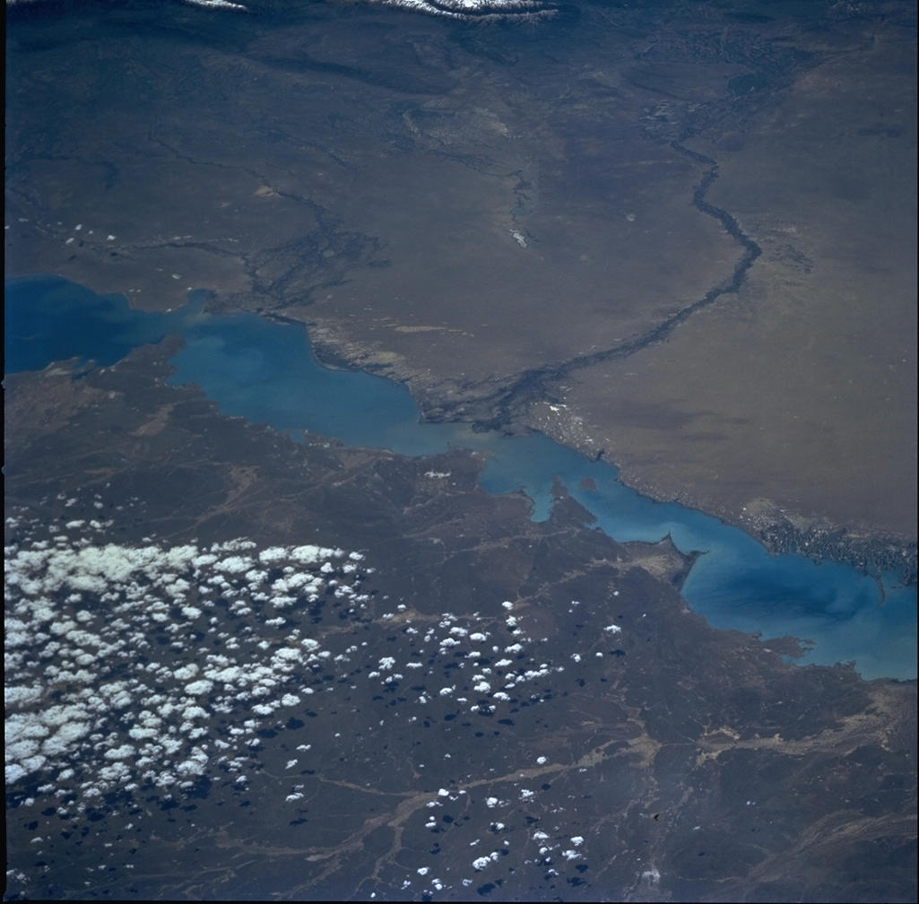
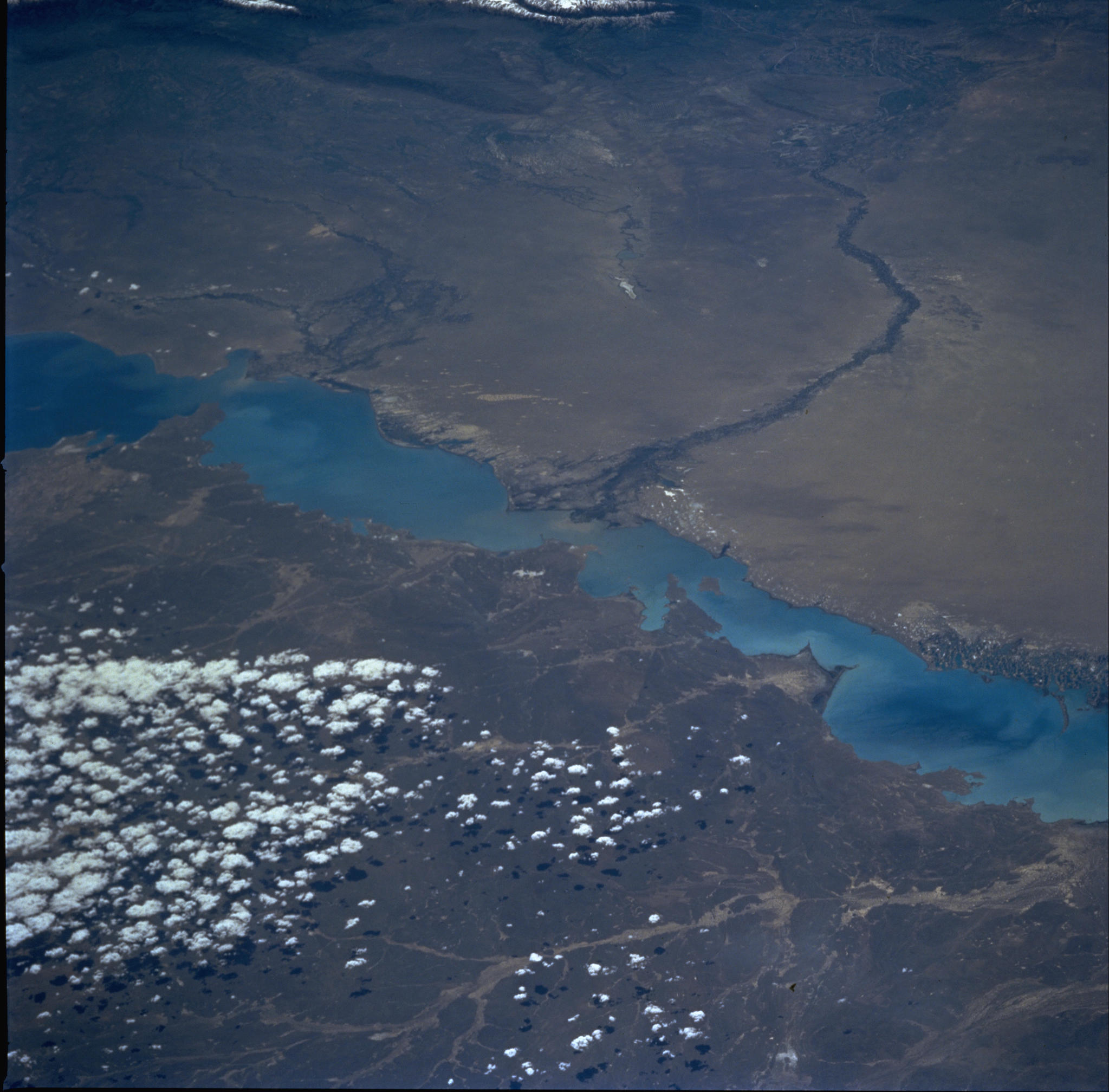
Spacecraft nadir point: 50.7° N, 70.1° E
Photo center point: 46.5° N, 77.0° E
Photo center point by machine learning:
Photo center point: 46.5° N, 77.0° E
Photo center point by machine learning:
Nadir to Photo Center: Southeast
Spacecraft Altitude: 202 nautical miles (374km)
Country or Geographic Name: | KAZAKHSTAN |
Features: | L. BALKHASH, KARATAL DELTA |
| Features Found Using Machine Learning: | |
Cloud Cover Percentage: | 10 (1-10)% |
Sun Elevation Angle: | 51° |
Sun Azimuth: | 126° |
Camera: | Hasselblad |
Focal Length: | 250mm |
Camera Tilt: | Low Oblique |
Format: | 5069: Kodak Elite 100S, E6 Reversal, Replaces Lumiere, Warmer in tone vs. Lumiere |
Film Exposure: | Out of Focus |
| Additional Information | |
| Width | Height | Annotated | Cropped | Purpose | Links |
|---|---|---|---|---|---|
| 1025 pixels | 1008 pixels | No | No | Download Image | |
| 2047 pixels | 2015 pixels | No | No | Download Image | |
| 4094 pixels | 4029 pixels | No | No | Download Image | |
| 512 pixels | 504 pixels | No | No | Download Image |
Download Packaged File
Download a Google Earth KML for this Image
View photo footprint information
Download a GeoTIFF for this photo
Image Caption: none
