STS095-709-14
| NASA Photo ID | STS095-709-14 |
| Focal Length | 250mm |
| Date taken | 1998.10.31 |
| Time taken | 19:14:15 GMT |
Resolutions offered for this image:
4036 x 4042 pixels 639 x 640 pixels 498 x 517 pixels 478 x 480 pixels
4036 x 4042 pixels 639 x 640 pixels 498 x 517 pixels 478 x 480 pixels
Cloud masks available for this image:
Spacecraft nadir point: 27.7° N, 77.8° W
Photo center point: 37.0° N, 76.5° W
Photo center point by machine learning:
Photo center point: 37.0° N, 76.5° W
Photo center point by machine learning:
Nadir to Photo Center: North
Spacecraft Altitude: 295 nautical miles (546km)
Country or Geographic Name: | USA-VIRGINIA |
Features: | PAN-PAMLICO SOUND, COAST |
| Features Found Using Machine Learning: | |
Cloud Cover Percentage: | 5 (1-10)% |
Sun Elevation Angle: | 36° |
Sun Azimuth: | 223° |
Camera: | Hasselblad |
Focal Length: | 250mm |
Camera Tilt: | High Oblique |
Format: | 5069: Kodak Elite 100S, E6 Reversal, Replaces Lumiere, Warmer in tone vs. Lumiere |
Film Exposure: | Over Exposed |
| Additional Information | |
| Width | Height | Annotated | Cropped | Purpose | Links |
|---|---|---|---|---|---|
| 4036 pixels | 4042 pixels | No | No | Earth From Space collection | Download Image |
| 639 pixels | 640 pixels | No | No | Earth From Space collection | Download Image |
| 498 pixels | 517 pixels | No | No | Download Image | |
| 478 pixels | 480 pixels | Download Image |
Download Packaged File
Download a Google Earth KML for this Image
View photo footprint information
Download a GeoTIFF for this photo
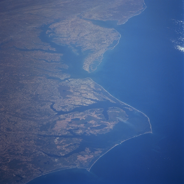
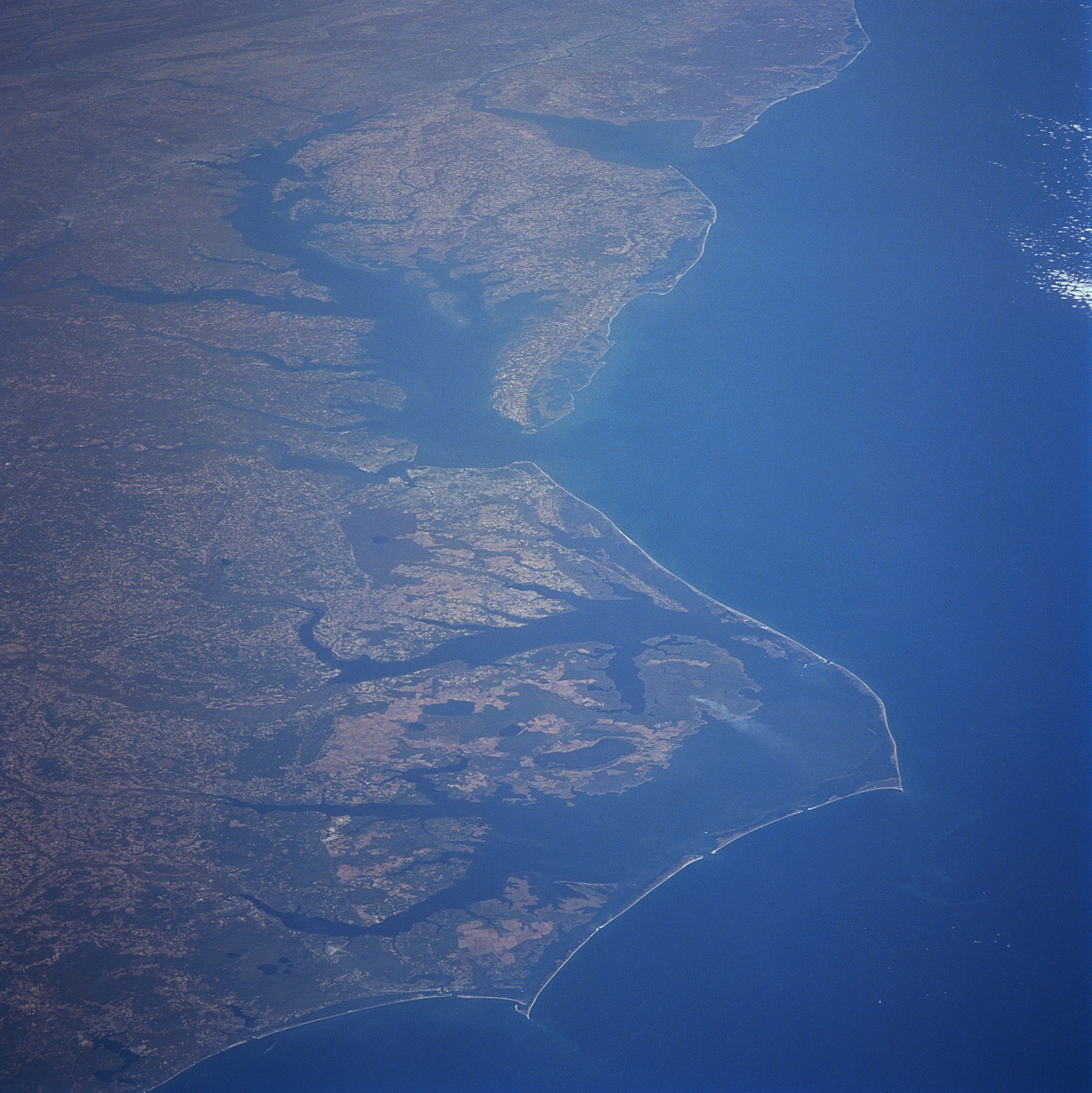
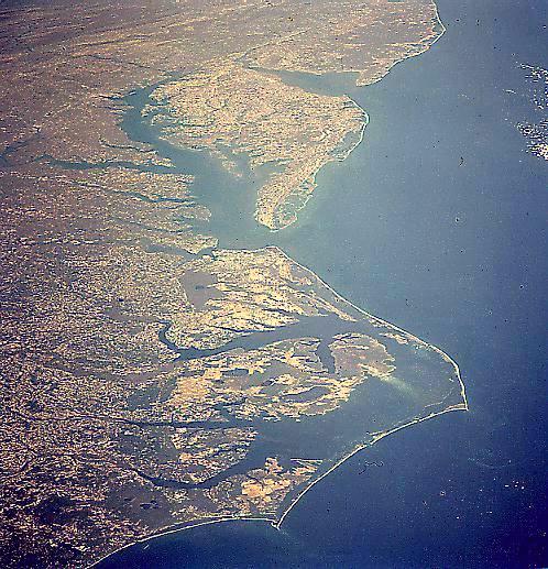
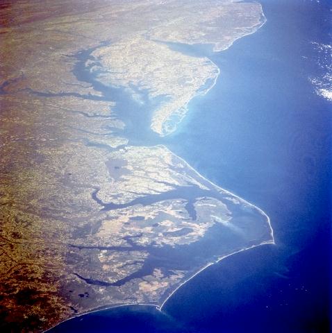
Image Caption: STS095-709-014 Pan Mid-Atlantic Coast, United States October 1998
This photograph covers the mid-Atlantic Coast of the eastern United States from New Jersey (just to the right of top center of the image) southward to just southwest of Cape Lookout, North Carolina. Near the upper left of the image, the folded Appalachian Mountains of South-central Pennsylvania are discernible. Delaware Bay between the state of New Jersey to the north and the state Delaware is visible. The Delmarva Peninsula is discernible to the south of Delaware Bay. To the west of the Delmarva Peninsula is Chesapeake Bay. At the entrance to Chesapeake Bay, Cape Charles (north) and Cape Henry (south) can be seen. Capes Hatteras and Lookout and their barrier islands are visible in the bottom portion of the image. To the west of the Barrier Islands is Pamlico Sound. West of Pamlico Sound are agricultural fields of the coastal plain of North Carolina.
This photograph covers the mid-Atlantic Coast of the eastern United States from New Jersey (just to the right of top center of the image) southward to just southwest of Cape Lookout, North Carolina. Near the upper left of the image, the folded Appalachian Mountains of South-central Pennsylvania are discernible. Delaware Bay between the state of New Jersey to the north and the state Delaware is visible. The Delmarva Peninsula is discernible to the south of Delaware Bay. To the west of the Delmarva Peninsula is Chesapeake Bay. At the entrance to Chesapeake Bay, Cape Charles (north) and Cape Henry (south) can be seen. Capes Hatteras and Lookout and their barrier islands are visible in the bottom portion of the image. To the west of the Barrier Islands is Pamlico Sound. West of Pamlico Sound are agricultural fields of the coastal plain of North Carolina.
